Kozje - Pokojni vrh (Bohor) (via Vetrnik)
Starting point: Kozje (276 m)
| Latitude/Longitude: | 46,07270°N 15,55710°E |
| |
Route name: via Vetrnik
Walking time: 1 h 30 min
Difficulty: easy marked way
Elevation gain: 435 m
Elevation difference along the route: 495 m
Map: Posavsko hribovje Boč - Bohor 1:50.000
Recommended equipment (summer):
Recommended equipment (winter):
Views: 2.948
 | 2 people like this post |
Access to starting point:
A) Exit at Dramlje on the highway and through Šentjur and Lesično to Kozje.
B) From the direction of Podčetrtek, right in the settlement Prelasko through Buč to Kozje.
C) From the direction of Bistrica ob Sotli, left in the settlement Prelasko through Buč to Kozje.
D) From the direction of Brestanica, Senovo and Podsreda to Kozje.
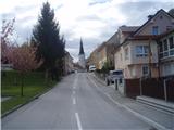
Kozje is the main settlement of Kozjansko and relatively easily accessible from several directions.
Route description:
After a short tour of the settlement Kozje, head from the center in the direction of Bistriški graben on the asphalt road to the turn-off left for Vetrnik. In the part to the turn-off for Vetrnik, the path is also Marijina pilgrimage path and marked with the signs of that path. The path higher towards Vetrnik is a well-hardened forest road which winds quite steeply higher and is easy to follow. When you reach the asphalt, which leads somewhere along the upper ridge, turn right and step also on Zasavska planinska pot, which is additionally marked beside the markings with "Z". Follow the signs and mainly on asphalt connections except below the summit Raskože easily reach Pokojni vrh. You ascend to it on the pasture and on the top there is also a bench.
Photos:
 1
1 2
2 3
3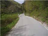 4
4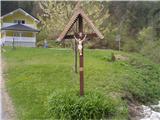 5
5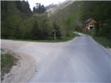 6
6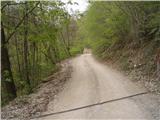 7
7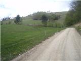 8
8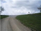 9
9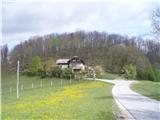 10
10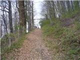 11
11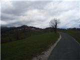 12
12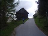 13
13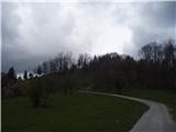 14
14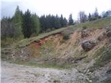 15
15 16
16
Discussion about the trip Kozje - Pokojni vrh (Bohor) (via Vetrnik)
To post a comment you must log in:
If you do not yet have a username, you must first
register.