Starting point: Kraljev hrib (540 m)
| Latitude/Longitude: | 46,30610°N 14,60880°E |
| |
Walking time: 3 h 30 min
Difficulty: easy marked way
Elevation gain: 1263 m
Elevation difference along the route: 1263 m
Map: Kamniške in Savinjske Alpe 1:50.000
Recommended equipment (summer):
Recommended equipment (winter): ice axe, crampons
Views: 53.261
 | 3 people like this post |
Access to starting point:
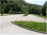
First, we drive to Kamnik, then we continue driving in the direction of Kamniška Bistrica and the cableway to Velika planina. In Stahovica we continue left (direction Kamniška Bistrica and cableway Velika planina) and follow the moderately ascending road to the large parking lot near the lower cableway station to Velika planina (the parking lot is located on the right side of the road).
Route description:
From the parking lot, we continue on the road in the direction of Planina Dol and Velika planina. After approximately 100 m of walking on the road, just before the first right turn, we will notice on the left side first a wide footpath that ascends into the forest (the turn-off is not marked). We continue on the mentioned path, which soon crosses a belt of bushes and immediately brings us to a junction, where we continue on the right path. Further, we ascend on the footpath that after a short ascent brings us to a forest road, which we follow to the left (unmarked).
After a minute or two of walking on the road, we come to a marked junction, where we continue right on the marked footpath. The path ahead first gently ascends among wild garlic growth, then starts to ascend steeper and steeper. A relatively steep path that all the time runs through the forest brings us higher to a short section exposed to falling rocks. Further, the path ascends even steeper, then turns to the left, where the steepness eases. Only a few minutes of easy walking follow and the path brings us to a forest road, which we follow to the right. The road, which immediately exits the forest onto the western edge of Planina Dol, we follow for about 5 minutes to a marked junction, where we continue left in the direction of Konj (right Velika planina).
The path ahead moderately ascends across a meadow, then enters the forest, where it turns right and gradually starts ascending steeper and steeper. Approximately 20 minutes of steep ascent through the forest follow, then the path brings us to a small viewpoint. Here the path turns left and levels off somewhat. We continue on a moderately steep path, from the increasingly sparse forest soon entering a belt of dwarf pines. A short ascent follows on a well-trodden path through the dwarf pines and the path brings us to Planina Rzenik, on the edge of which we notice a shepherd's hut.
From the hut we continue on the marked path towards Konj (slightly left to Rzenik on the western path, the path to Rzenik is not marked), which quickly brings us among dwarf pines. We continue the ascent on a moderately steep path that continues to lead through dwarf pines. Higher up, the path brings us right by the main ridge, where the path turns right and continues ascending through dwarf pines. Only a few dozen steps remain and the increasingly scenic path quickly brings us to the summit of Konj.
The summit register box is located somewhat lower, specifically in the direction towards Presedljaj. A short steep descent on a secured climbing path separates us from it.
Kraljev hrib - Planina Dol 2:00, Planina Dol - Konj 1:30.

Photos:
 1
1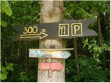 2
2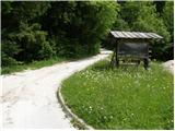 3
3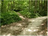 4
4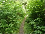 5
5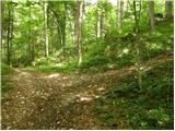 6
6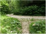 7
7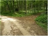 8
8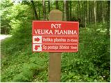 9
9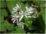 10
10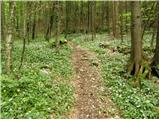 11
11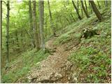 12
12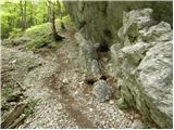 13
13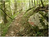 14
14 15
15 16
16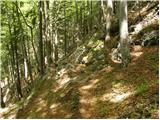 17
17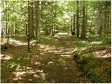 18
18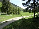 19
19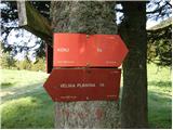 20
20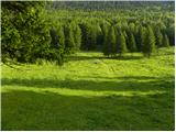 21
21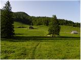 22
22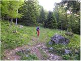 23
23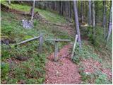 24
24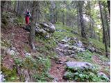 25
25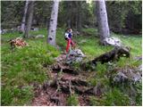 26
26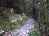 27
27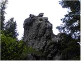 28
28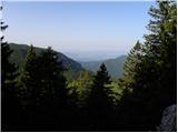 29
29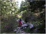 30
30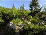 31
31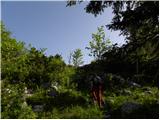 32
32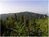 33
33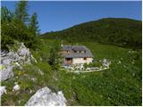 34
34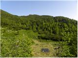 35
35 36
36 37
37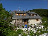 38
38 39
39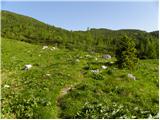 40
40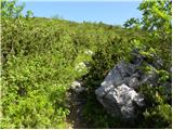 41
41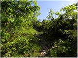 42
42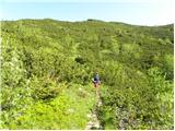 43
43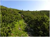 44
44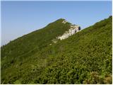 45
45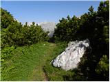 46
46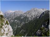 47
47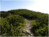 48
48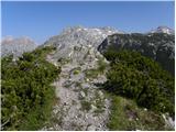 49
49 50
50
Discussion about the trip Kraljev hrib - Konj
|
| tinkica129. 04. 2011 |
hey! We did this tour on Monday.. The path is not demanding, but quite steep (: It was very slippery on the path, because there is a lot of leaves (up to the knees), and some rocks.. it was damp, so on the way back down, I was sliding a bit (: Otherwise, the view from Konj is wonderful.. really nice, I recommend.. just the top of Konj is not for the vertiginous! (:
|
|
|
|
| Volk30. 04. 2011 |
This is a description of the Path with a capital letter, madonna! The word path appears no less than 18 times in such a short piece. 
And Tinkica1, the view FROM Konj must have been really unusual.
Joke aside.
As starting point the above-mentioned Kraljev hrib is given, which won't hold up. It's also strange that it's not marked from the start with the ascent to Konj through Dolski graben ...
Also the mentioned unmarked trail to Rzenik via the western path ... in fact it's very hard to find if you don't know about it (I don't know why mention it at all (superficially)).
Ah, probably it's time to meddle in the text. 
Otherwise nicely photo-documented.
Best regards.
|
|
|
|
| klm25. 06. 2011 |
Very nice hike. 1:07 h. The view... undoubtedly one of the best in the Kamnik Alps.
|
|
|
|
| trilko29. 01. 2012 |
Today looking for sun on Konj... and found it! Nice little tour, even in winter conditions. From Planina Dol onwards there was some ice on the path, crampons recommended! Not much snow, but in the lower part of the path there is locally a lot of leaves (~30 cm), so you're actually trampling through leaves and can't see what's underneath 
The view FROM (as they say in the Kamnik-Domžale region ) Konj is really incredible, one of the best towards the highest peaks of KSA.
|
|
|
|
| redbull11. 02. 2012 |
I'm interested in what the conditions are like now, after some more snow in this area, from Kraljev hrib towards Konj. Please report here if anyone has been up there after 11.2., because I'd go after the 20th since the weather looks better now. I'm especially interested if there's danger of avalanches (amount of snow is no obstacle - crampons, gaiters,... I have) in this part of the hike.
thanks in advance
|
|
|
|
| Vinetou12. 02. 2012 |
I visited Konj via this path on 9.2. In the last days less than 5 cm snow fell in this area, so conditions aren't much different. From parking at the cable car for Velika planina to planina Dol around 10-15cm powder, path nicely trodden. From planina Dol to planina Rzenik a bit more snow, around 20-30cm. Snow still powder up to here. Crampons maybe good only for the path from planina Rzenik to summit Konj, as snow is wind-packed here and path icy. For the rest more optional, maybe by 20th it transforms more and freezes in some parts and will be useful on steeper sections too.
|
|
|
|
| redbull12. 02. 2012 |
thanks a lot, then I'll go - off I go
|
|
|
|
| matejsteini26. 04. 2012 |
Does anyone perhaps know what the conditions (snow) are like on Konj? LP
|
|
|
|
| Janez Seliškar26. 04. 2012 |
Along the road towards Kamniška Bistrica, a little further from the lower station of the gondola to Velika Planina. The place is called Kopišča, and the path through Dolski Graben to Planina Dol starts there.
|
|
|
|
| ljubitelj gora28. 04. 2012 |
From pl. Dol to Konj there is no more snow, not muddy either.
|
|
|
|
| Kokta2. 05. 2012 |
Nice trail through the ravine. At the top, as they say, one of the best views in KSA. All the giants like on the palm of your hand. I recommend the trip. If you have time, detour to Gradišče past Planina Konjščice.
|
|
|
|
| pohodnik386. 05. 2012 |
Here are some video glimpses of the views from Konj and Rzenik.
VIDEO
|
|
|
|
| borutpovse3. 05. 2013 |
Hello. Has anyone been up there yet? Is there still a lot of snow, or has it melted?
|
|
|
|
| Janiel7411. 04. 2018 |
Hello. Does anyone know the current conditions? I'm particularly interested from Planina Dol to the summit? There is surely snow, probably no avalanche risk there? Thanks for the info. Best regards
|
|
|
|
| trilko12. 04. 2018 |
On Saturday I was at Rzenik. Snow starts a little before Dol. From Dol onwards there is snow all the time, otherwise rotten, but you can go up without problems.
|
|
|
|
| Zdenkob17. 06. 2021 11:16:21 |
Last Saturday I was on Konj for the first time. The weather was just right, partly cloudy so it wasn't too hot. The path to Planina Dol drags on and doesn't offer much views because it goes through the forest. Only from Planina Rzenik does the view open a bit, even more so of course from the ridge just below the summit.
Despite the path description saying that the stamping box is not at the top but lower towards Predesljaj, the logbook is at the top and so is the stamp.
|
|
|
|
| garmont17. 06. 2021 20:30:05 |
Yes, the description is a bit dated.
A few years ago the path markers moved the stamp and box from the fore-summit to the true summit, so now it's easier to access.
And it's also on the summit…
|
|
|
|
| Limonca8914. 12. 2021 20:21:19 |
Hello, I'm interested if anyone has been to Konj in the past days and what the conditions are like? Thanks for the reply
|
|
|
|
| zbil9. 08. 2022 22:49:21 |
Walked today.
Nicely marked, junction to Rzenik nicely signposted. From planina Rzenik to both summits a real car road, on both sides at least a meter thoroughly mown and cleaned. Thanks to everyone who has/have made the effort.
From the summits fantastic views in all directions.
|
|
|
|
| frover4. 09. 2022 15:35:16 |
Was there yesterday, nice weather and wonderful views from the top. I join "zbila"'s thanks to all path markers Met the marker Martin, who marked the path really nicely that day. Perhaps it would be good to clean a bit the part of the path from the parking lot at the lower cable car station to the first bigger climb. It's quite overgrown.
|
|
|
To post a comment you must log in:
If you do not yet have a username, you must first
register.