Kranj-Stražišče (Šrotenturn) - Šmarjetna gora (east path)
Starting point: Kranj-Stražišče (Šrotenturn) (410 m)
| Latitude/Longitude: | 46,23540°N 14,33990°E |
| |
Route name: east path
Walking time: 45 min
Difficulty: easy unmarked way
Elevation gain: 236 m
Elevation difference along the route: 250 m
Map: Škofjeloško in Cerkljansko hribovje 1:50.000
Recommended equipment (summer):
Recommended equipment (winter):
Views: 10.880
 | 1 person like this post |
Access to starting point:
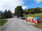
From the old road Ljubljana - Kranj, in Kranj we turn towards Stražišče, and then a little behind the football field, at the roundabout, we take the first exit in the direction of Šmarjetna gora. From the roundabout, on Delavska cesta we drive past Mercator for another 100 m and exactly opposite the ATM we turn left (still before the former TUŠ store) onto Trojarjeva ulica and after ~500 m we arrive at the recycling spot, which is situated a few 10 meters before the mansion or castle Šrotenturn. We park at a suitable place by the road, behind the recycling spot.
Route description:
From the starting point we continue straight ahead, then at the castle right onto the road Na Šmarjetno gora. Along the mentioned road we walk to the chapel, which we notice on the right side, but here still before the NOB memorial we continue left. The path ahead enters the forest and a little further diagonally to the left crosses the road which we recently left. There follows an ascent through the forest, and when we reach the cart track, we follow it to the right. For some time we ascend diagonally to the right, then the cart track turns slightly to the left and levels out. The cart track, which bypasses Gradišče (592 m) on the right side, we leave after a short descent and continue slightly right onto a well-beaten path, which continues through the forest. A little further, at another junction we continue straight, then for a short time parallel to the asphalt road which leads to the top of Šmarjetna gora. A little further we step onto the road for a few steps, then continue left uphill on the macadam path, along which we then ascend moderately. Higher up the path takes us out of the forest, where along the lower side we bypass the utility building, then soon we reach the asphalt road, along which with fine views we ascend to the top of Šmarjetna gora, where stand the church of St. Marjeta and the hotel Bellevue.
Description and pictures refer to the condition in 2016 (October).

Photos:
 1
1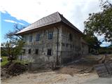 2
2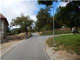 3
3 4
4 5
5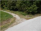 6
6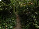 7
7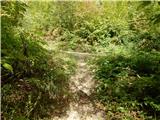 8
8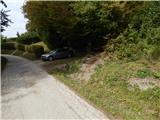 9
9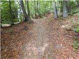 10
10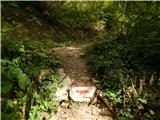 11
11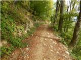 12
12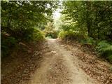 13
13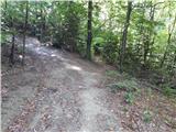 14
14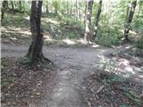 15
15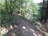 16
16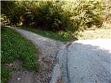 17
17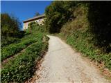 18
18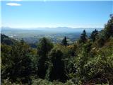 19
19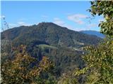 20
20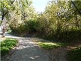 21
21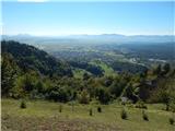 22
22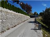 23
23 24
24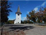 25
25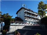 26
26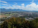 27
27 28
28
Discussion about the trip Kranj-Stražišče (Šrotenturn) - Šmarjetna gora (east path)
|
| sirt126. 10. 2016 |
Maybe some additions. Old road LJ-KR, at the first traffic light a sign directs us left to Stražišče (therefore "starting point Kranj-Stražišče (Šrotenturn)" would be appropriate) straight Kranj. From the roundabout along Delavska cesta past Mercator another 100 m and exactly opposite the ATM turn left (still before the former TUŠ store) onto Trojarjeva ulica and after ~500 m we reach the ecological island.
Nice that you use the correct name for the manor, although most still wrongly call it "Šempeterska graščina" after the chapel of St. Peter in fig.5.
|
|
|
|
| Tadej27. 10. 2016 |
Thanks for the addition. I have corrected it.
|
|
|
To post a comment you must log in:
If you do not yet have a username, you must first
register.