Križe - Tolsti vrh (steep path over Kriška gora)
Starting point: Križe (508 m)
| Latitude/Longitude: | 46,33940°N 14,29790°E |
| |
Route name: steep path over Kriška gora
Walking time: 3 h 40 min
Difficulty: easy marked way
Elevation gain: 1207 m
Elevation difference along the route: 1250 m
Map: Karavanke - osrednji del 1:50.000
Recommended equipment (summer):
Recommended equipment (winter): ice axe, crampons
Views: 3.371
 | 3 people like this post |
Access to starting point:
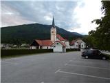
a) From the Ljubljana - Jesenice motorway take the Naklo exit, then continue driving towards the places Žeje, Spodnje and Zgornje Duplje to the place Retnje, where we turn right towards the settlement Križe. Continue past the NOB monument, the Križe sports ground to the parking lot next to the cemetery and the parish church of the Exaltation of the Holy Cross.
b) From the Jesenice - Ljubljana motorway take the Podbrezje exit, then continue driving towards Ljubelj and Tržič. Before the Petrol filling station in Bistrica pri Tržiču turn right and then drive into Tržič. When the road descends into the valley continue sharply right towards Pristava and Križ, then drive along the main road leading towards Zgornje and Spodnje Duplje, leave the mentioned main road at the settlement Retnje, where we continue left towards the settlements Križe and Golnik. Continue past the NOB monument, the Križe sports ground to the parking lot next to the cemetery and the parish church of the Exaltation of the Holy Cross.
Route description:
From the parking lot continue along the road eastwards, where the path leads us first past the church, then past the post office, the inn pri Benk and the bakery to the junction at the chapel, where we continue left towards Pristava. The road then leads past the Tušek market Markič shop, then we notice the first mountain signs for Gozd, Kriška gora and Storžič, which lead us right onto Planinska pot street. At junctions through the settlement follow the markers, then the road loses the asphalt covering and enters the forest. A few minutes higher, at the junction of gravel roads continue right, then gradually we emerge from the forest, from where a nice view opens towards Gorenjska. After the viewing section the road becomes asphalted and brings us to the place where we join the road leading towards Gozd. Follow the road left, but walk on it only briefly as the markers lead us right onto the cart track.
Leave the road at a small information board informing about the opening of the Zavetišče v Gozdu. From the cart track continue immediately twice left, so the ascent continues on the forest path, which soon joins another cart track, on which in a few minutes we return to the asphalt road. Walk a few steps on the road, then from the left a path from Tržič joins, to the right the footpath or cart track towards Zavetišče v Gozdu continues, we continue on the asphalt road to the nearby parking lot.
From the parking lot continue in the direction of the steep path to Kriška gora. For a short time we still walk on a fairly level path, then it becomes increasingly steep. Follows a steep ascent on a more or less forested path, then we reach an indistinct ridge where the path becomes even steeper. Follows a few more minutes of walking through the forest, then the forest ends quickly and the ascent continues on an increasingly panoramic grassy slope. With nice views of the Julian Alps, large part of Gorenjska, part of the Ljubljana Basin and Inner Carniola, Polhograjsko and Škofjeloško hills, we arrive at a bench on the upper part of the grassy slope. Above the bench the path returns to the forest, from the left the path from Tržič via Mala and Velika Mizica joins us.
Here continue right, then in moderate ascent, first still through the forest, in the last part on the grassy slope, in approximately 15 minutes reach Koča na Kriški gori.
From Koča na Kriški gori continue on the marked path towards Tolsti vrh. The path just a few metres behind the hut turns slightly left (slightly right Gozd) and begins to ascend gently across the grassy slope. After three minutes of walking an almost imperceptible path to Grahovše branches left, we continue on the well-trodden hiking path which continues along the main ridge of Kriška gora. Further the path withdraws from the ridge to the right side several times, but the panoramic path mostly leads across grassy slopes. Somewhat further the path returns to the ridge, which we reach exactly at a distinct saddle where a pathless path to Grahovše branches left downwards.
The path ahead leads across the pasture fence, then bypasses Vrata (1591 m) on the right side. Higher the path returns to or along the ridge and ascends only gently for some time. After a few minutes of traversing we arrive at the place where the path begins to ascend steeply towards the forepeak of Tolsti vrh. From the forepeak a nice view opens in all directions, the path ahead leads for a short time along the narrower ridge. Follows some descent through the forest, then the path begins to ascend again. Higher the forest thins, and the increasingly panoramic path brings us to Tolsti vrh.
Starting point - junction before Gozd 0:55, junction before Gozd - junction on Kriška gora ridge 1:25, junction on Kriška gora ridge - Koča na Kriški gori 0:20, Koča na Kriški gori - Tolsti vrh 1:00

Photos:
 1
1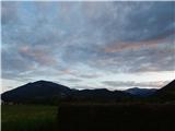 2
2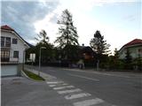 3
3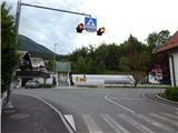 4
4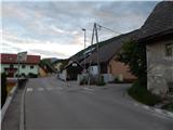 5
5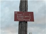 6
6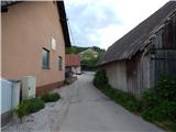 7
7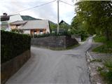 8
8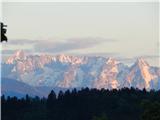 9
9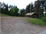 10
10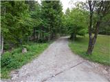 11
11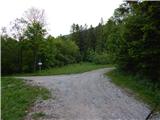 12
12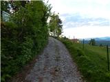 13
13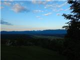 14
14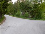 15
15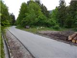 16
16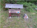 17
17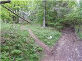 18
18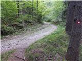 19
19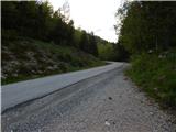 20
20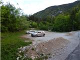 21
21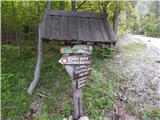 22
22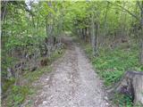 23
23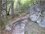 24
24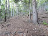 25
25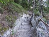 26
26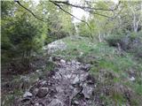 27
27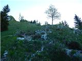 28
28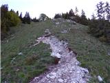 29
29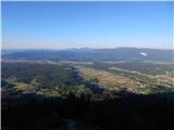 30
30 31
31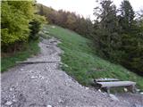 32
32 33
33 34
34 35
35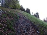 36
36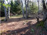 37
37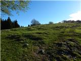 38
38 39
39 40
40 41
41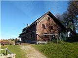 42
42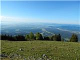 43
43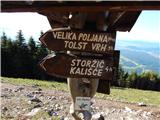 44
44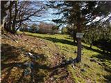 45
45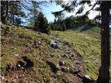 46
46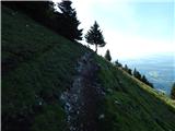 47
47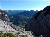 48
48 49
49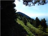 50
50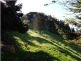 51
51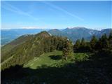 52
52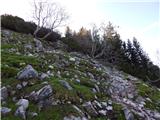 53
53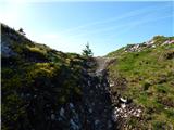 54
54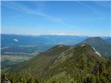 55
55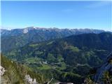 56
56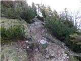 57
57 58
58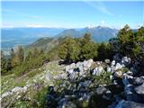 59
59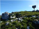 60
60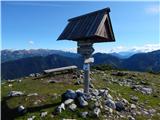 61
61 62
62
Discussion about the trip Križe - Tolsti vrh (steep path over Kriška gora)
To post a comment you must log in:
If you do not yet have a username, you must first
register.