Starting point: Križevska vas (584 m)
| Latitude/Longitude: | 46,10910°N 14,71470°E |
| |
Walking time: 40 min
Difficulty: easy marked way
Elevation gain: 252 m
Elevation difference along the route: 252 m
Map:
Recommended equipment (summer):
Recommended equipment (winter): ice axe, crampons
Views: 2.460
 | 3 people like this post |
Access to starting point:
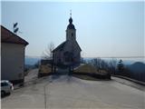
A) From the highway Ljubljana - Celje, we take the exit Šentjakob and follow the road ahead towards Litija. From the roundabout at Dolsko, we take the exit in the direction of the settlement Vinje, and at the next crossroad, we go right in the direction of Križevska vas. There follows approximately 5 km of driving on a somewhat narrower and mostly ascending road, which we follow to the church of the Holy Cross in Križevska vas. We park in a suitable place near the church.
B) First, we drive to Litija, then continue driving towards Ljubljana. When we arrive at the crossroad by the settlement Senožete, we take the exit in the direction of the mentioned settlement. The road then immediately brings us to the village, where at the crossroad we turn right and drive past the fire station, after which we come to the next crossroad, where we go left. We continue straight ahead and follow the road all the way to Velika vas, where we turn left. We then drive to Križevska vas, where we park in a smaller parking lot near the church of the Holy Cross.
Route description:
Opposite the church, by the playground we notice a sign for St. Miklavž, which directs us to the path that bypasses the playground on the left side and the nearby house on the right, after which we step onto a cart track, which we follow to the right. At first, from the cart track there opens a nice view of Križevska vas and the surrounding hills, then the path enters the forest, through which it ascends continuously along the cart track, which makes a few hairpin turns. Higher, we reach the ridge of Cicelj, but we continue right (left to farm Buven and Murovica), along the cart track, which a little higher changes into a gradually steeper footpath. When the path flattens again higher up, a hunting path from Velika vas also joins from the right. Here too we continue straight ahead and after a minute of further walking we arrive at the forested Cicelj.
Photos:
 1
1 2
2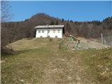 3
3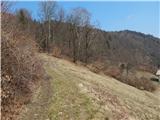 4
4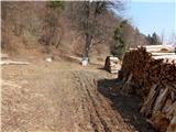 5
5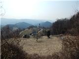 6
6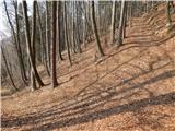 7
7 8
8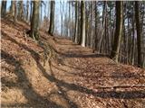 9
9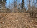 10
10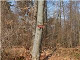 11
11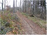 12
12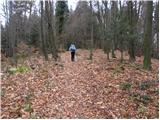 13
13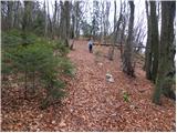 14
14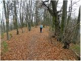 15
15 16
16
Discussion about the trip Križevska vas - Cicelj
To post a comment you must log in:
If you do not yet have a username, you must first
register.