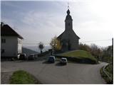
Starting point: Križevska vas (584 m)
| Latitude/Longitude: | 46,10910°N 14,71470°E |
| |
Walking time: 45 min
Difficulty: easy marked way
Elevation gain: 159 m
Elevation difference along the route: 175 m
Map:
Recommended equipment (summer):
Recommended equipment (winter):
Views: 5.062
 | 1 person like this post |
Access to starting point:
A) From the highway Ljubljana - Celje, we take the exit Šentjakob and follow the road ahead towards Litija. From the roundabout at Dolsko, we take the exit in the direction of the settlement Vinje, and at the next intersection, we go right in the direction of Križevska vas. There follows approximately 5 km of driving on a somewhat narrower and mostly ascending road, which we follow to the church of the Holy Cross in Križevska vas. We park at a suitable place near the church.
B) First, we drive to Litija, and then we continue driving towards Ljubljana. When we get to the intersection at the settlement Senožete, we take the exit in the direction of the mentioned settlement. The road then immediately brings us into the village, where at the intersection we turn right and drive past the fire station, after which we come to the next intersection, where we go left. We continue straight and follow the road all the way to Velika vas, where we turn left. We then drive to Križevska vas, where we park on a smaller parking lot near the church of the Holy Cross.
Route description:
From the starting point at the church of the Holy Cross we continue towards the north and we continue on the macadam road which is diagonally ascending. After a good 10 minutes of walking from the starting point, we get to a smaller saddle between two chapels.
Here we continue left (straight - farm Buven, right - Cicelj) and we follow the road a little less than 100 meters and then blazes lead us left into the forest, on at first a steep footpath. The footpath quickly flattens, and then continues with some shorter ascents and descents to a marked crossing, where the path from Dolsko joins. Here we continue right and after 5 minutes of additional walking, we get to the forested peak of Murovica.
The trip can be extended to the following destinations: Cicelj
Photos:
 1
1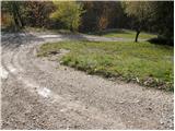 2
2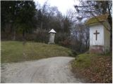 3
3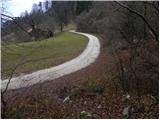 4
4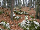 5
5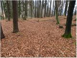 6
6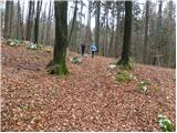 7
7 8
8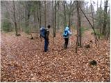 9
9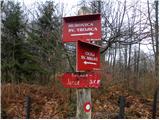 10
10 11
11 12
12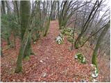 13
13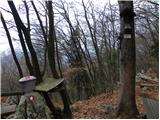 14
14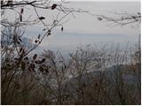 15
15
Discussion about the trip Križevska vas - Murovica
|
| balon15. 03. 2014 |
Hello!
Tomorrow we would like to go on a hike and we wonder if the trail through the forest is cleared/passable due to black ice and the rest.
Thanks and best regards,
Balončki
|
|
|
|
| PeterZ18. 06. 2016 |
Error in the description:
In Dolske at the roundabout turn towards Vinje, then after 200m right towards Križevska vas. The hayfields are much further on.
|
|
|
To post a comment you must log in:
If you do not yet have a username, you must first
register.