Križovec - Belska planina (Svečica) (footpath)
Starting point: Križovec (1222 m)
| Latitude/Longitude: | 46,46990°N 14,08380°E |
| |
Route name: footpath
Walking time: 1 h 45 min
Difficulty: easy marked way
Elevation gain: 478 m
Elevation difference along the route: 550 m
Map: Karavanke - osrednji del 1:50.000
Recommended equipment (summer):
Recommended equipment (winter): ice axe, crampons
Views: 36.612
 | 3 people like this post |
Access to starting point:
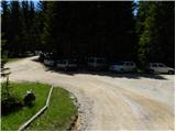
From the Ljubljana - Jesenice highway, take the Lipce exit and follow the road ahead in the direction of Jesenice. When we come to the traffic-light intersection, where we join the old road, we continue right in the direction of Žirovnica. We follow this road only a short time, as at the next somewhat larger intersection (traffic lights) we continue left in the direction of Javorniški Rovt. The road then goes through the underpass (railway) and then turns left (right Koroška Bela). We follow the road that higher up starts to ascend steeply in the direction of Javorniški Rovt. The road ahead takes us past the Dom Pristava mountain hut (the hut is a little above the road) and behind the hut we come to the next (smaller) intersection, where we go right. Ahead we drive on a macadam road all the way to Križovec, which we recognize by the intersection of several roads (near the intersection there are a few smaller parking spots and a cross).
Route description:
From Križovec we continue past the cross along the road in the direction of Pusti Rovt. The road at the beginning leads past a gate and then slightly ascends through the forest. After approximately 15 minutes of walking, the road turns left and brings us out of the forest to the lower edge of Pusti Rovt. We continue on the road to which a marked path from the Dom Pristava mountain hut in Javorniški Rovt joins from the right, and after a few dozen steps of further walking it brings us to the shepherd's hut on Pusti Rovt.
From the shepherd's hut we continue on the road, which in the upper part of Pusti Rovt turns right into the forest. Only a little further we come to a marked junction, where we continue slightly right (left Golica) on a moderately steep path, which a few meters higher crosses a relatively new road leading to Belska planina - Svečica. We only cross the mentioned road and continue the ascent on the marked path, which soon emerges from the forest onto panoramic slopes below Sedlo Kočna. We continue the ascent past a smaller hunting hut, behind which we soon reach the watering place for animals. Only a short ascent follows and the path brings us to Sedlo Kočna, from which a nice view opens onto the Austrian side.
On the saddle we continue right in the direction of Struška (left Golica and Ptičji vrh) on a relatively gentle path that continues along the main ridge. After a few minutes the path begins to ascend more steeply and then turns sharply right, where in a traverse ascent it crosses the slopes to the right. Higher up the path brings us from a belt of sparse forest and scrub onto a panoramic ridge, where after a few dozen meters of further ascent we cross a pasture fence.
Immediately after crossing the pasture fence, the trail splits into two parts. We continue on the right lower and marked path (slightly left Struška along the ridge or along and beside the state border), which further crosses the slopes towards the southeast. The path ahead continues for some time through the forest, then passes into a belt of dwarf pines, where it begins to ascend more noticeably again. Higher up the path briefly returns to the forest again, then passes onto the pasture areas of Belska planina - Svečica. Here we continue slightly left and after a few minutes of further walking we arrive at the shepherd's hut on the mentioned pasture.

Photos:
 1
1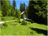 2
2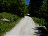 3
3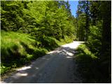 4
4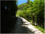 5
5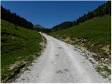 6
6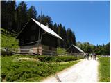 7
7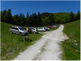 8
8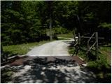 9
9 10
10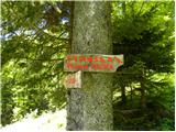 11
11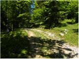 12
12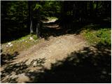 13
13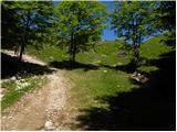 14
14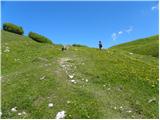 15
15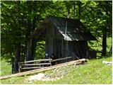 16
16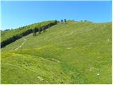 17
17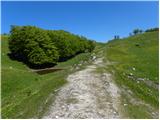 18
18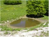 19
19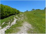 20
20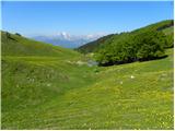 21
21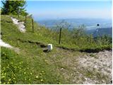 22
22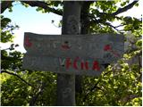 23
23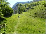 24
24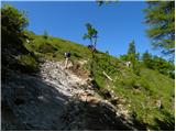 25
25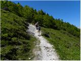 26
26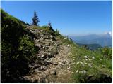 27
27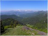 28
28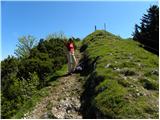 29
29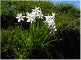 30
30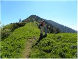 31
31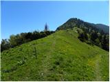 32
32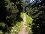 33
33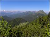 34
34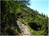 35
35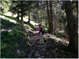 36
36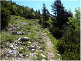 37
37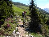 38
38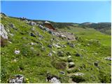 39
39 40
40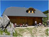 41
41
Discussion about the trip Križovec - Belska planina (Svečica) (footpath)
|
| francimedved12. 04. 2012 |
Excellent hike, especially in May when everything is in bloom.
|
|
|
|
| Pohodnica5615. 06. 2013 |
Has anyone been to Belska planina last week? Can you drive to Križovec by car?
|
|
|
|
| Kokta15. 06. 2013 |
You can get there without any problems. Lp
|
|
|
|
| Pohodnica5615. 06. 2013 |
Thanks kokta, thanks heinz. Interesting description, I'll try it myself, but I'll take the grandson along the marked path from Križovec, a bit shorter, they are not yet "broken in".
|
|
|
|
| heinz16. 06. 2013 |
From Prihodi apparently not passable due to rockfall, while from Pristava no problems.
|
|
|
|
| AdryBK18. 06. 2013 |
Is the shepherd's hut on Belska planina open, what's good to eat there so we don't have to carry everything with us  ? ?
|
|
|
|
| babim18. 06. 2013 |
Last Sunday we were returning from Belska planina, when the diligent workers and shepherd were just snacking on juicy Kranjska sausages, because they opened the hut on that day. What they have on the menu I don't know, because the goods were still in the car and the menu wasn't posted yet.
|
|
|
|
| francimedved5. 05. 2014 |
Has anyone been up here, we're interested in flowers, is the alpine pasture already in bloom?
|
|
|
|
| Pohodnica565. 05. 2014 |
A few days ago in Pusti rovt, which is much lower, the small and large bells were still "ringing", question whether everything higher up will already be in bloom. Last year at the beginning of June it was all blue from gentians.
|
|
|
|
| francimedved5. 05. 2014 |
Pohodnica56, thanks. I'll go up tomorrow to check, because I have the task to lead a group of people up there during the blooming time.
|
|
|
|
| otiv5. 05. 2014 |
Franci, if you're leading a group, I recommend the road, namely from Sedlo Kočna towards Belska planina there is still a lot of snow. The road is almost dry, only in the last part there is snow. The flowers are not yet in full bloom, but there's something to find for us photographers.
|
|
|
|
| francimedved5. 05. 2014 |
Otiv many thanks, I've been looking for info on this trail for several days. Today we arranged to go on May 31st. Up the road, and back via the upper mountain trail. We'll overnight at Križovec. If there's no more snow, we might go to the top of Struška.
|
|
|
|
| potočan6. 05. 2014 |
I'm interested in the condition of the road from Pristava to Križovec and further to Pusti rovt.
|
|
|
|
| otiv6. 05. 2014 |
The road to Križovec is normal, only the last part towards Pusti rovt is worse due to timber extraction, winter has also caused damage in the forest here.
|
|
|
|
| diana.jug4. 03. 2019 |
Hi, I'm wondering if the road from Pristava to Križovec is still icy. Thanks.
|
|
|
|
| Majdag9. 06. 2021 20:05:57 |
Belska planina, Ptičji vrh - yesterday.. The road through Savske jame is already quite damaged. Also through Pusti rovt it's torn up, with deep ditches along the road. Belska planina is currently in full bloom, wonderful. Only fog covered the views, but no matter. This alpine world is interesting and beautiful and only a little away from the city. On Ptičji vrh daffodils are blooming, full of dandelion flowers, primroses and other little flowers. For those who can't make it to the planina anymore, little flowers bloom for them too. Click on the blog below and view the pictures. Relive memories and it will be nice for you..
https://jelenkamenmajdag.blogspot.com/2021/06/cvetoci-raj-belska-planina-in-pticji-vrh.html
|
|
|
|
| Majdag1. 06. 2023 11:28:53 |
30.5.. Belska planina, Korenščica.. In the morning I drive past Pristava and continue through Pusti rovt. At the beginning of the rovt there are bumps and holes. I start at the junction for sedlo Suha. At Belska planina - Svečica there is plenty of colorful flowers. Everything you wish for, you get on this planina. I didn't go to the top of Struška because of wide snow bands and my summer shoes. But Korenščica is also an interesting peak and the path is nice. Back I drove through Savske jame. The road is worse than the morning one.
Little flowers and views, and wind and cold reigned on the planina. Beautiful, very beautiful..
https://jelenkamenmajdag.blogspot.com/2023/06/na-belsko-planino-rozce-gledat-in-se-kaj.html
|
|
|
|
| kati19091. 06. 2023 22:04:31 |
Beautiful pictures, I really envy you the flowering views. Are they renovating the road from Pusti rovt towards Belska planina?
|
|
|
|
| Majdag2. 06. 2023 09:18:16 |
Kati1909.. From Pusti rovta to the road junction, barrier, nothing is happening towards Belska planina. Further towards the planina, they are widening the road. Probably for truck width. Something will happen on the planina, or tree felling will take place.
|
|
|
|
| keti19. 06. 2023 13:38:48 |
I'm interested if the road to Križovec is good? Can you drive further?
|
|
|
|
| Toni-k9. 06. 2023 15:06:58 |
Yes, you can drive all the way to sedlo Suha, just need to watch out on planina Pusti rovt, there are some holes over about 100 meters, but doable with slow driving
|
|
|
|
| keti19. 06. 2023 15:13:35 |
Thanks for the info
|
|
|
|
| Jošt128. 09. 2023 16:53:06 |
|
|
|
|
| srečko5514. 08. 2024 21:59:04 |
Inhospitality in the hut on Belska planina. On August 12, 24, I went from Stol to Golica. By unfortunate coincidence, I ran out of water shortly before the hut on Belska planina. When I arrived at the hut, I asked if it was possible to get or buy some water to have until the hut below Golica. The arrogant reply of the plump lady cooling her ass in the shade was: WE BRING OUR OWN WATER UP HERE!! Such a reply and unwillingness to help in the mountains only shows the attitude of some who have their asses full of everything. They should be ashamed to the bottom of their hearts, also the couple watching nearby, like what are you even looking for here. Well, with a bit more effort I still reached Golica, where I thoroughly quenched my thirst. I must also say that from Belska planina to the hut on Golica it's a good two hours walk. Still, I must thank the lady for the "hospitality", but all others stay far away from the hut on Belska planina.
|
|
|
|
| ljubitelj gora19. 08. 2024 12:43:21 |
I understand you, but what did you expect, nowadays most only care about their own behind. I stick to the principle of going once and never returning there. And if we all do that, they will eventually realize the problem is with them.
|
|
|
|
| Svečica 20. 08. 2024 15:29:50 |
There is a shepherd's hut on Belska planina. Anyone who kindly asks for water gets it, but it's true that the tap water is not drinkable. The gentleman has already shown his culture and friendliness with what was written. Arrogance doesn't belong in the mountain pasture.
|
|
|
|
| tango15. 12. 2025 18:44:14 |
We started at the crossroads where the road to Križovec branches left, straight goes towards Medji dol. Over Pusti rovt to Belska, minimal snow on the road. Day gorgeous, views kitschy, thermometer at the hut showed 11°C. We were fairly early so we went to Seča (a bit tricky snow patch just before stepping onto the planina), then, to avoid repetition, decided for Medji dol. At certain spots still tricky, hard, partially icy, so we considered putting on crampons, but it went carefully without. Instead of turning right towards Konjska peć we went all the way to Trilobit, from there across meadows to the road and along the road to the start. It added up to a bit over 13 km and a bit more than 820m elevation. Summary: it was great
|
|
|
|
| Martin Dercar26. 12. 2025 07:39:05 |
I'm curious if anyone else has been here and experienced this inhospitality or if it only happened to you, Srečko 55.
|
|
|
To post a comment you must log in:
If you do not yet have a username, you must first
register.