Krnica (most čez Radovno) - Gogala linden tree
Starting point: Krnica (most čez Radovno) (620 m)
| Latitude/Longitude: | 46,37840°N 14,05430°E |
| |
Walking time: 4 h
Difficulty: easy unmarked way
Elevation gain: 105 m
Elevation difference along the route: 240 m
Map: TNP 1:50.000
Recommended equipment (summer):
Recommended equipment (winter):
Views: 486
 | 1 person like this post |
Access to starting point:
A) We drive to Bled, then follow the signs for Pokljuka. In the direction of Pokljuka we drive to the settlement Krnica, where we turn right downhill in the direction of Mojstrana, Zgornje Radovna and Krma. A shorter descent follows, then we cross the river Radovna over the bridge, after the bridge we turn right and park by the information board.
B) We leave the Gorenjska motorway at the exit Jesenice east (Lipce), then follow the signs for Spodnje Gorje. An ascent follows to the settlement Kočna, then we slowly start descending towards the valley of Radovna. After crossing the river Radovna some ascent follows again, in Spodnje Gorje, where we join the road from Bled, we continue in the direction of Pokljuka. In the direction of Pokljuka we drive to the settlement Krnica, where we turn right downhill in the direction of Mojstrana, Zgornje Radovna and Krma. A shorter descent follows, then we cross the river Radovna over the bridge, after the bridge we turn right and park by the information board.
Route description:
From the starting point, from where a nice view opens up on the dam on the river Radovna, we continue on the asphalt road in the direction of Mojstrana, Zg. Radovna and Krma. At the end of the settlement Krnica we enter the area of Triglav National Park, and we walk on the road which runs along the left bank of the river Radovna. At the road sign 2.5 km we arrive at HE Gorje, some 10 m further the signs for the source of Lipnik direct us left onto a side road which over a bridge leads us to the other side of the river. A little further, at the smaller crossroads we continue left onto the cart track (straight homestead Lipnikar), a few steps further over a small bridge we cross the stream Lipnik. On the other side of the stream we go right, where for a short time we still walk on the cart track, then the path narrows. Along the less trodden path we quickly arrive at the information board, a little further also at the source of Lipnik.
From the source we return to the macadam road, then continue towards the homestead Lipnikar, where in front of the house we continue right over the bridge. On the other side of the stream Lipnik the cart track quickly enters the forest, at the junctions we continue straight. The path soon approaches the river Radovna, along which we then continue mostly with an easy ascent. Further we go past another dam and later a source, then we arrive at a larger meadow, where on the right we notice Jezerce v dolini Radovne.
We bypass Jezerce on the left side, then continue straight and soon arrive at the bank of Radovna, along which we continue through the forest. Through the forest we follow the traceable path, but when we step onto the meadow, it disappears. We continue to the nearby two cottages, behind them we go straight, where in the forest a poorer path reappears. The path leads us somewhat to the left, so that it moves away from the river Radovna, and brings us to the source Zmrzlek, where the path completely disappears. We continue to the other side of the source and in a minute ascend from the forest to a larger meadow, where the cart track reappears. On the cart track we descend to a smaller crossroads, where we continue slightly left on the macadam road (right we return to the asphalt road), from which soon we go slightly right onto the cart track which crosses a stream, over which we go on slippery rocks. The cart track gradually turns into a path which brings us to the next meadow, where on the left we notice a collapsing cottage, but we keep slightly to the right direction, where in the forest a path appears which leads us through the forest. Through the forest we go past some springs, then the forest starts to thin and we arrive at a meadow, where there stands a hayrack and behind it a smaller cottage. The meadow is in the month of May usually full of flowers, among others there is also a lot of Clusius' gentian.
On the other side of the meadow, behind the smaller cottage a cart track appears, which then past a green ramp temporarily takes us into the forest. When we step out of the forest we keep slightly to the right direction, when we return to the forest we descend transversely along a poorer path to the bank of Radovna, where the path becomes more distinct and easier to follow. Walking through the forest follows, the path widens into a cart track, which a little further crosses the river Radovna, but we continue straight on the path which continues along the river. Traversing the slopes somewhat above the river follows, a landslide has carried away part of the path in two places, so the passage is somewhat more difficult, but still undemanding. When the traversing ends we step onto a larger meadow, where on the right a cart track appears, along which we continue to the asphalt road.
We follow the road to the right, where we immediately cross Radovna, after the bridge we arrive at the memorial park Radovna, where we go left onto the macadam road. At the crossroads we follow the road straight, when on the left we notice a lake, we walk to it across the meadow.
From the lake we return to the road, at the nearby crossroads we go straight (left we return to the main road). We continue across meadows, after a few minutes we arrive at the farm Klemenak, where they sell cheese and dairy products. Here the road turns left and somewhat further crosses the river Radovna, when we return to the main road we follow it to the right. Somewhat further from the road a road towards Pokljuka branches off, which is closed to public traffic, we continue straight, where we go past a water trough and forestry cottages (along the main road there is only one cottage). Further the road starts to ascend somewhat more noticeably and leads us past Psnak's sawmill and mill, then from the main road we go right in the direction of Gogalova lipa (straight Krma and Mojstrana), to which we arrive after approximately 5 minutes of further walking.
We return along the same path or along a shorter path on the asphalt road.
Krnica - source of Lipnik 0:50, source of Lipnik - Jezerce v dolini Radovne 0:40, Jezerce v dolini Radovne - lake Kreda 1:30, lake Kreda - Gogalova lipa 1:00.
Description and pictures refer to the condition in 2019 (May).

Along the route: HE Gorje (633m), Izvir Lipnika (665m), Jezerce v dolini Radovne (657m), Spominski park Radovna (670m), Jezero Kreda v dolini Radovne (674m)
Photos:
 1
1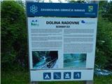 2
2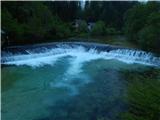 3
3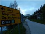 4
4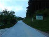 5
5 6
6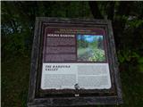 7
7 8
8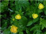 9
9 10
10 11
11 12
12 13
13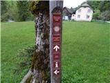 14
14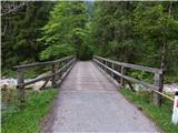 15
15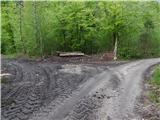 16
16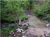 17
17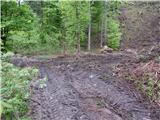 18
18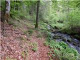 19
19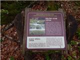 20
20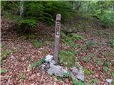 21
21 22
2223
 24
24 25
25 26
26 27
27 28
28 29
29 30
30 31
31 32
32 33
33 34
34 35
35 36
36 37
37 38
38 39
39 40
40 41
41 42
42 43
43 44
44 45
45 46
46 47
47 48
48 49
49 50
50 51
51 52
52 53
53 54
54 55
55 56
56 57
57 58
58 59
59 60
60 61
61 62
62 63
63 64
64 65
65 66
66 67
67 68
68 69
69 70
70 71
71 72
72 73
73 74
74 75
75 76
7677
 78
78 79
79 80
80 81
81 82
82 83
83 84
84 85
85 86
86 87
87 88
88 89
89 90
90 91
91 92
92 93
93 94
94 95
95 96
96 97
97 98
98 99
99 100
100 101
101 102
102 103
103 104
104 105
105 106
106
Discussion about the trip Krnica (most čez Radovno) - Gogala linden tree
To post a comment you must log in:
If you do not yet have a username, you must first
register.