Krnica (most čez Radovno) - Source of Lipnik
Starting point: Krnica (most čez Radovno) (620 m)
| Latitude/Longitude: | 46,37840°N 14,05430°E |
| |
Walking time: 50 min
Difficulty: easy marked way
Elevation gain: 40 m
Elevation difference along the route: 45 m
Map: TNP 1:50.000
Recommended equipment (summer):
Recommended equipment (winter):
Views: 1.460
 | 1 person like this post |
Access to starting point:
A) We drive to Bled, then follow the signs for Pokljuka. In the direction of Pokljuka we drive to the settlement Krnica, where we turn right downhill in the direction of Mojstrana, Zgornja Radovna and Krma. A shorter descent follows, then we cross the Radovna River over the bridge, after the bridge we turn right and park by the information board.
B) We leave the Gorenjska highway at exit Jesenice east (Lipce), then follow the signs for Spodnje Gorje. An ascent to the settlement Kočna follows, then we slowly start descending towards the Radovna valley. After crossing the Radovna River some ascent follows again, in Spodnje Gorje, where we join the road from Bled, we continue in the direction of Pokljuka. In the direction of Pokljuka we drive to the settlement Krnica, where we turn right downhill in the direction of Mojstrana, Zgornja Radovna and Krma. A shorter descent follows, then we cross the Radovna River over the bridge, after the bridge we turn right and park by the information board.
Route description:
From the starting point, from where a nice view opens up on the dam on the Radovna River, we continue on the asphalt road in the direction of Mojstrana, Zg. Radovna and Krma. At the end of the settlement Krnica we enter the area of Triglav National Park, and we walk on the road which runs along the left bank of the Radovna River. At the road sign 2.5 km we arrive at HE Gorje, some 10 m further signs for the Lipnik Spring direct us left onto a side road, which over a bridge leads us to the other side of the river. A little further, at the smaller crossroad we continue left on the cart track (straight to homestead Lipnikar), a few steps further over a small bridge we cross the Lipnik Stream. On the other side of the stream we go right, where for a short time we still walk on the cart track, then the footpath narrows. Along a less beaten footpath we quickly arrive at the information board, a little further to the Lipnik Spring.
Description and pictures refer to the condition in the year 2019 (May).

Along the route: HE Gorje (633m)
Photos:
 1
1 2
2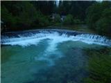 3
3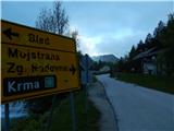 4
4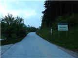 5
5 6
6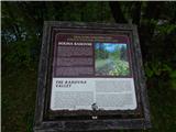 7
7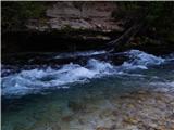 8
8 9
9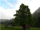 10
10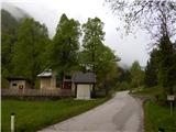 11
11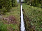 12
12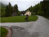 13
13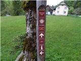 14
14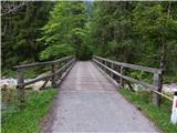 15
15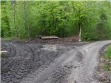 16
16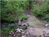 17
17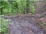 18
18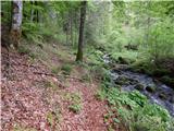 19
19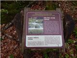 20
20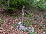 21
21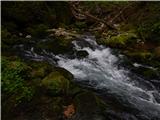 22
22
Discussion about the trip Krnica (most čez Radovno) - Source of Lipnik
To post a comment you must log in:
If you do not yet have a username, you must first
register.