Starting point: Krnica (660 m)
| Latitude/Longitude: | 46,37890°N 14,04190°E |
| |
Walking time: 5 h 30 min
Difficulty: easy marked way
Elevation gain: 1354 m
Elevation difference along the route: 1530 m
Map: TNP 1:50.000
Recommended equipment (summer):
Recommended equipment (winter): ice axe, crampons
Views: 15.093
 | 3 people like this post |
Access to starting point:
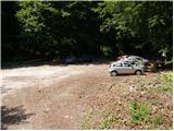
From the Ljubljana–Jesenice highway, take the Lesce exit and follow the road in the direction of Bled. At the traffic-light roundabout in Bled, continue right (direction Pokljuka) and follow the occasionally somewhat narrower road to the village of Krnica. Here we will notice signs for Pokljuka Gorge, which direct us right (direction Radovna) and then already after a few meters left. We continuously follow the road ahead towards Pokljuka Gorge, at the beginning of which we park in the designated parking lot.
Route description:
From the parking lot, we head right onto the road towards Klek and Kranjska dolina. The road quickly enters the forest, where it begins to ascend steeply. A little higher, the road temporarily flattens and takes us past a smaller landmark (St. Miklavž) to the other side of the ridge from Pokljuka Gorge. We continue on the relatively steep road, which takes us past pastures and a shepherd hut to a somewhat larger chapel, behind which we soon reach a marked junction.
We continue slightly right (left Lipanca) and follow the poorer road for only a few dozen steps to the point where the blazes direct us onto a footpath that enters the forest. The path ahead ascends through the forest along the edge of the expansive Pokljuka mountain pasture. Higher up, the path, which runs along the edge of the pasture fence, brings us to a wide cart track, along which we continue the ascent. The cart track higher up crosses a forest road several times, and we always follow it towards Planina Klek and Planina Meja dolina. After a while, the cart track brings us to a larger clearing where young spruces are already growing. Here the trail almost completely disappears among the spruces, but after a few minutes of bushwhacking through the young woodland, we will soon step onto a cart track, which we then follow to the nearby road.
When we step onto the road, we follow it sharply right (direction Klek, Lipanca), walking along it for only a few dozen metres, after which signs for Klek on a small clearing direct us left onto a quite overgrown footpath (on this section there is quite a lot of uncut fallen timber). Higher up, the marked path returns to the road, and we continue along it to the point where the blazes direct us slightly right onto a rough forest cart track. We ascend the cart track for a few dozen steps, after which the marked path turns left, moderately ascending through the forest. Higher up, we cross the road again; an occasionally poorly visible trail then takes us past the NOB memorial plaque to the edge of the abandoned Planina Meja dolina.
We continue along the marked path, which bypasses the aforementioned mountain pasture on the left and higher up crosses the forest road again. The path ahead begins to ascend steeply, then gradually flattens after crossing the road once more, bringing us to a small parking lot near Planina Klek. Here we follow the road right, and already after a few steps we notice hiking signposts directing us left onto the marked footpath. We then ascend past a watering place for animals, and the moderately steep path quickly brings us to the shepherd huts on Planina Klek. From these huts, a beautiful view opens onto the entire mountain pasture, and we continue the path slightly right, traversing down to the second part of the pasture where a few more shepherd dwellings stand.
We continue along the poorly visible path, which after a few dozen steps of further walking enters a larch forest. Here the trail becomes clearer again, and we follow it towards Lipanca. There follow a few shorter ascents and descents along the occasionally poorly visible trail. After about 30 minutes of walking from Planina Klek, we reach a marked junction where we continue right towards Debela peč (slightly left Lipanca and Debela peč via Spodnjih Brd). At the junction, the trail disappears briefly, but if we continue in the direction indicated by the signpost, we quickly find it. Ahead, the path begins to ascend moderately through increasingly sparse (mostly) larch forest. A little further on, we enter a small valley, ascending along it to the point where signs for Debela peč direct us sharply left. The path ahead enters a belt of dwarf pines, through which we ascend below the Klečice ridge (the true Klečice peak is further right). Just a few dozen metres before the mentioned ridge, the marked path turns left and begins to descend transversely towards the southwest. During the descent, wonderful views of Debela peč open up several times. The path ahead crosses dwarf pine-covered slopes for a while longer, then turns right and begins a very steep ascent. After a short ascent, we reach the ridge again, from which a beautiful view opens towards Radovna.
On the ridge, the path turns left and retreats into the dwarf pines, through which it continues ascending very steeply. Higher up, the path flattens and brings us to a scenic and in places sheer ridge (the path runs somewhat below the ridge, so there is no major risk of slipping). The path ahead descends slightly, then brings us to the upper edge of a V-shaped gully. We continue along the marked path, which leads us along the ridge of Debela peč, bringing us after less than 5 minutes of further walking to the scenic summit.

Along the route: Planina Pokljuka (900m), Spodnji Pokljuški Rovti (980m), Planina Meja dolina (1300m),
Planina Klek (1556m)
Photos:
 1
1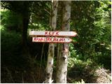 2
2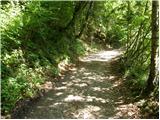 3
3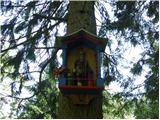 4
4 5
5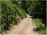 6
6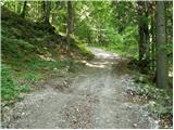 7
7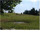 8
8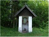 9
9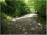 10
10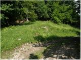 11
11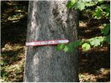 12
12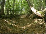 13
13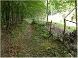 14
14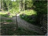 15
15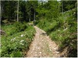 16
16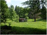 17
17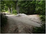 18
18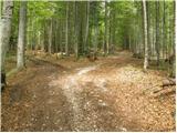 19
19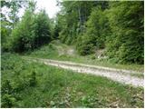 20
20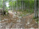 21
21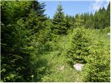 22
22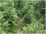 23
23 24
24 25
25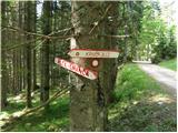 26
26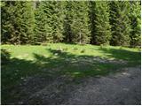 27
27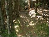 28
28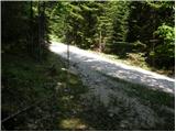 29
29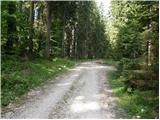 30
30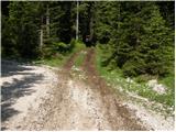 31
31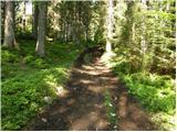 32
32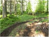 33
33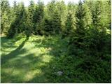 34
34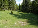 35
35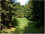 36
36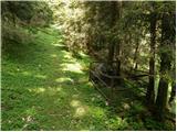 37
37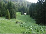 38
38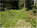 39
39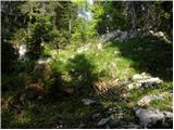 40
40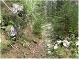 41
41 42
42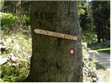 43
43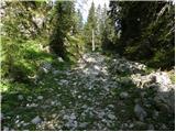 44
44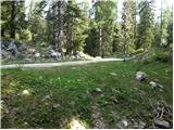 45
45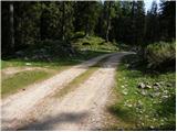 46
46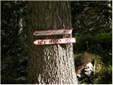 47
47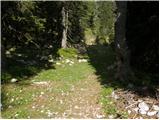 48
48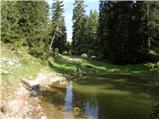 49
49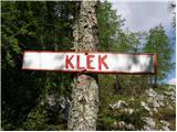 50
50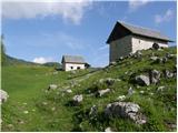 51
51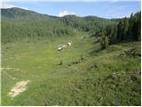 52
52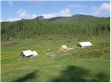 53
53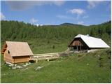 54
54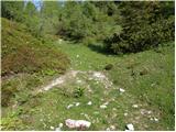 55
55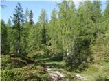 56
56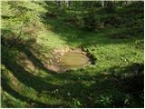 57
57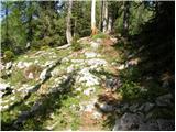 58
58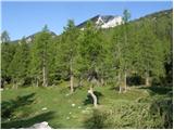 59
59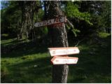 60
60 61
61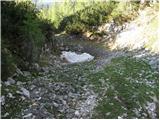 62
62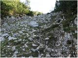 63
63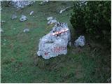 64
64 65
65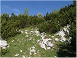 66
66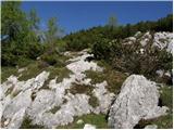 67
67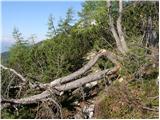 68
68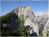 69
69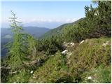 70
70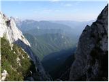 71
71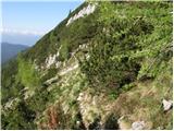 72
72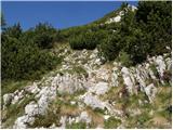 73
73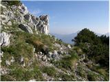 74
74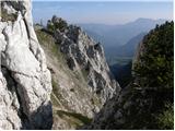 75
75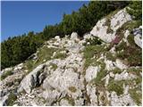 76
76 77
77 78
78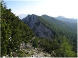 79
79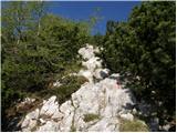 80
80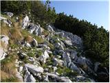 81
81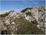 82
82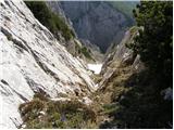 83
83 84
84 85
85 86
86
Discussion about the trip Krnica - Debela peč
|
| grdksmrt27. 07. 2012 |
I just returned from this tour, which I did today. I'd like to point out that it's essential to renew some markers and reattach the signposts. One signpost pointed in the wrong direction, and we even found another on the ground. This extended our trip by at least 2 hours since those signposts are right in the forested section of the path. It wouldn't hurt to renew the markings in forested areas (before the ascent to Klek) as they are sometimes very hidden and faded. It wouldn't hurt to add a few new markers, especially at junctions, in the forest (lots of logging trails), and on Planina Klek. There the path gets lost.
I wouldn't recommend the whole tour to everyone as our expedition up and down took quite a few hours. Also, right below the summit there's a slightly more demanding ascent where you need to use hands and feet.
Definitely, this path didn't seem like an easy marked path to me. You have to consider that you still need to get from the hill back to the valley I recommend to everyone to choose the direction of Planina Lipanca for the descent as the path branches off after about half an hour of walking also to Klek. The view from Debela peč is wonderful!!! I recommend to everyone to choose the direction of Planina Lipanca for the descent as the path branches off after about half an hour of walking also to Klek. The view from Debela peč is wonderful!!!
|
|
|
|
| grdksmrt29. 07. 2012 |
I have one question:
Does anyone perhaps know if Klečnica below Debela peč is just a ridge or some peak?
|
|
|
|
| toggleff20. 08. 2013 |
I started from a place near the Klek. In 2 hours I came to the top. In 1.5 hours I came back to my car.
It is a beautiful way. Yes you have to use your hands to climb, but it is very easy and not dangerous.
|
|
|
|
| di12. 10. 2025 17:34:16 |
Especially the first part of the trail (which has many roads, cart tracks, junctions...) to Klek is unmarked at several key junctions (unmarked or no direction signs).
Today's conditions: fog (like in a horror movie), snow remnants, spruces (in photos) have grown in nature.
|
|
|
To post a comment you must log in:
If you do not yet have a username, you must first
register.