Krnica - Kucelj (on Čaven) (via Veliki Rob)
Starting point: Krnica (972 m)
| Latitude/Longitude: | 45,94150°N 13,78750°E |
| |
Route name: via Veliki Rob
Walking time: 1 h 40 min
Difficulty: easy marked way
Elevation gain: 265 m
Elevation difference along the route: 400 m
Map: Nanos (PZS) 1:50.000
Recommended equipment (summer):
Recommended equipment (winter): ice axe, crampons
Views: 13.717
 | 1 person like this post |
Access to starting point:
A) From Nova Gorica, we drive through Solkan in the direction of Bovec, then at the last traffic-light intersection, already at the exit from Solkan, we continue straight towards Lokve (left Bovec, right bypass). We continue driving to the village of Trnovo, where at the beginning of the village by the building of the Gozdno gospodarstvo we turn right towards the hamlet Rijavci (marked). We follow the main road through Rijavci, continue past Kopitnik and on macadam to the forestry cottage in Krnica, where again on asphalt at the intersection we turn right. We continue a few tens of meters to a large clearing on the left (timber skidding), where we can park. In case timber skidding is taking place on the mentioned clearing, we continue driving through the hairpin bend and park at the first suitable place by the road.
B) From Tolmin we drive to the beginning of Solkan and at the first traffic-light intersection we turn left towards Lokve (continuation as in the description from Nova Gorica).
Route description:
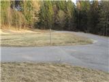
From the starting point, we continue along the asphalt road over the hairpin bend. The road then levels out and after approximately 200 meters a sign on a pole directs us sharply right onto a poorer cart track. We follow the cart track, which runs almost parallel to the road, only briefly, as a new signpost on a tree directs us left onto the marked path towards Veliki Rob. (At this spot, the path is also joined by a shortcut from the road, marked by a cairn, which shortens the bend along the cart track). The path first ascends moderately for a short time, then we ascend only slightly through the forest along a well-trodden and marked path. When a new sign directs us right towards the ridge, the path starts ascending more steeply again and we soon reach the ridge from where a view opens onto the Vipava Valley, and from the right the path from Vitovelj joins us. At the junction we continue left towards the summit, which we already see ahead. The path ahead turns slightly left from the ridge and avoids the steep cliffs. An ascent through a short stretch of forest follows and the path leads us to the summit slope of the mountain, from where we have only a few dozen steps to the summit.
From the summit of Veliki Rob a notice on the rock directs us right towards Kucelj. A shorter descent along the ridge and then through the forest follows, after which the path levels out briefly. The path then runs through the forest or along the edge of the plateau, from where beautiful views of the Vipava Valley open up. A longer and somewhat steeper descent then leads us to the junction with the old road link between the Vipava Valley (Vrtovinom) and the Trnovo Plateau. We follow the mentioned road link right, then signs at the junction direct us left onto a footpath, which is quite overgrown in the initial section. When the belt of scrub ends, the path ascends gently across extensive grassy slopes to the junction, where the footpath from Vrtovina joins from the right. At the junction we continue straight and after a shorter somewhat steeper ascent we soon reach the summit of Kucelj.
Krnica – Veliki Rob 40 min, Veliki Rob – Kucelj 1 hour.
We can extend the trip to the Koča Antona Bavčarja hut on Čavnu (45 min).

Photos:
 1
1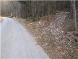 2
2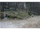 3
3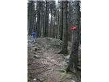 4
4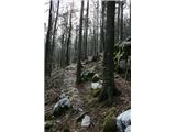 5
5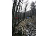 6
6 7
7 8
8 9
9 10
10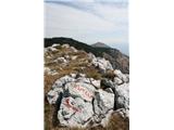 11
11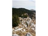 12
12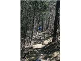 13
13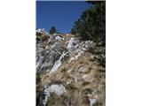 14
14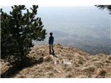 15
15 16
16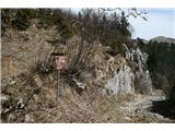 17
17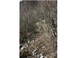 18
18 19
19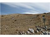 20
20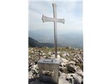 21
21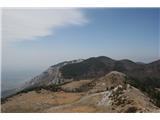 22
22 23
23
Discussion about the trip Krnica - Kucelj (on Čaven) (via Veliki Rob)
To post a comment you must log in:
If you do not yet have a username, you must first
register.