Starting point: Krnice (450 m)
| Latitude/Longitude: | 46,11780°N 15,10570°E |
| |
Walking time: 1 h 5 min
Difficulty: easy marked way
Elevation gain: 312 m
Elevation difference along the route: 312 m
Map:
Recommended equipment (summer):
Recommended equipment (winter):
Views: 8.115
 | 1 person like this post |
Access to starting point:
From Sevnica or Celje we drive to Zidani Most, where we head towards Hrastnik. We follow this very narrow road to the spot where the road towards the village Krnice goes right through the underpass. The turn-off is marked. We then follow the road to one of the smaller parking lots by the road, but there are not many. We park before we reach the village.
From Hrastnik we drive towards Zidani Most but only to the turn-off for the village Krnice. Here we turn left into the underpass... Further, follow the above description.
Route description:
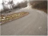
From the parking lot, we continue on the road ahead and it soon brings us to the village. The road then runs through the village and at the last house in the village it changes into a cart track which for a few steps descends and brings us to a crossing. Here we continue on the left upper cart track which in a gentle diagonal ascent crosses a grassy slope. The path, which still runs on a cart track and is well marked, goes after that into the forest. After a few minutes of additional walking, we come to a crossing, where we leave the cart track. Here we go slightly left upwards in the direction of Gor (Gore), straight ahead Sovretova pot. The path ahead moderately ascends, then for a few steps descends. Here from the right joins the path from Šavna peč. We continue straight on a wide path, which ascends diagonally over in parts pretty steep slopes. Also the path, which runs through the forest, occasionally steeply ascends. After one hour of walking, the path brings us to a wide gently sloping cart track, which we follow to the right. The cart track then runs past the church of St. Jurij to the mountain hut Dom v Gorah.

Photos:
 1
1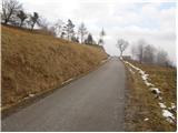 2
2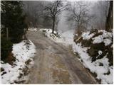 3
3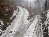 4
4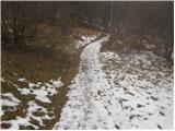 5
5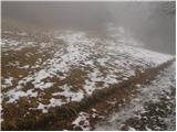 6
6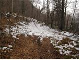 7
7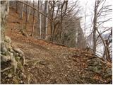 8
8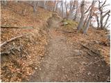 9
9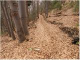 10
10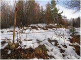 11
11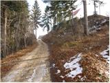 12
12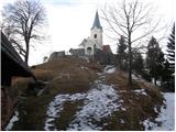 13
13 14
14
Discussion about the trip Krnice - Dom v Gorah
To post a comment you must log in:
If you do not yet have a username, you must first
register.