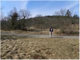
Starting point: Krog (215 m)
| Latitude/Longitude: | 45,45480°N 13,92690°E |
| |
Walking time: 1 h 15 min
Difficulty: easy marked way
Elevation gain: 193 m
Elevation difference along the route: 225 m
Map: Slovenska Istra - Čičarija, Brkini in Kras 1:50.000
Recommended equipment (summer):
Recommended equipment (winter):
Views: 7.226
 | 1 person like this post |
Access to starting point:
From the Ljubljana - Koper highway, take the Črni Kal exit. From Črni Kal, continue driving on the old road towards the coast, but drive along it only to the next somewhat larger crossroads, where we turn left in the direction of the Sočerga border crossing. On the mentioned road, we drive past the settlement Kubed to the village Gračišče, where at the crossroads we turn left in the direction of Rakitovec, Movraž and Smokvica. From Gračišče we drive to the village Movraž, and there we turn right in the direction of Dvori. Before the village Dvori we come to the next crossroads, where we continue sharply right (left Dvori), and on the road we drive another few hundred meters to the hiking signposts, which we see by the road. We park on an appropriate place by the hiking signposts.
Route description:
From the starting point, we go on a marked footpath in the direction of the natural bridge (Naravni most) and Sveti Kvirik. The path already after a few steps brings us to an unmarked junction, where it splits into the old left and new right path.
Walking on the old otherwise more interesting path, which leads past the natural bridge, is discouraged because of preserving rare bird species, therefore we continue on the right, on the newly arranged mountain path. The path ahead ascends gently to moderately, crossing bush-covered slopes to the right. Somewhat higher we leave the wide path, as the blazes direct us sharply left onto an initially still clearly traceable trail, which begins to ascend more steeply. Soon the trail disappears among tall grasses and bushes, and we continue straight up the slope, where we quickly reach the path leading from Sveti Kvirik towards the rock shelters of Velega badina.
Here, where the old much more interesting path also joins from the left, we continue right and continue the ascent on a well-trodden path, which continues along the edge of a partly precipitous ridge. The path ahead crosses a short stretch of forest, then transitions again to bare slopes, from which beautiful views open up. The path quickly returns to the ridge, which we follow with some ascents and shorter descents to the place where a 50 m long path branches off to the left to the nearby Bunker (a smaller natural window in which there is a logbook). Here we continue straight and after a short ascent arrive at the RTV repeater above Sočerga.
We bypass the repeater on the right side, and follow the trail, which begins to descend gently, to the nearby church of sv. Kvirik.

Along the route: Bunker (390m)
Photos:
 1
1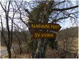 2
2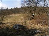 3
3 4
4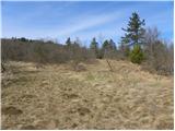 5
5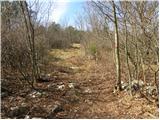 6
6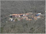 7
7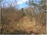 8
8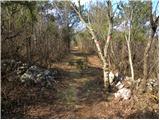 9
9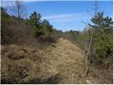 10
10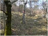 11
11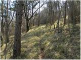 12
12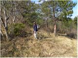 13
13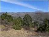 14
14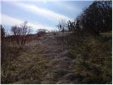 15
15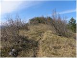 16
16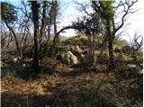 17
17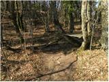 18
18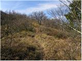 19
19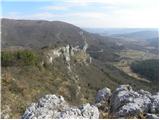 20
20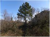 21
21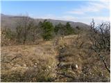 22
22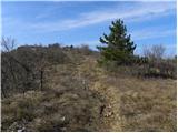 23
23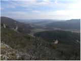 24
24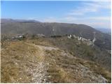 25
25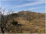 26
26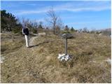 27
27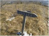 28
28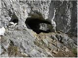 29
29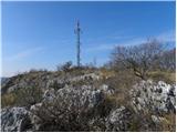 30
30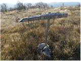 31
31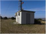 32
32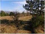 33
33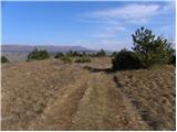 34
34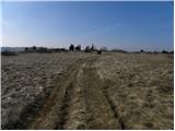 35
35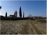 36
36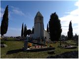 37
37
Discussion about the trip Krog - Sveti Kvirik
|
| Hribovc8810. 03. 2011 |
Great trip, but did Esti check all the larches with a razor?  
|
|
|
|
| VanSims20. 11. 2011 |
When approaching the starting point, the last right turn might be harder to spot, from the direction of Dvorov (where we turn around if we missed it). In that case, we go slightly left where the description says 'sharp right'. In the first bend, we don't go straight onto the gravel but sharply turn left i.e. stay on the winding asphalt until we reach the signposts.
|
|
|
To post a comment you must log in:
If you do not yet have a username, you must first
register.