Kropa (Slovenska peč) - Partisan cyclostyle Tehnika Meta
Starting point: Kropa (Slovenska peč) (576 m)
| Latitude/Longitude: | 46,28690°N 14,19690°E |
| |
Walking time: 1 h 50 min
Difficulty: easy unmarked way, easy marked way
Elevation gain: 524 m
Elevation difference along the route: 535 m
Map: Karavanke - osrednji del 1:50.000
Recommended equipment (summer):
Recommended equipment (winter): ice axe, crampons
Views: 651
 | 1 person like this post |
Access to starting point:
A) We drive to Kropa, then continue driving towards Železniki and Dražgoše. When Kropa ends, we continue driving along the Kroparica stream, and on the right, just before the left hairpin turn and Slovenska peč, we notice a larger macadam area where we park.
B) From Besnica (near Kranj) we drive towards Dražgoše, higher above the settlement of Podblica we continue towards Kropa. The path ahead leads past the village of Jamnik, then we begin to descend steeply towards Kropa. Behind Slovenska peč, we will soon notice a larger macadam area on the left, where we park.
C) We drive to Železniki, then follow the signs for Dražgoše and Kropa. The path ahead leads past the village of Jamnik, then we begin to descend steeply towards Kropa. Behind Slovenska peč, we will soon notice a larger macadam area on the left, where we park.
Route description:
From the starting point, along the road that runs along the Kroparica, we ascend to Slovenska peč (Slovenska peč is the oldest preserved smelting furnace in Slovenia, built in the 14th century), opposite which stands a NOB monument; behind the furnace, the signs for Vodice direct us right onto a worse road, which quickly turns into a wide path. Still before crossing the Kroparica, we continue sharply left onto an unmarked footpath, which further ascends diagonally to the left, higher up crossing the asphalt road several times. Higher up, we stay on the road and follow it to the right hairpin turn. From the mentioned hairpin turn, we continue straight onto a cart track, which further crosses the slopes, then ascends diagonally and brings us in a few minutes to a marked junction, where we join the marked path that starts in the center of Kropa.
Here we continue right in the direction of Vodiška planina (straight to Kropa, slightly right to Jamnik).
There follows a few minutes of steep ascent, then we cross an asphalt road.
On the other side of the road, we continue along the marked cart track, from which we soon go right onto a footpath, which after a few minutes returns to the cart track. There follows some ascent along the cart track, where we make a few hairpin turns, then the cart track narrows into a mountain path. During the further ascent, we get some partial views towards Jamnik; after a smaller landmark, the path widens into a cart track, which brings us to a junction where the path from Jamnik joins from the left.
We follow the signs for Vodice and soon arrive at a junction, where the path to Tehnika Meta branches off to the left.
Here we leave the path to Vodiška planina and continue slightly left onto a footpath that past a storage facility brings us in approximately 5 minutes of further walking to the Partizanska tehnika Meta.

Along the route: Slovenska peč v Dnu nad Kropo (583m)
Photos:
 1
1 2
2 3
3 4
4 5
5 6
6 7
7 8
8 9
9 10
10 11
11 12
12 13
13 14
14 15
15 16
16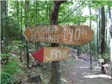 17
17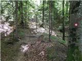 18
18 19
19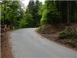 20
20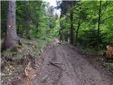 21
21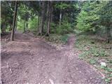 22
22 23
23 24
24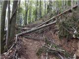 25
25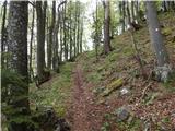 26
26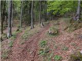 27
27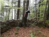 28
28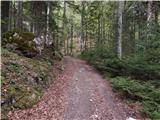 29
29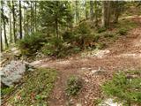 30
30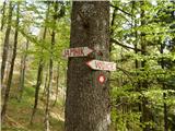 31
31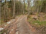 32
32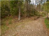 33
33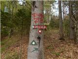 34
34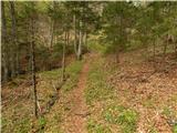 35
35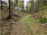 36
36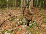 37
37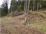 38
38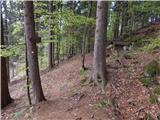 39
39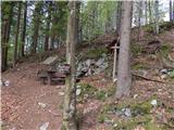 40
40
Discussion about the trip Kropa (Slovenska peč) - Partisan cyclostyle Tehnika Meta
To post a comment you must log in:
If you do not yet have a username, you must first
register.