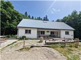
Starting point: Kugina kuća (1171 m)
| Latitude/Longitude: | 44,62212°N 15,07017°E |
| |
Walking time: 1 h
Difficulty: easy marked way
Elevation gain: 278 m
Elevation difference along the route: 278 m
Map:
Recommended equipment (summer):
Recommended equipment (winter): ice axe, crampons
Views: 169
 | 1 person like this post |
Access to starting point:
a) From the A1 motorway, take the Otočac exit. Follow the road towards Krasno village and NP Northern Velebit. The fairly winding road takes us through Švica village to Krasno, where the road from Senj joins (access possible also from this direction). In Krasno, continue left towards Štirovače and when the road to NP Northern Velebit branches right, continue straight. The asphalt road leads through forests to the Mrkvište hut, where the road to Alan branches right (arrival possible also from this direction). The road begins to descend to Štirovače, where we continue driving towards Gospić, but only to the turn-off for Kugina kuća and Ravni Dabar. Turn onto the gravel road, which is not in the best condition. After about 9 km of driving, arrive at Kugina kuća on the left. Park somewhere by the road. From Krasno, 37 km drive.
b) From the A1 motorway, take the Perušić exit (toll payable only by card or ENC system), then continue left and immediately right towards Klanac, Kaluđerovac and Malo Polje. Drive to Klanac, at the junction continue right. The road takes us through Aleksinica and beyond Velika Plana village into the forest. After about 20 km of asphalt from the last village, arrive at a junction, continue left towards Kugina kuća. The road becomes gravel, which is not in the best condition. After about 9 km of driving, arrive at Kugina kuća on the left. Park by the road. From Velika Plana, about 28 km drive.
Starting point reachable also from Karlobag or Gospić via Baške Oštarije. Road from Ravni Dabar fully gravel and quite damaged in several places.
Route description:
From Kugina kuća, cross the road to the poorer ascending road. After about 15 minutes of traverse ascent along the slope of the unnamed eastern forepeak of Lisac, arrive at the right branch for Lisac summit. Continuing on the road reaches Premužić Trail. The trail ascends to a small valley, then turns right into another valley and left. At the time of description, there was a wasp nest and full of wasps on this section. Detour around required. Trail crosses small rocky blocks and short rock step, then steeply ascends eastern slope of Lisac. Trail first turns right, then serpentines up to the summit. Huge number of fallen trees on trail, so carefully follow markers. Trail leaves forest and ascends grassy slope to Lisac summit, from where view opens all around, especially Dabarski kukovi stand out to the south.
Description and photos refer to July 2025 conditions.
Photos:
 1
1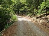 2
2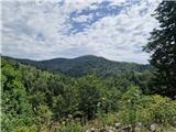 3
3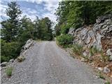 4
4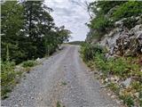 5
5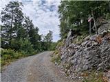 6
6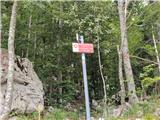 7
7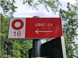 8
8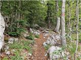 9
9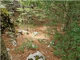 10
10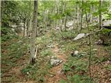 11
11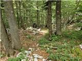 12
12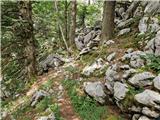 13
13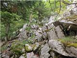 14
14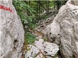 15
15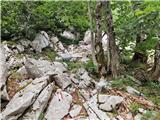 16
16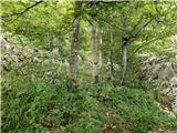 17
17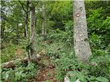 18
18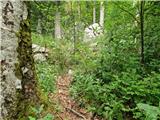 19
19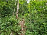 20
20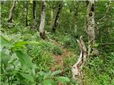 21
21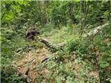 22
22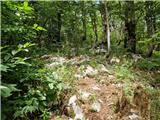 23
23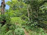 24
24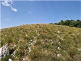 25
25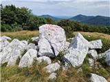 26
26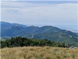 27
27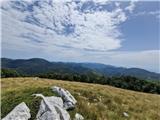 28
28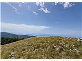 29
29
Discussion about the trip Kugina kuća - Lisac
To post a comment you must log in:
If you do not yet have a username, you must first
register.