Starting point: Kupljenik (642 m)
| Latitude/Longitude: | 46,33820°N 14,07850°E |
| |
Walking time: 1 h 30 min
Difficulty: easy marked way
Elevation gain: 486 m
Elevation difference along the route: 515 m
Map: Karavanke - osrednji del 1:50.000
Recommended equipment (summer):
Recommended equipment (winter): ice axe, crampons
Views: 101.046
 | 3 people like this post |
Access to starting point:
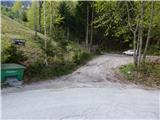
A) From the motorway Ljubljana - Jesenice, take the Lesce exit, then continue driving towards Bled and further towards Bohinj. When Bled ends, first the road towards Bohinjska Bela branches off to the right, approximately 1.5 km further, at the top of the hill the road towards the village Kupljenik branches off to the left. Continue towards Kupljenik and continue driving on the ascending asphalt road, which we follow to the mentioned settlement. In the settlement, on the part where there are no houses, we arrive at the left hairpin turn, in the middle of which a short road to the marked parking lot branches off to the right.
B) First drive to Podbrdo and from there to Bohinjska Bistrica (by car shuttle train or over Soriška planina). From Bohinjska Bistrica continue driving towards Bled. Before arriving at Bled, we will come to a crossroads where the road towards the village Kupljenik branches off to the right (the turn-off from the main road is marked). Continue towards Kupljenik and continue driving on the ascending asphalt road, which we follow to the mentioned settlement. In the settlement, on the part where there are no houses, we arrive at the left hairpin turn, in the middle of which a short road to the marked parking lot branches off to the right.
Route description:
From the marked parking lot, continue on the poorer road in the direction of the cave under Babji zob and Babji zob. The road first leads along the edge of the pasture, from where a nice view temporarily opens up reaching all the way to the highest peaks of the Karavanks, then after the left bend, where we notice the mountain signposts, it gradually enters the forest. We walk on the road for a few minutes, then at a relatively new junction of macadam roads continue slightly left (at the time of the description the junction was not marked) on the cart track, which after a few metres turns even more to the left (straight [to] Jama pod Babjim zobom). There follows an ascent through the forest; a few minutes higher the cart track brings us to a scenic hay meadow, where a wooden hut stands at its lower edge, and a nice view opens towards Lake Bled and part of the Karavanks around Golica. The cart track brings us just a little higher to another hay meadow, where the signs lead right onto an initially less noticeable path that enters the forest. Once we enter the forest, the path becomes easy to follow, and it starts to ascend more steeply. A few minutes higher we cross a new, not yet fully completed forest road, above which the marked path ascends quite steeply through the forest. When the path turns right it levels off somewhat, then ascends transversely to the right across increasingly steep slopes. Higher up the slope becomes even steeper, but the path is relatively wide, so traversing it causes no major difficulties, though in wet conditions, snow or leaves more caution is needed, especially on the descent, to avoid slipping. When the path bypasses some rocky pillars it turns left, enters a small valley, and a few steps further also emerges from the forest onto Planina Prihod, which has just the right name since we have reached the edge of Jelovica.
When we reach the mountain pasture we continue straight or slightly right, then step onto a cart track where the path from Planina Vršana and Danejeva planina joins us. The cart track soon turns into a footpath which, with the "help" of a signpost, leads us onto a precipitous ridge. The path mostly runs a few metres left of the drop, so there is no major slipping hazard; we must be careful primarily when we step a few paces right off the marked path for a nice view. The path, from which beautiful views open up through the treetops towards Bled, Bohinjska Bela and the highest peaks of the Julian Alps, brings us to the forepeak, where a less noticeable path branches left towards the nearby Planina Ricman.
Continue straight along the path, which starts to descend visibly. After a few minutes the descent ends, and only a short moderate ascent separates us from the viewpoint and the summit logbook box of Babji zob.
Kupljenik - Planina Prihod 1:00, Planina Prihod - Babji zob 30 minutes.
Description and pictures refer to the condition in 2015 (April).

Photos:
 1
1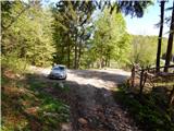 2
2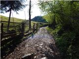 3
3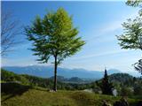 4
4 5
5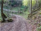 6
6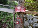 7
7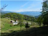 8
8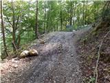 9
9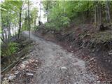 10
10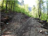 11
11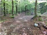 12
12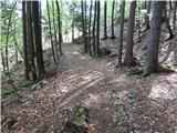 13
13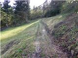 14
14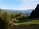 15
15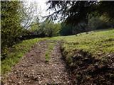 16
16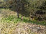 17
17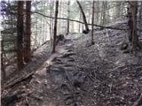 18
18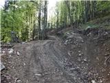 19
19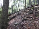 20
20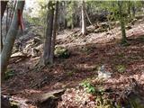 21
21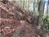 22
22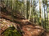 23
23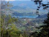 24
24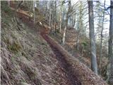 25
25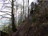 26
26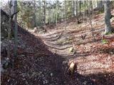 27
27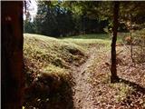 28
28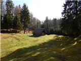 29
29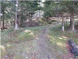 30
30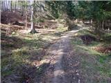 31
31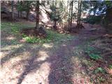 32
32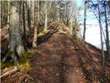 33
33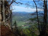 34
34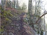 35
35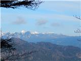 36
36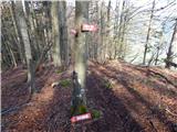 37
37 38
38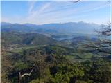 39
39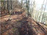 40
40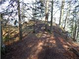 41
41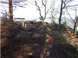 42
42 43
43
Discussion about the trip Kupljenik - Babji zob
|
| lubnikar14. 05. 2008 |
really nice view of Bled lake, but Triglav was hiding.
|
|
|
|
| Planinček31. 07. 2008 |
In the lower part the path is overgrown and full of ticks. Yesterday I picked up four. If you're heading on this path, take insect repellent spray with you.
|
|
|
|
| guzejvin13. 12. 2008 |
I'm sending you an anecdote about Babji Zob, which is certainly more original than the dragon one. Please excuse if you can somehow publish it in the context of Babji Zob.
ANECDOTE ABOUT BABJI ZOB ON JELOVICA
Old people say that on the Jelovica plateau an old woman lived. Some even claimed she was already over one hundred and fifty years old, that she was a witch who hid there, otherwise they would have burned her at the stake. The old woman gathered herbs, dabbled in witchcraft and potions, and sent her spells into the valley.
Everyone in the valley feared the old woman, for whenever she sent spells, no farmer dared to go to the field or forest, because even today the devil's mare lurks there, which can kill any farmer immediately due to her spells.
But when the old woman was already old she no longer gathered herbs so well, as her time was slowly coming. No one knew how old she was, as she had already lived well over a hundred years.
One day, when the old woman had not gathered enough herbs, she threw spells over the edge of the plateau in anger and behold, the old woman slips on this plateau. And as she topples into the vast depths from where her old spells could still be heard.
And from the echo of the mountains the spell could be heard even in the valley:
Jelovica, you will no longer be as steep as before, make a notch right there at this spot.
And since then at the end of Jelovica, which descends towards Bohinjska Bela, one always sees the big Babji Zob, which for over a hundred years all generations from generation to generation have called that way. And in Bilžina there still stands a hut, for which more than three owners have already passed.
Author: Guzej Vinko.
|
|
|
|
| heinz27. 03. 2009 |
An interesting trip which I did today.
Let me add that the trail along the precipitous edge and a bit back is in winter (early spring) time somewhat dangerous, as the wind-packed frozen snow is "polished" at an angle, so in many places you really need to watch how you step. In summer surely no problems, but for now it would be safer if the trail ran a bit more inside the forest - nothing easier.
Otherwise I wouldn't recommend visiting without crampons.
It was blowing hard at the summit itself.
Short tour, nice view of Gorenjska.
Recommended. Good luck and steady steps!
|
|
|
|
| robi2412. 04. 2009 |
super hike beautiful view over Gorenjska only towards summit from last meadow could be a bit better marked or I didn't notice blazes otherwise super
|
|
|
|
| Lj17. 05. 2009 |
Today our granny group visited Babji zob. Nice, quite steep path and wonderful views. Seeing the fresh bear tracks in the mud made us feel right at home (p.s.: we're from the Kočevje area) Nice, quite steep path and wonderful views. Seeing the fresh bear tracks in the mud made us feel right at home (p.s.: we're from the Kočevje area)
|
|
|
|
| zmp25. 11. 2009 |
The coordinate itself is slightly wrong (that's Planina Ricman). The correct coordinate of the summit of Babji zob is
46,328646°N / 14,073743°E, or
N46°19'43.13, E14°04'25.48
|
|
|
|
| Tadej5. 11. 2009 |
zmp2, thanks. It's already corrected.
Best regards, Tadej
|
|
|
|
| vikikrema25. 11. 2010 |
On descent, some attention is not amiss when you reach the section with a lot of fallen trees (currently). There a "rag" is hung, where you continue left downhill. Useful if not too attentive
|
|
|
|
| JORDAN23. 05. 2011 |
Yesterday we did a circular hike starting in Ribno to Kupljenik and then to Babji zob. We returned back to the clearing where the observation post stands, there we turned right on the wide path and at the second junction turned left on the still wide path and came to the sign Na babi. We continued steeply down through Tolsti vrh to Lovska koča na Taležu. From Talež we returned to Ribno. Nice circular tour and the weather served us well.
|
|
|
|
| tigrr10. 07. 2011 |
Nice hike, especially the last part on the ridge. Well marked, but on the return attention to the markings is really not superfluous. (there at cunji, which is no longer
|
|
|
|
| likozar2. 01. 2012 |
Nice short hike, took a good hour, mainly because you need to orient yourself well several times. Despite the path description, at the fallen hut (it's a few meters lower than in the picture) I searched a bit. You have to go sharply right just before the hut into almost impassable forest. Markings poorly visible and sparse, brush hanging again. Why isn't the route to the cave described? I missed it first, then I ran out of time.
|
|
|
|
| darh18. 03. 2012 |
Yesterday we climbed to Babji zob via this path. Except for the icy first right bend on the cart track above Kupljenik, the path was completely dry. You can find a detailed description of our circular route starting from Selški most and returning via planina Talež here.
|
|
|
|
| metod16. 05. 2012 |
I thought the "at your own risk" sign was because you first climb to the tip of Babji zob to check if it's filled.  Nice view though! Nice view though!
|
|
|
|
| Kokta5. 01. 2013 |
Really nice path. No problems with markings either. In some places leaves up to the knees .
|
|
|
|
| Nanus7. 10. 2014 |
On Sunday we were at Babji zob, we had some problems with orientation because apparently they made some new forest tracks. On the way up we missed and walked quite a while on the mentioned tracks. It would be good to make new markings at 3-4 places.
|
|
|
|
| donat19. 02. 2018 |
I was up there 3 weeks ago, a bit tricky only a bit before the bend to the alpine pasture, where the path was narrow and icy, a slip would end quite a bit lower...
|
|
|
|
| francimedved19. 06. 2018 |
Today I was up there, the path is nicely arranged except in one section where you need to scramble a bit over fallen trees. New direction signs have been installed.
|
|
|
|
| francimedved18. 11. 2018 |
Today I was again on Babji zob, the path is excellently maintained, they also removed those few trees that had fallen across the path, commendable.
|
|
|
|
| maks578. 08. 2019 |
Today, my wife and I were on Babji zob. And via a route that isn't described anywhere. We misunderstood the directional sign and already about a third of the way, instead of following the road, we turned right steeply uphill. The path was narrow and steep, and suddenly we found ourselves at a rocky section where the path continued with the help of a plastic-covered steel cable, which helped us all the way to the top.
Instead of a 1.5-hour hike, we thus did an interesting and quite adrenaline-filled route that we hadn't planned at all. Adrenaline-filled because we did it in the rain, which fell occasionally and made the path slippery, and the cable was slippery too.
I'm curious which path my wife and I actually conquered on Babji zob today.
|
|
|
|
| anica.zu@gmail.com8. 08. 2019 |
I also went on this path to Babji zob recently. The markings are really disastrous or missing where needed.
That's why I also missed the way and went up via the cable (as described by maks57), and down the normal path. If they're already building new roads so high up and thus destroying the current hiking paths, it would be appropriate for us ordinary hikers to install additional directional signs.
|
|
|
|
| maks5712. 08. 2019 |
I really don't understand how someone can put up a directional sign just a few meters before the path branches off from the road, which isn't even the right one.
Trail markers, get your act together, if you don't want to have some lost hiker's mishap on your conscience.
|
|
|
|
| Markelj 37. 04. 2020 |
The trail is not an easy hiking trail, as indicated in one of the trail descriptions on this page. Please, editor, can you change this for the benefit of future visitors. Towards the summit there are several secured sections under which there are cliffs. In January an unsecured section of the trail unfortunately contributed to the accident of a young girl with a fatal outcome, she slipped into the depths. I recommend poles and good hiking footwear, and special caution until - if at all - the PZS activates and secures the most dangerous sections.
P.S. On the page I looked for a contact on how to contact the editor but I couldn't find it.
|
|
|
|
| JusAvgustin7. 04. 2020 |
That's not correct. The accident did not happen on the trail.
|
|
|
|
| Tadej9. 04. 2020 |
Hello Markelj 3. First thanks for the warning.
To me the trail did not seem technically demanding, it is marked that way on maps too, but the slipping hazard is mentioned in the description.
|
|
|
|
| Lou11. 05. 2021 18:10:33 |
Yesterday I walked this trail with wonderful views. Thanks to the above comments, I didn't end up on the steel cables under the wall myself. At the sign (1h 5min), we follow the road for a few more minutes, leaving it only when the wooden steps take us right into the forest.
|
|
|
|
| keti131. 05. 2021 11:59:03 |
I also hiked this trail yesterday. It didn't seem demanding anywhere to me, and the markings are perfectly fine. Behind the sign for 1 hour 5 min, an unmarked path does branch off to the right, but the sign doesn't point that way, so I didn't find it problematic. It shows continuing along the road, from where after a few minutes a marked path branches off to the right (via steps). If you miss that, in the next 300 m two more marked paths branch off to the right (everywhere at junctions there's a "Babji zob" sign). We figured this out when returning via the circular path to planina Ricman, then another approx. 1 hour along the road.
Otherwise a very nice hike, not too long, with wonderful views.
|
|
|
|
| J.P.4. 01. 2022 21:00:12 |
The path is nicely arranged - marked, but I don't know how it was before. Short tour, extremely nice summit with beautiful views. But you have to be careful on the edges below the summit, which are precipitous. I would advise families with small children another destination. Safe travels. LP
|
|
|
|
| KSG10. 03. 2022 21:20:48 |
Hiked at the end of February. Nice and easy trail with really nice views, especially on Beljsko jezero. Some snapshots at: https://bit.ly/3t1ihSs
|
|
|
|
| Zoelcek25. 05. 2022 11:07:26 |
Does anyone know if the stamp is still in the box at the top, the one shown in one of the photos?
|
|
|
|
| J.P.25. 05. 2022 16:06:13 |
In January there was one stamp in the box. Lp
|
|
|
|
| Zoelcek23. 06. 2022 20:32:21 |
Thanks for the reply Cheers
|
|
|
|
| ZB28. 01. 2023 11:48:07 |
The path is really exposed in two places and is not suitable for inexperienced hikers in snow or ice. However, you can easily avoid the most exposed part by following the ridge. There the path is already trodden and completely safe.
|
|
|
|
| Srečko7314. 07. 2023 11:25:15 |
Is it possible to go directly from the cave under Babji zob to the trail leading to planina Ricman or to planina Tamar?
|
|
|
To post a comment you must log in:
If you do not yet have a username, you must first
register.