Kurnikovo sedlo - Hochobir (Ojstrc) (footpath)
Starting point: Kurnikovo sedlo (997 m)
| Latitude/Longitude: | 46,48580°N 14,53340°E |
| |
Route name: footpath
Walking time: 3 h 5 min
Difficulty: easy marked way
Elevation gain: 1142 m
Elevation difference along the route: 1142 m
Map: Karavanke - osrednji del 1:50.000
Recommended equipment (summer):
Recommended equipment (winter): ice axe, crampons
Views: 26.363
 | 2 people like this post |
Access to starting point:
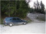
Via the border crossing Jezersko or Pavličevo sedlo, we drive to Železno Kaplo / Eisenkappel, from where we continue driving westwards in the direction of »Hochobir«. We follow this road for approximately 3 km to the intersection, where the signpost for »Eisenkappler Hütte« directs us right onto the still asphalted road, which starts to ascend more steeply and brings us higher to the place where toll is collected. Here we park on the marked parking lot.
In the winter time, driving and parking are prohibited.
Route description:
From the parking lot, we continue on the asphalt road which ascends moderately mostly through the forest. The road crosses a few torrent streams and after one hour of walking brings us to Obirska planina.
From the mountain pasture where a shepherd's hut stands, we continue on the road which soon makes a large right turn. After the turn, a marked footpath branches off to the left upwards onto which we head (it is possible to continue also on the road). The path which starts ascending somewhat more steeply crosses a cart track and through the forest in less than 30 minutes brings us to a poor forest road. The road brings us higher out of the forest and then turns left. After a few meters, the footpath goes onto the grassy slopes below the hut »Eisenkappler Hütte« to which only a few steps remain.
In the summer season, when the road is open, we can drive by car almost to the hut Eisenkappler Hütte (this shortens the path by approximately 1 hour and a half).
From the hut, we continue in the direction of the natural science educational trail (Naturkundlicher Rundwanderweg). The path ahead ascends moderately partly through the forest, partly over meadows. Along the path there are educational boards which tell us interesting things about the surroundings through which we walk. The path then at the emergency shelter crosses the gate and continues through increasingly sparse forest. Shortly after that, a nice view opens up on Obir with its highest peak Ojstrc / Hochobir. The locally very wide path then brings us to panoramic grassy slopes, where a view opens towards Slovenia, where we notice the Košuta ridge. At the altitude of 2042 m we reach the ruins of the former highest Austrian meteorological station.
We continue onwards and the path brings us to a junction, where the path from Šajda / Zell-Schaida joins. From the junction to the summit we have only a few minutes of easy walking on the panoramic summit slope of the mountain.
Starting point - Obirska planina 1:00, Obirska planina - Eisenkappler Hütte 30 minutes, Eisenkappler Hütte - Ojstrc / Hochobir 1:30.

Photos:
 1
1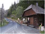 2
2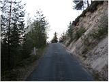 3
3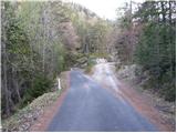 4
4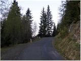 5
5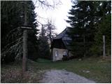 6
6 7
7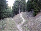 8
8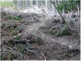 9
9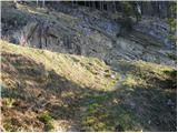 10
10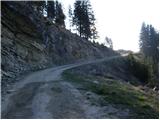 11
11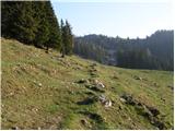 12
12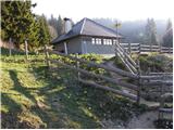 13
13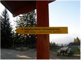 14
14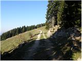 15
15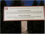 16
16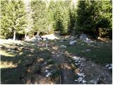 17
17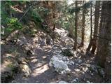 18
18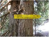 19
19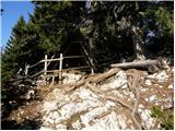 20
20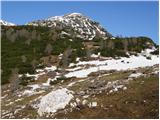 21
21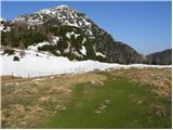 22
22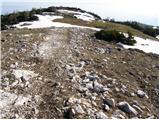 23
23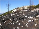 24
24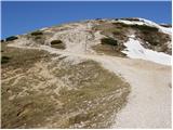 25
25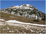 26
26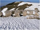 27
27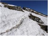 28
28 29
29
Discussion about the trip Kurnikovo sedlo - Hochobir (Ojstrc) (footpath)
|
| francija15. 08. 2009 |
Nice trip.
We were at the summit today
|
|
|
|
| geppo9. 09. 2010 |
In 2008 it was 5 euros. It was paid at the alpine hut where you park.
Regards
|
|
|
To post a comment you must log in:
If you do not yet have a username, you must first
register.