Starting point: La Crusc (2045 m)
| Latitude/Longitude: | 46,60870°N 11,89610°E |
| |
Walking time: 4 h
Difficulty: difficult marked way
Elevation gain: 1010 m
Elevation difference along the route: 1100 m
Map: Tabacco 07 1:25.000
Recommended equipment (summer): helmet
Recommended equipment (winter): helmet, ice axe, crampons
Views: 10.129
 | 2 people like this post |
Access to starting point:
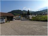
A) From Kranjska Gora over Korensko sedlo to Austria, where at the first larger intersection we continue left towards Podklošter / Arnoldstein and Trbiž / Tarvisio. At the end of the settlement Podklošter signs for Šmohor / Hermagor direct us right onto a regional road, along which past the mentioned settlement we drive to the end of the Ziljske doline valley, or more precisely to the settlement Kötschach-Mauthen, where we turn right towards the settlement Oberdrauburg. The route ahead leads us over the Alpine pass Gailbergsattel (982 m), after which we descend into the mentioned settlement. After crossing the bridge over the river Drau, we continue left towards the settlement Lienz. In the main roundabout in Lienz we continue "left" in the direction of the settlement Sillian and Italy. Further, we cross the border between Austria and Italy, and we follow the main road past settlements Dobbiaco / Toblach, Villabassa / Niederdorf, Monguelfo - Tesido / Welsberg - Taisten, Brunico / Bruneck. Only a little after the last-mentioned settlement, past which a bypass road leads, we turn left into the Alta Badia valley. Further, we drive along the mentioned valley, and we follow the road to the settlement Badia / Abtei. In the settlement Badia / Abtei we turn left and park on the parking lot at the bottom station of the chairlift. With two chairlifts we then go to the highest point of the ski area.
B) From Nova Gorica we drive to Italy and further on the highway to the settlement Portogruaro, where at the highway junction we turn in the direction of the settlement Belluno. We follow the highway to its end (we don't turn in the direction towards Belluno), and then we continue driving towards Cortina d'Ampezzo. When we arrive in Cortina d'Ampezzo, we follow the signs for the Alpine pass Passo Falzarego. At the pass Passo Falzarego (2105 m) we turn right in the direction of Alta Badia and first ascend to the neighbouring pass Passo Valparola (2192 m), from there we descend into the mentioned valley, and we drive along it to the settlement Badia / Abtei. In the settlement Badia / Abtei we turn right and park on the parking lot at the bottom station of the chairlift. With two chairlifts we then go to the highest point of the ski area.
The chairlift in the summer months operates from 8:30 to 17:15.
Route description:
From the upper station of the second chairlift we continue slightly right and on a wide path through the forest ascend to the church. At the church we continue right on path no. 15 following the signs »St. Kassian / S. Cassiano«. The path further crosses the slopes towards the south for a long time and mostly gently descends. Along the path, from which there is a nice view mainly towards the west, there are also Stations of the Cross. When the path brings us to a marked junction we continue left on path 12A following the signs »Forc. La Varella«.
The path further begins to ascend and runs mostly through sparse larch forest. Later the path brings us into dwarf pines for a short time, then from the right the path from the settlements La Villa and S. Cassiano joins.
At the junction we continue left towards the saddle La Varella and the path through dwarf pines soon brings us to the scree. Further the path ascends in zigzags up the valley Val Medesc for some time. Later the path turns to the left side of the valley under the slopes of Piz de Medesc and continues ascending on the scree. The increasingly steep path then brings us to the saddle from which nice views also open towards the east.
From the saddle, where there are signposts, we continue right following the signs La Varella. The path across the scree soon brings us to the somewhat steeper slopes of the summit La Varella. Further the path becomes more demanding and runs along the steep western slopes of the mountain. At some points the path ascends steeply, then follows the ascent along a fairly wide ledge on which there is a lot of scree. The path is not secured and considerable caution is required. Special caution is needed on the descent, as the path is dangerous for slipping. From the ledge the path turns slightly left and ascends steeply up the rocky slope. The path then becomes less demanding again and brings us to a junction just below the summit. We continue left and soon reach the summit along the panoramic ridge.

Along the route: Forcella de Medesc (2533m)
Photos:
 1
1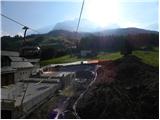 2
2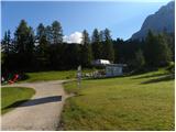 3
3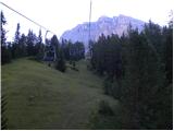 4
4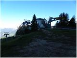 5
5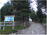 6
6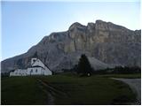 7
7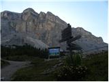 8
8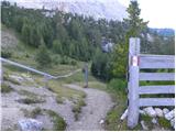 9
9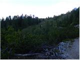 10
10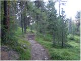 11
11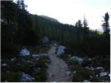 12
12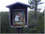 13
13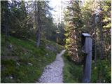 14
14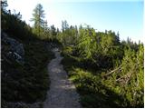 15
15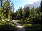 16
16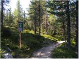 17
17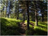 18
18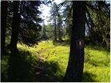 19
19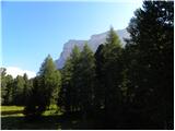 20
20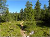 21
21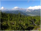 22
22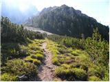 23
23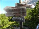 24
24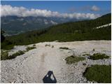 25
25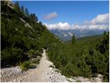 26
26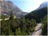 27
27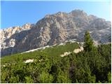 28
28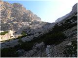 29
29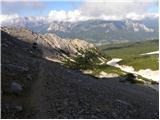 30
30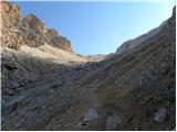 31
31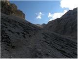 32
32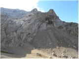 33
33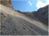 34
34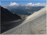 35
35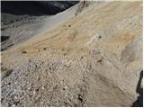 36
36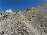 37
37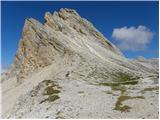 38
38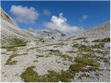 39
39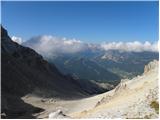 40
40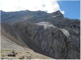 41
41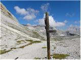 42
42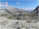 43
43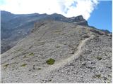 44
44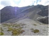 45
45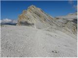 46
46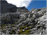 47
47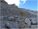 48
48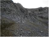 49
49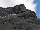 50
50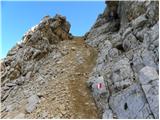 51
51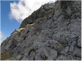 52
52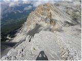 53
53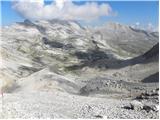 54
54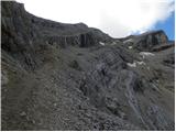 55
55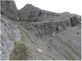 56
56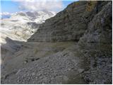 57
57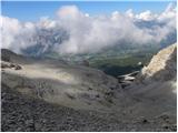 58
58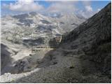 59
59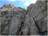 60
60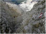 61
61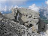 62
62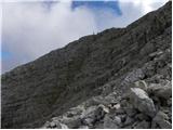 63
63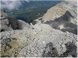 64
64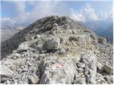 65
65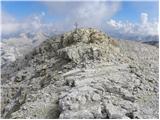 66
66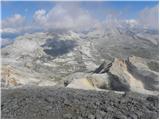 67
67 68
68
Discussion about the trip La Crusc - Lavarella
|
| VanSims9. 09. 2011 |
I hiked the trail to the saddle (Forcella Lavarella) three years ago (starting from La Ville). Up to the scree it is a nice and easy path. The scree is somewhat annoying, the little path is less visible, so it is easy to miss it and end up in sliding rocks.
The view from the saddle is magnificent. I then continued to Rifuggio Lavarella where I stayed overnight.
The path from the saddle to the Rifugio is geologically interesting as there are supposedly some hollow rocks (which are said to produce a sound when tapped, I tried but it didn't work for me), which are sediments from the coral sea from which the Dolomites were formed.
|
|
|
To post a comment you must log in:
If you do not yet have a username, you must first
register.