Ladinger Straße - Sandkogel (via Zechhütte)
Starting point: Ladinger Straße (1365 m)
| Latitude/Longitude: | 46,83990°N 14,71110°E |
| |
Route name: via Zechhütte
Walking time: 2 h 15 min
Difficulty: easy marked way
Elevation gain: 646 m
Elevation difference along the route: 670 m
Map: WK 237 Saualpe-Lavanttal-Koralpe 1:50.000
Recommended equipment (summer):
Recommended equipment (winter): ice axe, crampons
Views: 98
 | 1 person like this post |
Access to starting point:
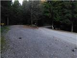
We leave the Klagenfurt am Wörthersee - Graz highway at the Wolfsberg Süd exit, then at the roundabout take the exit signposted St. Michael and Saualpe. Further on, at several junctions we keep following the left-hand directions; from the village of St. Michael we follow the signs for the settlement of Lading. Further ahead the road becomes narrower and starts climbing more steeply towards the mentioned settlement, where at several junctions we follow the main road or the signs for the Alpengasthof Gießlhütte guesthouse. From the guesthouse we continue driving a few hundred metres further to the marked parking lot next to the yellow hiking signposts.
Route description:
From the parking lot, we take the left path in the direction of the cottages Offnerhütte, Wolfsberger Hütte and Zechhütte (right along the road to Ladinger Hütte), where at the end of the parking lot the path enters the forest and then ascends diagonally. A few minutes higher, we reach a macadam road and follow it to the left in the direction of Zechhütte and Reiseberger Hütte (straight across the road is the usual footpath towards Offnerhütte and Wolfsberger Hütte).
We continue along the road that leads through the forest. Very soon we arrive at a resting place with a bench, from where a beautiful view opens towards Peca. A few minutes further on, we leave the forest and continue diagonally across a panoramic pasture. When we reach the edge of the forest on the opposite side of the pasture, a short one-minute path branches off to the left to Zechhütte. We continue along the road to the right, which proceeds through the forest. Higher up, we leave the road slightly to the right and continue the diagonal ascent parallel to the road. After the point where the road makes a sharp turn to the right, we cross it. Following a short further ascent, we emerge from the forest and rejoin the road. Nearby we reach a marked junction where we merge with the usual path that runs along the ridge of Moarhaltberg.
We continue left along the road, from which a path soon branches off quite inconspicuously to the right, crossing a pasture fence, towards the Offnerhütte hut; this is the path we follow (straight ahead is the Wolfsberger Hütte hut, but it is also possible to reach the Offnerhütte hut by continuing on the road).
Next follows an ascent over an increasingly panoramic pasture, where we follow a fainter footpath and sparse blazes. Higher up, we cross a grazing fence once again and return to the road; we turn right and in about a minute of further walking we arrive at the mountain hut Offnerhütte.
Before the cottage we go left upwards in the direction of Wolfsberger Hütte (right past the cottage the path leads towards Ladinger Hütte) and start ascending a mostly grassy slope, where at first a rather sparse forest still accompanies us along the path, higher up we reach an indistinct side ridge along which, with beautiful views, we continue to a barely noticeable junction, from where we continue straight ahead (slightly left towards Wolfsberger Hütte), for a short time still along the indistinct ridge, then the path turns right and gradually brings us onto a kind of cart track that leads us diagonally to the nearby Beilsteiner Bach stream, which we cross, after which we begin to ascend more steeply. Higher up, quite sparse blazes direct us slightly right from the cart track onto a well-trodden grassy path, and higher still we return to a cart track which, however, gradually begins to disappear on the grassy slopes.
We continue roughly northwards, higher up the path flattens and, alongside a grazing fence, brings us to the eastern ridge of Velika Svinja, where there is an unmarked junction.
Here we turn right towards Ladinger Hütte and the Sandkogel summit (left Velika Svinja) and then continue gently descending alongside the grazing fence. The path towards Ladinger Hütte soon turns left downwards, while we continue all the way to the indistinct summit of Sandkogel, which is located on the other side of the wire fence near the hunting observatory.
The starting point - Zechhütte 0:35, Zechhütte - Offnerhütte 0:30, Offnerhütte - Sandkogel 1:10.
Description and photographs refer to conditions in November 2025.

Photos:
 1
1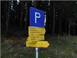 2
2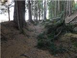 3
3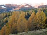 4
4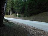 5
5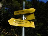 6
6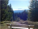 7
7 8
8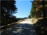 9
9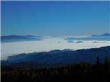 10
10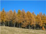 11
11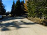 12
12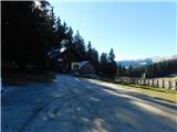 13
13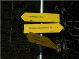 14
14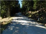 15
15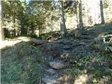 16
16 17
17 18
18 19
19 20
20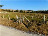 21
21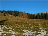 22
22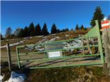 23
23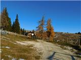 24
24 25
25 26
26 27
27 28
28 29
29 30
30 31
31 32
32 33
33 34
34 35
35 36
36 37
37 38
38 39
39 40
40 41
41 42
42 43
43 44
44 45
45 46
46 47
47 48
48
Discussion about the trip Ladinger Straße - Sandkogel (via Zechhütte)
To post a comment you must log in:
If you do not yet have a username, you must first
register.