Lago di Fedaia - Capanna al Ghiacciaio
Starting point: Lago di Fedaia (2098 m)
| Latitude/Longitude: | 46,45740°N 11,86490°E |
| |
Walking time: 1 h 45 min
Difficulty: easy marked way
Elevation gain: 602 m
Elevation difference along the route: 602 m
Map: Tabacco 7
Recommended equipment (summer):
Recommended equipment (winter):
Views: 4.930
 | 2 people like this post |
Access to starting point:
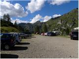
First, we drive to Cortina d'Ampezzo (to get here, you can go via the border crossing at Rateče or Predel to Trbiž / Tarvisio and then on the highway in the direction of Videm / Udine to the Tolmezzo exit. From Tolmezzo, we follow the road in the direction of the village Ampezzo and the mountain pass Passo della Mauria. The road then descends and brings us to an intersection, where we continue left (also possible right) in the direction of Cortina d'Ampezzo. At all subsequent intersections, we follow the signs for Cortina d'Ampezzo and then the signs for the alpine pass Passo di Falzarego. Already in the first part of the ascent towards the pass Falzarego, we will come to an intersection, where the signs for the pass Passo di Giau (2233 m) and Marmolada direct us left. The road after the pass Giau starts to descend, and we follow it through the settlements in the lower part in the direction of Marmolada or the pass Passo di Fedaia. The road, which then starts ascending again, brings us higher to the pass Fedaia, and we follow it to the other side of the lake, where we park on the parking lot near the hut Rifugio Castiglioni Marmolada.
Access from Primorska: We drive on the highway in the direction of Padova, but only to the highway junction, where we continue in the direction of Veneto and Belluno. Near Belluno, the highway ends, and we follow the road ahead in the direction of Belluno, where at the larger intersection we continue right in the direction of the town Agordo. From the mentioned town onwards, we follow the frequent signs for Marmolada or the pass Passo di Fedaia. When we arrive at the mentioned pass, we follow the road to the west side of the lake, where we turn left onto the road that goes over the dam and then park on the upper large parking lot.
Route description:
From the parking lot, we head onto path 606 following the signs “Punta Penia, Rif. Pian dei Fiacconi”. The path initially ascends through sparse dwarf pines and bushes a little left of the cable car that leads to the hut Pian dei Fiacconi. The path then brings us out of the dwarf pines and soon turns right, bringing us to the west side of the cable car. Here, the path begins to ascend below the sheer walls of the peak Col di Bousc (2494 m) towards the south. A few more zigzags follow, and we are already at the saddle Col de Bous (2438 m). At the saddle, where there is a junction, we continue left in the direction of the hut Pian dei Fiacconi.
Further on, we ascend rocky terrain towards the southeast. From the path we are following, wonderful views continually open up towards Marmolada and also to the north, where Piz Boè stands out. When we approach the cable car again, the path turns slightly right, and to the hut, where there are usually lots of people, only a short easy ascent remains.
From the hut, we continue following the signs “Capanna al Ghiacciaio” and begin ascending the rocky slope with numerous concrete steps. In about five minutes, we reach the hut, which is located right next to the glacier.

Photos:
 1
1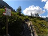 2
2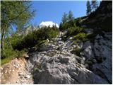 3
3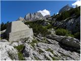 4
4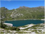 5
5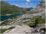 6
6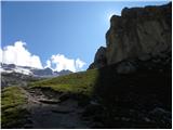 7
7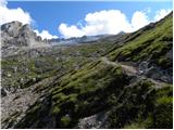 8
8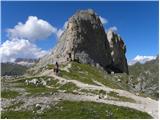 9
9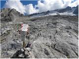 10
10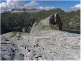 11
11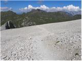 12
12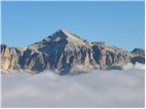 13
13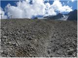 14
14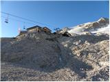 15
15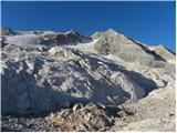 16
16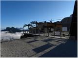 17
17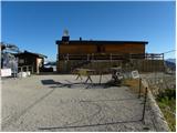 18
18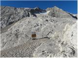 19
19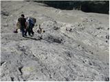 20
20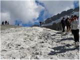 21
21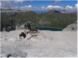 22
22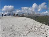 23
23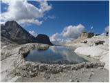 24
24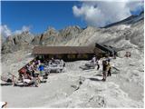 25
25
Discussion about the trip Lago di Fedaia - Capanna al Ghiacciaio
To post a comment you must log in:
If you do not yet have a username, you must first
register.