Lago Scin - Rifugio Faloria (Ferrata Sci Club 18)
Starting point: Lago Scin (1336 m)
| Latitude/Longitude: | 46,54533°N 12,16605°E |
| |
Route name: Ferrata Sci Club 18
Walking time: 4 h
Difficulty: extremely difficult marked way
Via ferrata: D
Elevation gain: 787 m
Elevation difference along the route: 800 m
Map: Tabacco 03 1:25.000
Recommended equipment (summer): helmet, self belay set
Recommended equipment (winter): helmet, self belay set, ice axe, crampons
Views: 1.210
 | 2 people like this post |
Access to starting point:
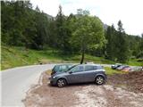
Via the border crossing at Rateče or Predel to Trbiž / Tarvisio and then on the highway in the direction of Videm / Udine to the Tolmezzo exit. From Tolmezzo we follow the road in the direction of the village Ampezzo and mountain pass Passo della Mauria. The road then descends and brings us to an intersection, where we continue right towards Auronzo. Further on, we follow the signs for the pass Tre Croci. From the pass we continue roughly 8 km towards Cortina d'Ampezzo, then we park in the parking lot near the restaurant Ristorante Lago Scin, which is located on the right side of the road.
Route description:
From the parking lot, we cross the road and at Lake Lago Scin by the main road we will notice signposts that direct us left into the forest. The path immediately at the beginning turns slightly right and although there are plenty of blazes on the path, we still need to pay attention because there are quite a few side paths and cart tracks that are better beaten than the marked path. After a short initial ascent, the path brings us to a cart track where we continue right. The cart track then descends slightly and brings us to a motocross polygon, which is already somewhat overgrown. We continue on the footpath, which further runs through the forest over somewhat swampy terrain. Later the path ascends slightly and brings us to an indistinct saddle where there are plenty of blazes on the trees.
Here there is a quite poorly visible junction. We leave the main path and head left where a small inscription on the blaze (Ferrata S.C.18) directs us. A somewhat less beaten trail then brings us out of the forest into the dwarf pines. The path through the dwarf pines then brings us to a junction where paths from the Rio Gere hut and from the Mandres hut join us on path number 206, where there is the midway station of the cable car.
At the junction we continue straight towards the walls of Faloria following the signs »Ferrata Sci Club 18«. The path then ascends quite steeply mostly through dwarf pines all the way to the entry into the climbing section of the path.
Before the entry into the climbing section of the path, we must equip ourselves with a helmet and via ferrata kit.
Already at the very beginning the climbing path ascends vertically, aided only by a few stemples (difficulty D). After the initial demanding section the path turns right and a somewhat easier traverse to the right follows. The path then turns left and steeply ascends along the steel cable for a while (C). The difficulty eases slightly again, then a short vertical ascent follows (D). Further on, difficulties from B to C alternate for a while. The path then turns slightly right and ascends slightly to the right of the cable car. The climbing path is in fact visible the whole time also from the cable car that runs to the Faloria hut. The path becomes demanding again and steeply ascends along the steel cable (C and C/D), meanwhile also ascending over a short ladder. The path continues somewhat to the right and brings us into a gully. Here the path turns left and a less demanding traverse follows along a narrow ledge. The path then also descends slightly and brings us again under the cable car.
Here a longer almost vertical ascent follows, aided by a few stemples (C/D). In the final section the climbing path then turns right, crosses a short gully and ascends along a narrow ridge (difficulty from A to C). At the end only a traversing ascent follows (C/D) and the path brings us to the gentle slopes before the hut.
At the end of the climbing path we continue along the gentle path towards the Faloria hut, which we already see in front of us.
The described path is extremely demanding and suitable only for experienced mountaineers with sufficient arm strength. The climbing path is relatively new as it was built in 2009.
We descend along the easier path number 212 towards the Mandres hut. A little before the mentioned hut where there is the midway station of the cable car, we turn right onto path 210 towards the starting point at Lake Lago Scin.

The trip can be extended to the following destinations: Rifugio Tondi
Photos:
 1
1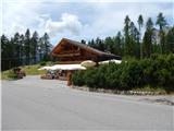 2
2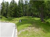 3
3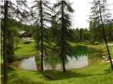 4
4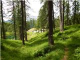 5
5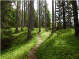 6
6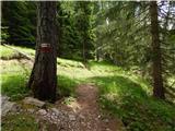 7
7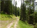 8
8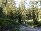 9
9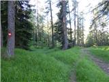 10
10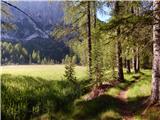 11
11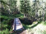 12
12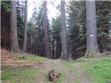 13
13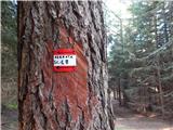 14
14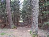 15
15 16
16 17
17 18
18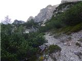 19
19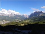 20
20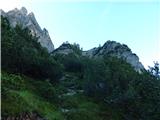 21
21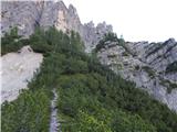 22
22 23
23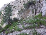 24
24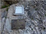 25
25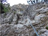 26
26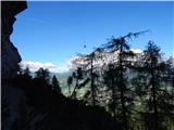 27
27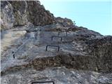 28
28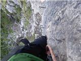 29
29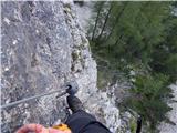 30
30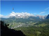 31
31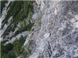 32
32 33
33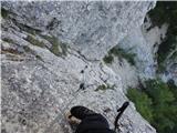 34
34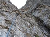 35
35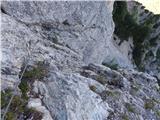 36
36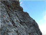 37
37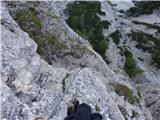 38
38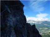 39
39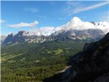 40
40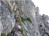 41
41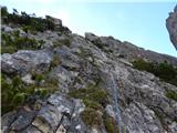 42
42 43
43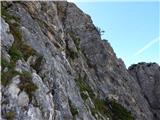 44
44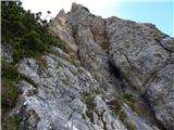 45
45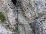 46
46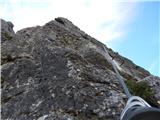 47
47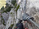 48
48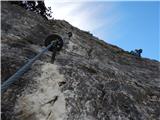 49
49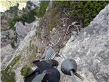 50
50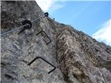 51
51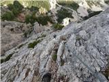 52
52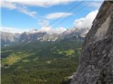 53
53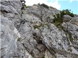 54
54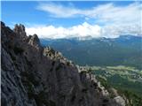 55
55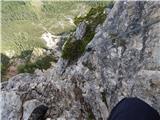 56
56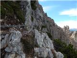 57
57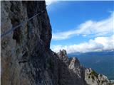 58
58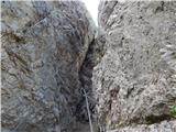 59
59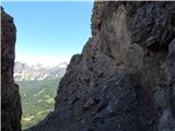 60
60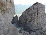 61
61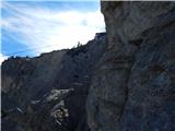 62
62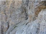 63
63 64
64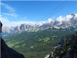 65
65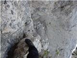 66
66 67
67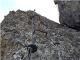 68
68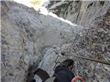 69
69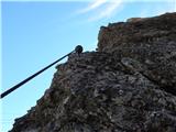 70
70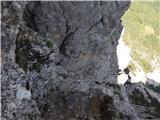 71
71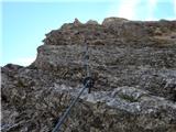 72
72 73
73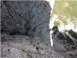 74
74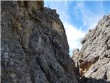 75
75 76
76 77
77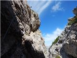 78
78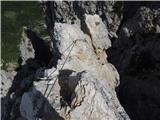 79
79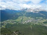 80
80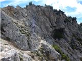 81
81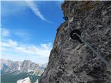 82
82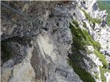 83
83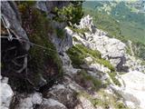 84
84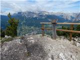 85
85 86
86 87
87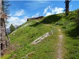 88
88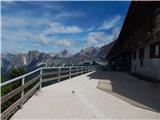 89
89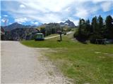 90
90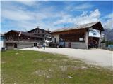 91
91
Discussion about the trip Lago Scin - Rifugio Faloria (Ferrata Sci Club 18)
To post a comment you must log in:
If you do not yet have a username, you must first
register.