Gradiško jezero - Sveti Mohor on Mohorjev hrib
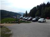
Starting point: Gradiško jezero (355 m)
| Latitude/Longitude: | 46,16210°N 14,70800°E |
| |
Walking time: 50 min
Difficulty: easy unmarked way
Elevation gain: 156 m
Elevation difference along the route: 170 m
Map: Ljubljana - okolica 1:50.000
Recommended equipment (summer):
Recommended equipment (winter):
Views: 1.870
 | 1 person like this post |
Access to starting point:
From the Ljubljana–Maribor highway, take the Lukovica exit, then continue driving towards Moravče. After crossing Radomlje, we arrive at the beginning of the settlement Spodnje Prapreče, where at the junction we continue left in the direction of Gradiško Lake. After a short ascent, we arrive at a junction with the priority road, where we continue right towards Gradiško Lake (left Gradišče), then only a little further, from the priority road left towards Gradiško Lake (right Preserje pri Lukovici), in front of which we then park on a large parking lot.
Route description:
From the starting point, we continue on the marked path in the direction of Limbarska gora, which continues along the northern shore of Gradiško Lake. The path, which continues on the macadam road and which is closed to public traffic, soon turns right and passes to the eastern side of the lake, where the marked path towards Limbarska gora (also the path to Sv. Mohor via the settlement Vinje pri Moravčah) turns left into the forest, but we continue further on the walking path. A shorter ascent follows, then a descent, after which we approach the lake again completely. Further on, we cross Drtijščica over the bridge, then a little further we arrive at a longer right bend, at the beginning of which an ascending macadam road branches off to the left, leading towards the village Prikrnica (the branch-off is not marked).
At the mentioned branch-off, we leave the walking path that leads around the lake (up to here also possible along the western shore of the lake) and continue on the mentioned ascending road. After a short ascent, we arrive at a smaller junction, where we continue left (right Prikrnica). A little further, we cross a larger clearing, where some benches are placed, then the path temporarily returns to the forest. When we step out of the forest again, an unmarked path branches off to the right, leading towards sv. Mohor. We continue on the mentioned path (straight homestead Rožek), which begins to ascend transversely to the right, higher up joining the marked path Vinje pri Moravčah - sv. Mohor.
We continue straight (left homestead Rožek) and follow the blazes; we already see the church of sv. Mohor quite close by. A few minutes further, we reach the macadam road, where we go left (right Imenje and Tuštanj), and the path leads us further past some Stations of the Cross. When we arrive at the nearby house, we go slightly left, then ascend the steps to the church of sv. Mohor.
The description refers to the state in November 2018, the pictures are from October 2016 and November 2018.

Photos:
 1
1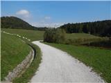 2
2 3
3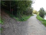 4
4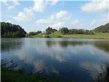 5
5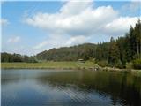 6
6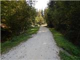 7
7 8
8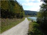 9
9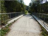 10
10 11
11 12
12 13
13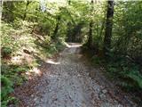 14
14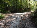 15
15 16
16 17
17 18
18 19
19 20
20 21
21 22
22 23
23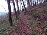 24
24 25
25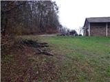 26
26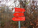 27
27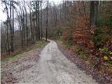 28
28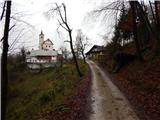 29
29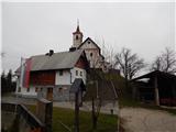 30
30 31
31
Discussion about the trip Gradiško jezero - Sveti Mohor on Mohorjev hrib
|
| grega_p11. 01. 2021 |
Excellent trail, offers a nice walk by the lake, an idyllically situated church of St. Mohor and with a detour also the ruins of Rožek castle, from where we soon join the above-mentioned trail (unmarked path).
For the return, I recommend a circular variant past the village of Prikrnica and joining back to the trail along the southern part of the lake. All together about 2h.
Currently, it really has a nice winter scenery, just enough white and at the same time not too much, so no need to wade.
|
|
|
To post a comment you must log in:
If you do not yet have a username, you must first
register.