Landro - Lastron dei Scarperi / Schusterplatte
Starting point: Landro (1406 m)
| Latitude/Longitude: | 46,64035°N 12,23197°E |
| |
Walking time: 6 h 30 min
Difficulty: difficult pathless terrain
Elevation gain: 1551 m
Elevation difference along the route: 1664 m
Map: Tabacco 10 1:25.000
Recommended equipment (summer): helmet
Recommended equipment (winter): helmet, ice axe, crampons
Views: 542
 | 4 people like this post |
Access to starting point:
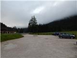
Via the border crossing Rateče we drive to Trbiž / Tarvisio, where we head onto the motorway in the direction of Vidma / Udine. We leave the motorway at the Tolmezzo exit and follow the road to the mentioned place. From Tolmezzo we continue in the direction of the settlement Ampezzo and the mountain pass Passo della Mauria. The road then starts descending and brings us into the Cadore valley, where we continue right (left Belluno and Cortina d'Ampezzo) in the direction of the settlement Auronzo. After a few more km of driving we come to the next larger crossroads, where we turn right in the direction of the place Misurina (left Tre Croci pass). From here we descend the road to a larger crossroads where we continue right towards the place Toblach / Dobbiaco (left Cortina). From the crossroads we continue past the lake Lago di Landro / Dürrensee. From the lake we follow the main road for approximately a kilometre, then we turn right onto a larger macadam parking lot.
Route description:
From the parking lot, we head east on the macadam road (path 102) following the signs »Rif. Locatelli«. Already after a few dozen metres we come to a crossroads where we continue straight on the gently sloping macadam road. Here from the path a nice view opens up on the mountain group Cristallo and on the nearby Monte Piano.
When we get a little closer to the slopes of the mountain Monte Piano we are again at a junction. The path towards the mentioned summit and towards the lake Lago di Landro branches off to the right, and we continue slightly left following the signs »Rif. Locatelli«. Further on we still walk on the macadam road that runs through the valley Valle della Rienza/Rienztal alongside the stream Rienza Nera. Later, the path towards the climbing garden branches off to the left, and a little after that the path towards the mountain pasture Malga Rinbianco branches off to the right. At the junctions we still continue on the gentle road from which very beautiful views open up on the surrounding peaks above the valley.
To the left then also branches path no. 10 towards the saddle Passo Grande dei Rondoi and further towards the hut Tre Scarperi; we continue on the macadam road which soon turns into a trail. The path further runs alongside the stream Rienza Nera and leads us through a sparse larch forest.
When we come to a smaller grassy clearing, a less trodden trail branches off to the right towards the hut Langalm Hütte. Here we continue straight following the signs »Rif. Locatelli«. Further on the path brings us out of the forest and then ascends in long zigzags through the dwarf pines. Later we come to steeper slopes where we will also notice a waterfall along the path. The path on this section is also secured with a fence. A shorter ascent follows, then we reach gentler grassy slopes from which a wonderful view opens up towards Tre Cime.
To the right then soon branches path no. 105 towards the hut Langalm and further towards the hut Auronzo. At the junction we continue straight towards the hut Locatelli and begin to ascend somewhat more steeply on a very scenic path. When we approach the slopes of Monte Paterna, a wide path from the hut Lavaredo joins from the right. At the junction we continue left and a somewhat steeper ascent to the hut Locatelli follows.
From the hut we continue north on path 102, which starts to descend gently. The path leads us past a cross by which there is also a small bench and table. Just a little after the mentioned cross we reach a junction. We head left following the signs »Lastron dei Scarperi«. The path further crosses mostly grassy slopes on the eastern side of the peak Torre di Toblin and brings us to the notch Forcella di San Candido on the northeastern side of the mentioned peak.
At the notch a signpost directs us right and further in the ascent we cross the slopes on the right south side of the ridge. The path then soon turns left and brings us to a smaller notch. Here we continue to the north side on the path which in descent crosses a fairly steep and crumbly slope. On this section some caution is also required. Further on the path ascends up the valley on the western side of the peak Crodon di San Candido. The path is relatively well trodden, aided by cairns and some faded blazes. Here we first ascend scree then a somewhat steeper rocky section follows where the climbing does not exceed grade I. After the rocky section ascent on scree follows again, bringing us to an unmarked junction.
At the junction we continue left, right leads the path towards the summit Crodon di San Candido. Further on we continue ascending scree and just before reaching the ridge the path brings us to the entrance of a gully through which the passage to the summit slopes of the mountain runs.
During the ascent through the gully a helmet is mandatory as there is quite a lot of scree on the path. For some time we still ascend up the gully, but when it becomes very narrow the cairns direct us left upwards. The first few metres out of the gully are somewhat steeper and require more caution. The path then leads us above the gully and just before the notch turns decisively left. The path becomes somewhat less steep and brings us to the south side of the peak. Here we continue slightly right and soon reach the ridge. Along the scenic and undemanding ridge we then soon reach the summit.
We descend along the ascent path.

Photos:
 1
1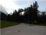 2
2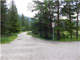 3
3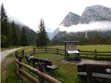 4
4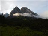 5
5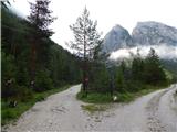 6
6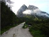 7
7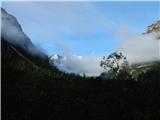 8
8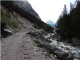 9
9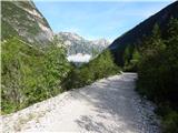 10
10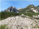 11
11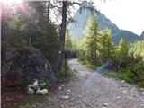 12
12 13
13 14
14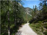 15
15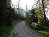 16
16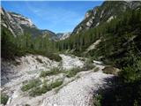 17
17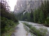 18
18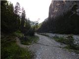 19
19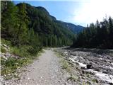 20
20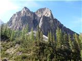 21
21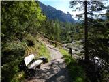 22
22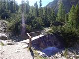 23
23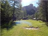 24
24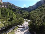 25
25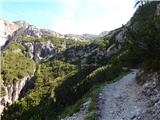 26
26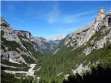 27
27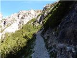 28
28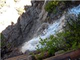 29
29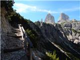 30
30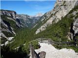 31
31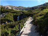 32
32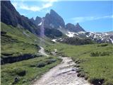 33
33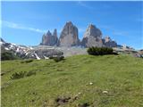 34
34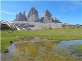 35
35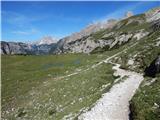 36
36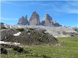 37
37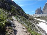 38
38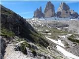 39
39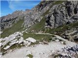 40
40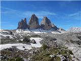 41
41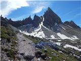 42
42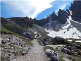 43
43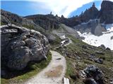 44
44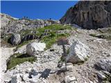 45
45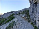 46
46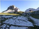 47
47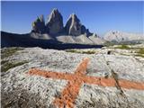 48
48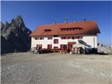 49
49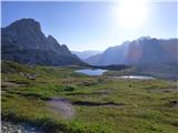 50
50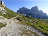 51
51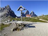 52
52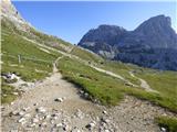 53
53 54
54 55
55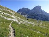 56
56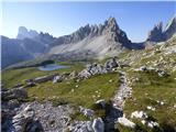 57
57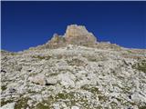 58
58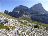 59
59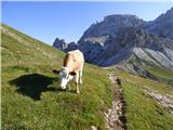 60
60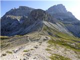 61
61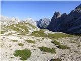 62
62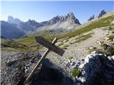 63
63 64
64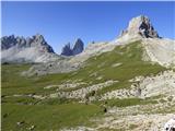 65
65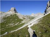 66
66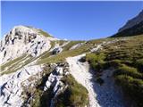 67
67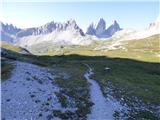 68
68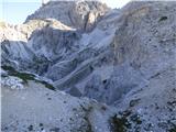 69
69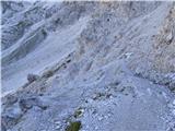 70
70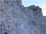 71
71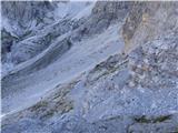 72
72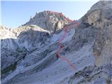 73
73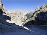 74
74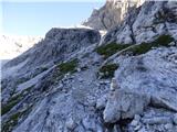 75
75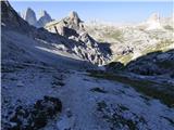 76
76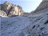 77
77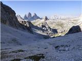 78
78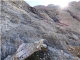 79
79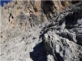 80
80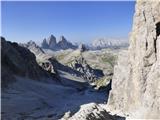 81
81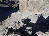 82
82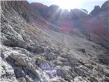 83
83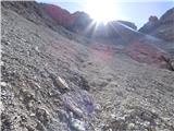 84
84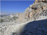 85
85 86
86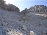 87
87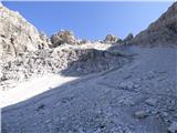 88
88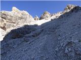 89
89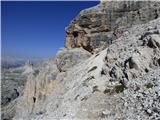 90
90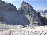 91
91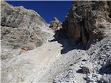 92
92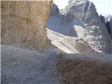 93
93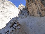 94
94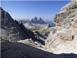 95
95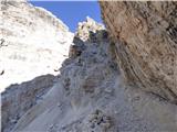 96
96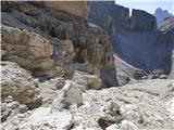 97
97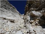 98
98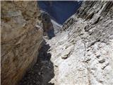 99
99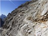 100
100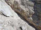 101
101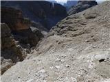 102
102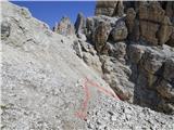 103
103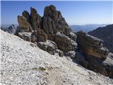 104
104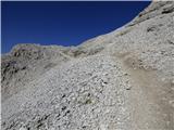 105
105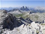 106
106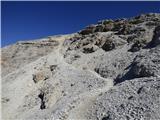 107
107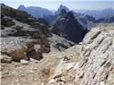 108
108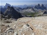 109
109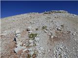 110
110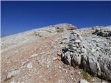 111
111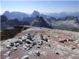 112
112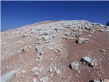 113
113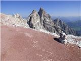 114
114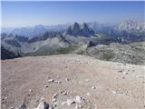 115
115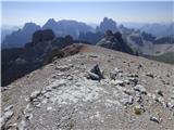 116
116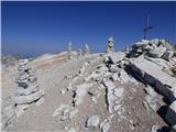 117
117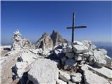 118
118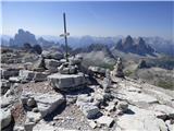 119
119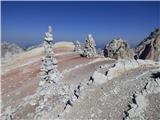 120
120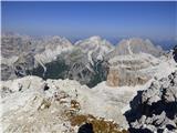 121
121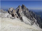 122
122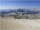 123
123
Discussion about the trip Landro - Lastron dei Scarperi / Schusterplatte
|
| mirank7. 12. 2017 |
The summit is accessible from four different starting points, of which the described one is the longest and the starting point also the farthest from Slovenia. However, all approaches (from Val Fiscalina, from rif. Auronzo or from Val Campo di Dentro) converge at the San Candido Saddle north of Toblach. There can be no talk of any pathless terrain here, as the trail to the summit is very well visible and trodden, there are plenty of cairns and quite faded red dots (here and there also yellow ones) are quite frequent. The views are - as almost everywhere around here - really fantastic; The tour will thrill everyone, regardless of the starting point from which they set out for this summit.
|
|
|
To post a comment you must log in:
If you do not yet have a username, you must first
register.