Starting point: Landro (1406 m)
| Latitude/Longitude: | 46,64035°N 12,23197°E |
| |
Walking time: 2 h 50 min
Difficulty: partly demanding marked way
Elevation gain: 899 m
Elevation difference along the route: 910 m
Map: Tabacco 10 1:25.000
Recommended equipment (summer): helmet
Recommended equipment (winter): helmet, ice axe, crampons
Views: 3.759
 | 2 people like this post |
Access to starting point:
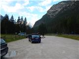
Via the Rateče border crossing we drive to Trbiž / Tarvisio, where we head onto the motorway in the direction of Vidma / Udine. We leave the motorway at the Tolmezzo exit and follow the road to the mentioned settlement. From Tolmezzo we continue in the direction of the settlement Ampezzo and mountain pass Passo della Mauria. The road then starts descending and brings us into the Cadore valley, where we continue right (left Belluno and Cortina d'Ampezzo) in the direction of the settlement Auronzo. After a few additional km of driving, we come to the next bigger intersection, where we go right in the direction of the settlement Misurina (left pass Tre Croci). From here we descend along the road to a bigger intersection where we continue right towards the settlement Toblach / Dobbiaco (left Cortina). From the intersection, we continue past the lake Lago di Landro / Dürrensee. From the lake, we follow the main road for approximately a kilometer, and then we turn right onto a larger macadam parking lot.
Route description:
From the parking lot, we head east on the macadam road (path 102) following the signs »Monte Piano«. Already after a few dozen meters, we come to a junction where we continue straight on the gently sloping macadam road. Here from the path a nice view opens up on the mountain group Cristallo and on the nearby Monte Piano.
When we get somewhat closer to the slopes of the mountain Monte Piano we are again at a junction. Straight leads the path towards the hut Locatelli, we continue right on path no. 6 following the signs »Monte Piano«. From the junction we walk on the gently sloping macadam road and soon come to a junction where the path from Lake Lago di Landro joins from the right.
At the junction we continue straight and soon come near the stream where the road ends. Here the trail crosses the stream over a wooden bridge and soon brings us to another junction. This time we continue on the left upper path.
Further on, we then ascend for a long time in zigzags on the old military path from which a view opens up on the valley Valle di Landro with lake Lago di Landro and on the mountain group Cristallo. The path here runs mostly through dwarf pines and sparse larch forest, occasionally we also cross somewhat steeper slopes. The path all the time runs slightly towards the southeast and higher brings us to somewhat steeper slopes where some steel cables also assist us. Then follows an ascent through dwarf pines, which brings us to a vantage point beside which crosses are placed in memory of the fallen soldiers.
Further on the dwarf pines become sparser and the path soon brings us to a marked junction.
Left leads a secured climbing path, we continue straight on the easier path. From the junction the path brings us below the precipitous walls of the summit Monte Piano and then crosses the slope on a fairly wide ledge. After the crossing the path brings us to a gentler slope covered with dwarf pines. Here the path turns somewhat to the left and starts ascending again. Higher the path leads us past some military ruins and trenches and brings us to gentler slopes on the Monte Piana plateau. On the plateau we soon reach a marked junction where we continue left following the signs »Monte Piano«. From the junction only a short ascent follows on the gentle and panoramic slope to the summit.

Photos:
 1
1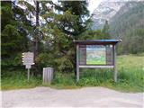 2
2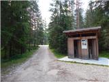 3
3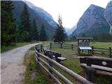 4
4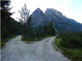 5
5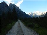 6
6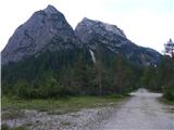 7
7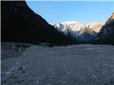 8
8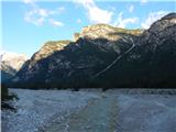 9
9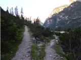 10
10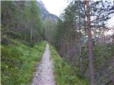 11
11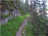 12
12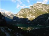 13
13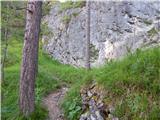 14
14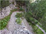 15
15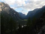 16
16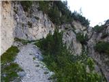 17
17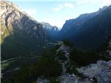 18
18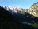 19
19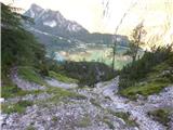 20
20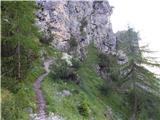 21
21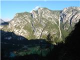 22
22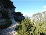 23
23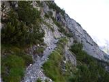 24
24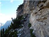 25
25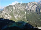 26
26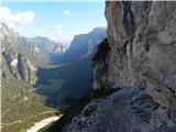 27
27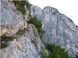 28
28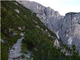 29
29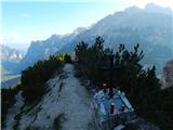 30
30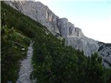 31
31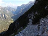 32
32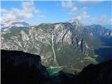 33
33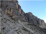 34
34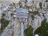 35
35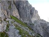 36
36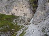 37
37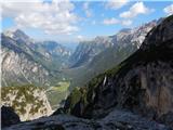 38
38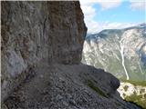 39
39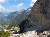 40
40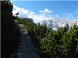 41
41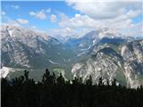 42
42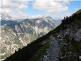 43
43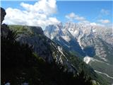 44
44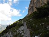 45
45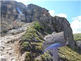 46
46 47
47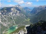 48
48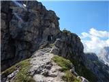 49
49 50
50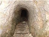 51
51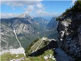 52
52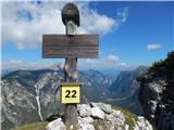 53
53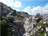 54
54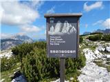 55
55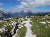 56
56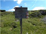 57
57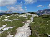 58
58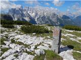 59
59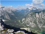 60
60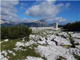 61
61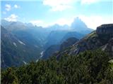 62
62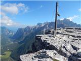 63
63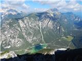 64
64
Discussion about the trip Landro - Monte Piano
To post a comment you must log in:
If you do not yet have a username, you must first
register.