Landro - Torre di Toblin / Toblinger Knoten
Starting point: Landro (1406 m)
| Latitude/Longitude: | 46,64035°N 12,23197°E |
| |
Walking time: 4 h 30 min
Difficulty: extremely difficult marked way
Via ferrata: C
Elevation gain: 1211 m
Elevation difference along the route: 1211 m
Map: Tabacco 10 1:25.000
Recommended equipment (summer): helmet, self belay set
Recommended equipment (winter): helmet, self belay set, ice axe, crampons
Views: 1.552
 | 3 people like this post |
Access to starting point:
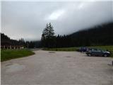
Via the Rateče border crossing we drive to Trbiž / Tarvisio, where we take the highway in the direction of Udine. We leave the highway at the Tolmezzo exit and follow the road to the mentioned settlement. From Tolmezzo we continue in the direction of the settlement Ampezzo and mountain pass Passo della Mauria. The road then starts descending and brings us into the Cadore valley, where we continue right (left Belluno and Cortina d'Ampezzo) in the direction of the settlement Auronzo. After a few additional km of driving, we come to the next bigger intersection, where we turn right in the direction of the settlement Misurina (left Tre Croci pass). From here we descend the road to a bigger intersection where we continue right towards the settlement Toblach / Dobbiaco (left Cortina). From the intersection, we continue past the lake Lago di Landro / Dürrensee. From the lake, we follow the main road for approximately a kilometer, and then we turn right onto a larger macadam parking lot.
Route description:
From the parking lot, we go towards the east on a macadam road (path 102) following the signs »Rif. Locatelli«. Already after a few dozen meters, we come to an intersection where we continue straight on a gently sloping macadam road. Here from the path a nice view opens up on the mountain group Cristallo and on the nearby Monte Piano.
When we get a little closer to the slopes of the mountain Monte Piano we are again at a junction. The path towards the mentioned summit and towards the lake Lago di Landro branches off to the right, and we continue slightly left following the signs »Rif. Locatelli«. Further, we still walk on a macadam road, that runs through the valley Valle della Rienza/Rienztal by the stream Rienza Nera. Later, the path towards the climbing garden branches off to the left, and a little after that also the path towards the mountain pasture Malga Rinbianco branches off to the right. At the junctions, we still continue on a gentle road from which very beautiful views open up on surrounding peaks above the valley.
Then path number 10 towards the saddle Passo Grande dei Rondoi and ahead towards the mountain hut Tre Scarperi branches off to the left, we still continue on a macadam road which then soon passes into a footpath. The path further still runs by the stream Rienza Nera and leads us through a sparse larch forest.
When we come to a smaller grassy clearing, a less trodden footpath towards the mountain hut Langalm Hütte branches off to the right. Here we continue straight following the signs Rif. Locatelli. Further, the path brings us out of the forest and then ascends in long zigzags through dwarf pines. Later we come on steeper slopes, where we will by the path notice also a waterfall. The path on this part is also secured with a fence. Next follows a shorter ascent, and then we come on less steep grassy slopes from which a breathtaking view opens up towards Tre Cime.
Right then soon the path number 105 towards the mountain hut Langalm and ahead towards the mountain hut Auronzo branches off. At the junction, we continue straight towards the mountain hut Locatelli and we start ascending a little steeper on very scenic path. When we get closer to slopes of Monte Paterno, from the right also joins a wide path from the mountain hut Lavaredo. At the junction, we continue left and then follows a little steeper ascent to the hut Locatelli.
From the hut, we continue towards the north past the chapel by which we will notice a signpost, which points us towards the climbing path Via Ferrata Torre di Toblin. After that, the path runs on the right side of the mountain Sasso di Sesto towards the north and is marked with red triangles. Later, the path turns to the left and then follows a short ascent to the saddle between the peaks Sasso di Sesto and Torre di Toblin. On the saddle, we continue a little to the right and we cross slopes below the western wall of the peak Torre di Toblin. The path then brings us on the northern side, where we enter into climbing part of the path.
At the beginning the path steeply ascends right upwards by the steel cable. Further, the path runs by steep gully and quite a few times vertically ascends on a ladder upwards. Because usually on the path there is quite a crowd there is also a great risk of falling stones. Later, the path turns a little to the left and crosses a vertical slope on pegs. Further follows also some vertical ascents on a ladder, and then we soon reach a very panoramic peak.
We descend on a little easier, but still very demanding path, which at first for a short time runs on the south ridge and then descends on the eastern side. Further, we are steeply descending by the steel cable downwards, and by the path, we will also notice some tunnels from the First World War. Steep path then brings us on the scree on the eastern side of the mountain from where we continue right towards the south and we descend to the mountain hut Locatelli.
Because usually on the path there is a large crowd, do not ascend in the reverse direction as described above. Because of this also the path on which we descend in the lower part is not marked.

Photos:
 1
1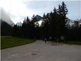 2
2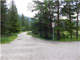 3
3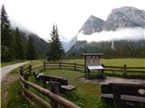 4
4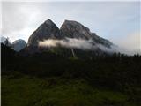 5
5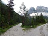 6
6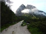 7
7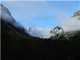 8
8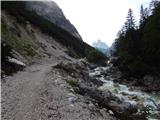 9
9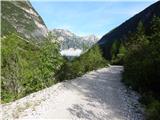 10
10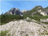 11
11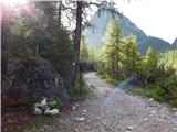 12
12 13
13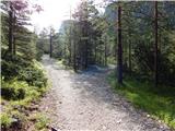 14
14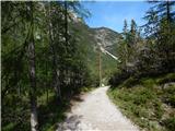 15
15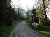 16
16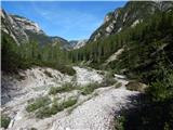 17
17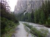 18
18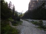 19
19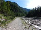 20
20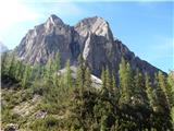 21
21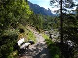 22
22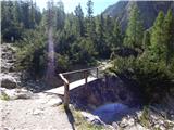 23
23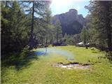 24
24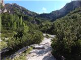 25
25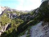 26
26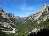 27
27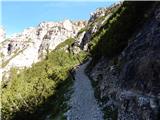 28
28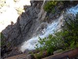 29
29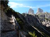 30
30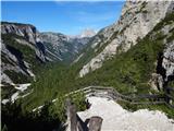 31
31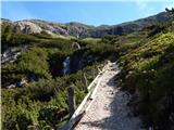 32
32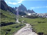 33
33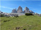 34
34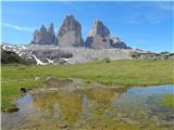 35
35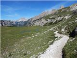 36
36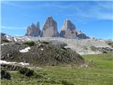 37
37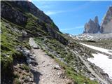 38
38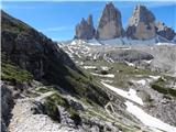 39
39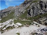 40
40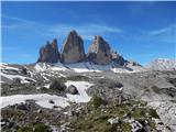 41
41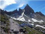 42
42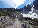 43
43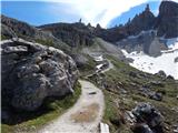 44
44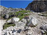 45
45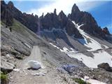 46
46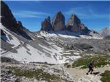 47
47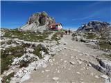 48
48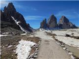 49
49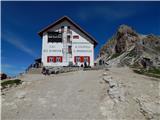 50
50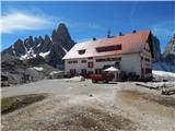 51
51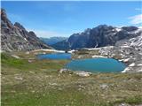 52
52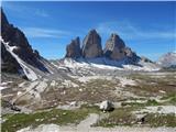 53
53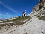 54
54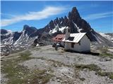 55
55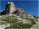 56
56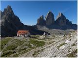 57
57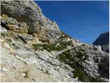 58
58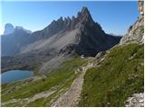 59
59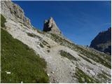 60
60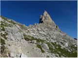 61
61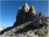 62
62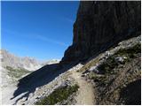 63
63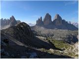 64
64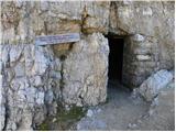 65
65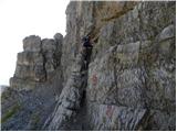 66
66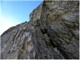 67
67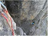 68
68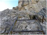 69
69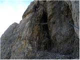 70
70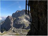 71
71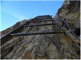 72
72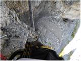 73
73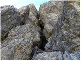 74
74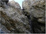 75
75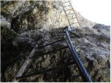 76
76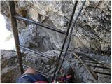 77
77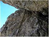 78
78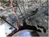 79
79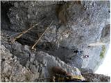 80
80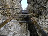 81
81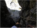 82
82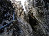 83
83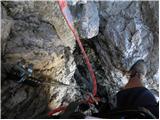 84
84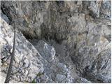 85
85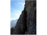 86
86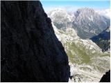 87
87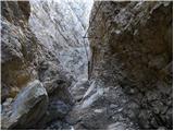 88
88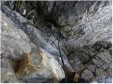 89
89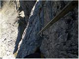 90
90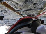 91
91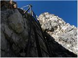 92
92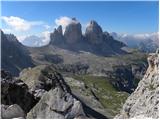 93
93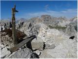 94
94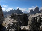 95
95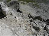 96
96 97
97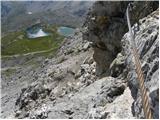 98
98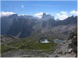 99
99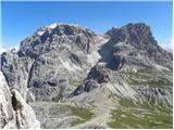 100
100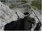 101
101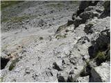 102
102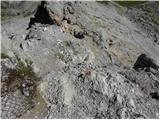 103
103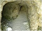 104
104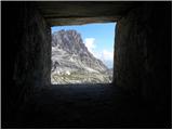 105
105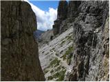 106
106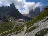 107
107
Discussion about the trip Landro - Torre di Toblin / Toblinger Knoten
To post a comment you must log in:
If you do not yet have a username, you must first
register.