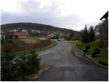
Starting point: Lašče (380 m)
| Latitude/Longitude: | 45,79180°N 14,94750°E |
| |
Walking time: 1 h 45 min
Difficulty: easy marked way
Elevation gain: 508 m
Elevation difference along the route: 525 m
Map: Dolenjska, Gorjanci in Kočevski rog 1:50.000
Recommended equipment (summer):
Recommended equipment (winter):
Views: 18.423
 | 2 people like this post |
Access to starting point:
A) From the motorway Ljubljana - Novo Mesto, take the exit Ivančna Gorica and continue driving in the direction of Žužemberk and Črnomelj. A little after Žužemberk, more precisely in the settlement Dvor, leave the main road and continue driving right in the direction of Kočevje. Behind the bridge over the river Krka, the road starts to ascend more steeply, and we follow it to the village Lašče, where we park on the parking lot opposite the local inn.
B) From the motorway border crossing Obrežje - Ljubljana, take the exit Novo Mesto - east, and continue driving to the mentioned settlement. From Novo Mesto, continue driving in the direction of Straže, Soteske and later Žužemberk. When we come to the settlement Dvor, turn left and continue driving towards Kočevje. Behind the bridge over the river Krka, the road starts to ascend more steeply, and we follow it to the village Lašče, where we park on the parking lot opposite the local inn.
Route description:
A little further from the inn, a forest road branches off to the left, by which we notice signs for the European footpath E7. We head onto the mentioned road, which soon loses its asphalt covering and then moderately ascends through the forest. Higher up, we come to a crossroads, where we continue on the left road, by which we notice signs for Sveti Peter. The road then flattens and brings us out of the forest onto a larger clearing named Oražem. After the clearing, we come to a crossroads, where by the hunting observatory we notice a sign for Sveti Peter, which points us onto the right road. Even though the signs show right, we continue on the left lower road, by which the blazes continue (continuation is possible also on the right road). The left road then entirely flattens, or after some time starts even lightly descending. We follow the mentioned road to a crossroads, where from the left joins a marked path from Podgozd. Here at the Station of the Cross number 8, we continue on the right somewhat steeper road, from which soon a marked footpath branches off to the left, which higher crosses the road we recently left. We continue on the cart track, which ascends past the next cross, and which gradually changes into a pleasant forest path. Higher, we once again cross the road, and we continue on a cart track, which also here changes into a footpath, which higher brings us to a mesh fence. We follow the path, which further first moderately, then steeply ascends along the fence, all the way to the summit of Sveti Peter, on which stands a smaller shrine and a wooden lookout tower.

Photos:
 1
1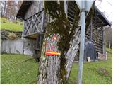 2
2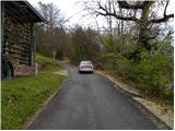 3
3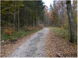 4
4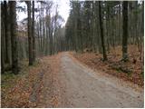 5
5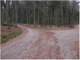 6
6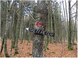 7
7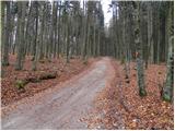 8
8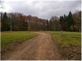 9
9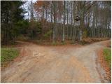 10
10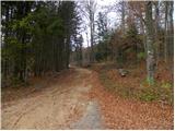 11
11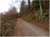 12
12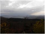 13
13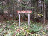 14
14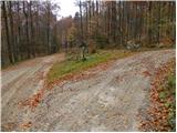 15
15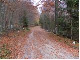 16
16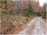 17
17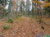 18
18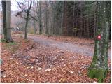 19
19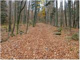 20
20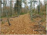 21
21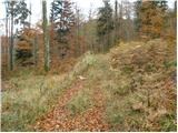 22
22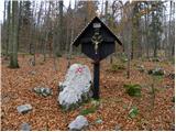 23
23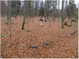 24
24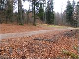 25
25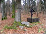 26
26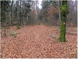 27
27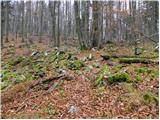 28
28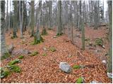 29
29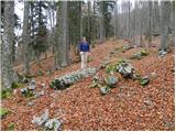 30
30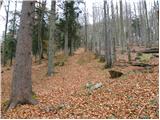 31
31 32
32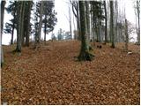 33
33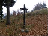 34
34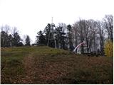 35
35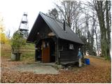 36
36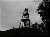 37
37 38
38 39
39 40
40
Discussion about the trip Lašče - Sveti Peter
|
| aleš437. 11. 2010 |
Usually I go from Podgozd along the way of the cross. I will definitely try this variant from Lašče too!
|
|
|
|
| Lj10. 04. 2011 |
Today I was back on this summit after almost 6 years. Pleasant surprise - the locals have excellently arranged the shelter and surroundings, so it's quite hard to head back to the valley. Full praise!
|
|
|
|
| lakkon11. 04. 2013 |
Hello,
I'm interested next week in the morning sometime Wed-Fri (if the weather allows) a hike to Sv. Peter from Podgozd and that for two reasons (source: map Dolenjska Gorjanci Kočevski rog 1:50,000):
there aren't many trails in Dolenjska where you have the opportunity to gain nearly 700m of elevation in a shorter time
+
that it's not a road but a footpath through the forest, which is probably more interesting too.
it surprises me that this trail is not listed on hribi.net nor elsewhere. maybe it's not well marked? some advice would be welcome. Parking-starting point?
how likely is it, if at all, to encounter a bear given that it's probably already part of Kočevski rog, where there are supposed to be quite a few?
In the following weeks, maybe I'll also visit Baza 20 from Občice and Plešivica from Soteska or Drenje. Both on trails clearly marked on the aforementioned map and not on roads. Bears?
Thanks for the help.
|
|
|
|
| Ivica 3. 06. 2013 |
Hello.
I run 2x weekly to base 20, vas Pogorelec, Jelendol, there are bears, but they usually retreat, I crunch with sneakers every now and then so they hear. So far I've seen it at safe distance 1x on the plain before base 20 and 1x at Jelendol, but it retreated quickly. Just need to be loud.
|
|
|
|
| Aja120. 02. 2018 |
There's also a very nice path starting from Podgozd. It's steeper, the path runs through the forest and is very well marked.
|
|
|
|
| opazovalec29. 02. 2020 |
Sveti Peter above Soteska or the Krka River valley offers exceptional views of the Julian Alps, Karavanke, Kamnik Alps and parts of Dolenjska to Kum on clear days, but forest obstructs other directions. Access is easy and the trail is well marked.
|
|
|
|
| Pohodnicar2. 08. 2023 13:40:53 |
Nice path
We set off on the path on 29.7.2023 from Soteska and it took 2h30min. Our path was nicely passable. From the top we wanted to descend along the path described on this page but some 500m below the summit the path was not passable due to fallen trees, so we went back the way we came (path as per Mrzle doline description)
|
|
|
To post a comment you must log in:
If you do not yet have a username, you must first
register.