Laško - Gradišče (Pustinjak)
Starting point: Laško (757 m)
| Latitude/Longitude: | 46,32560°N 14,39690°E |
| |
Walking time: 20 min
Difficulty: easy marked way
Elevation gain: 114 m
Elevation difference along the route: 131 m
Map: Karavanke - osrednji del 1:50.000
Recommended equipment (summer):
Recommended equipment (winter):
Views: 1.964
 | 1 person like this post |
Access to starting point:
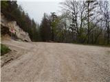
a) From the Ljubljana - Jesenice motorway, take the Kranj - east exit, then continue driving towards Jezersko. When arriving in Preddvor, leave the main road and continue left towards the centre of the mentioned town, from there follow the signs to the Bašelj settlement. Upon arriving in Bašelj, at the beginning of the left bend a narrower road continues straight to the parking lot at the TD Bašelj log cabin (in descriptions starting point Bašelj), we however from the mentioned junction continue along the main road for another good 100 m to the next junction, where we continue right on the road towards Gamsov raj and the Laško hamlet. Some 50 m further we continue on the left road, which gradually begins to ascend moderately. At the Laško hamlet continue left again, then the asphalt ends and we continue driving on a steep gravel road, which we follow to the parking lot next to a small junction. Red mountaineering direction signs are located at the junction.
b) From the Jesenice - Ljubljana motorway, take the Kranj - west exit and at the first junction continue left. Then drive through the underpass under the motorway, after which we arrive at a roundabout, from which we continue driving towards Golnik. The route further leads through the settlement of Mlaka pri Kranju, we at the end of the settlement continue right towards the Srakovlje settlement. This is followed by driving through Srakovlje, Spodnja Bela, Srednja Bela, Zgornja Bela (in Zgornja Bela we join the road from Preddvor) to Bašelj, where the main road makes a long left bend, where a narrower road continues straight to the parking lot at the TD Bašelj log cabin (in descriptions starting point Bašelj), we however from the mentioned junction continue along the main road for another good 100 m to the next junction, where we continue right on the road towards Gamsov raj and the Laško hamlet. Some 50 m further we continue on the left road, which gradually begins to ascend moderately. At the Laško hamlet continue left again, then the asphalt ends and we continue driving on a steep gravel road, which we follow to the parking lot next to a small junction. Red mountaineering direction signs are located at the junction.
Route description:
From the starting point continue along the wider gravel road (left to Dom pod sv. Lovrencem and sv. Lovrenc church), which gently and transversely ascends the slopes of Gora (918 m) (Gora is the peak located above the sv. Lovrenc church). The road, which for most of the time ascends through the forest, higher up passes onto the slopes of Gradišče, where the path from the Belica stream valley joins us from the right (starting point at TD Bašelj log cabin). We walk along the gravel road for another some 10 meters and we are already at the next junction, where another path branches off to the left to sv. Lovrenc.
From the mentioned junction we walk along the road only a few steps, then on the right, next to the sign indicating private parking space, we continue right onto a trodden path, along which in a minute or two of further walking we arrive at the top of Gradišče, where a small wooden hut stands.
Photos:
 1
1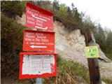 2
2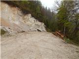 3
3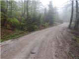 4
4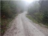 5
5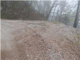 6
6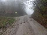 7
7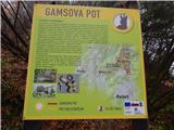 8
8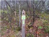 9
9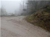 10
10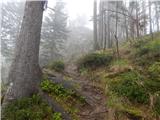 11
11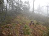 12
12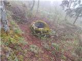 13
13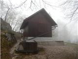 14
14 15
15
Discussion about the trip Laško - Gradišče (Pustinjak)
To post a comment you must log in:
If you do not yet have a username, you must first
register.