Laško (obračališče nad vasjo) - Mali Grintovec (via Bašeljski vrh)
Starting point: Laško (obračališče nad vasjo) (815 m)
| Latitude/Longitude: | 46,32980°N 14,39880°E |
| |
Route name: via Bašeljski vrh
Walking time: 3 h 20 min
Difficulty: easy marked way
Elevation gain: 998 m
Elevation difference along the route: 1100 m
Map: Karavanke - osrednji del 1:50.000
Recommended equipment (summer):
Recommended equipment (winter): ice axe, crampons
Views: 8.896
 | 1 person like this post |
Access to starting point:
a) From the Ljubljana - Jesenice motorway, take the Kranj - east exit, then continue driving towards Jezersko. When we arrive in Preddvor, leave the main road and continue left towards the centre of the mentioned place, from there follow the signs for the Bašelj settlement. When we arrive in Bašelj, at the beginning of the left bend a narrower road continues straight ahead to the parking lot at the TD Bašelj hut (in descriptions starting point Bašelj), we from the mentioned intersection continue along the main road for another good 100 m to the next intersection, where we continue right on the road towards Gamsov raj and the Laško hamlet. Just about 50 m further, continue on the left road, which gradually begins to climb moderately. At the Laško hamlet, continue left again, then the asphalt ends and we continue driving on a steep gravel road, which leads past the branch of the path (track) to the church of St. Lovrenc and Dom na Lovrencu. From the mentioned branch, we drive a little further to the end of the road or a smaller parking lot some 10 meters before.
b) From the Jesenice - Ljubljana motorway, take the Kranj - west exit and at the first intersection continue left. Then we drive through the underpass under the motorway, then we arrive at a roundabout, from which we continue driving towards Golnik. The road ahead leads through the settlement of Mlaka pri Kranju, we at the end of the settlement continue right towards the settlement of Srakovlje. Follows driving through Srakovlje, Spodnja Bela, Srednja Bela, Zgornja Bela (in Zgornja Bela we join the road from Preddvor) to Bašelj, where the main road makes a long left bend, where a narrower road continues straight ahead to the parking lot at the TD Bašelj hut (in descriptions starting point Bašelj), we from the mentioned intersection continue along the main road for another good 100 m to the next intersection, where we continue right on the road towards Gamsov raj and the Laško hamlet. Just about 50 m further, continue on the left road, which gradually begins to climb moderately. At the Laško hamlet, continue left again, then the asphalt ends and we continue driving on a steep gravel road, which leads past the branch of the path (track) to the church of St. Lovrenc and Dom na Lovrencu. From the mentioned branch, we drive a little further to the end of the road or a smaller parking lot some 10 meters before.
Route description:
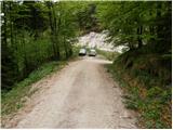
From the smaller parking lot, we walk to the turning point at the end of the road. From the end of the road, continue left onto the track towards Kališče and Storžič. The track then climbs moderately along the bed of the Belica stream and after about 10 minutes splits into two parts. Continue on the left track, which ends after a few meters. At this point, we leave the vicinity of the stream bed and continue slightly left on the path that steeply ascends through the forest. The steepness soon eases and the path takes us to the Partizanska bolnica Košuta.
After the hospital, we cross two consecutive gullies, then the path becomes steeper again. The path ahead still continues through the forest, crossing one steeper slope where more caution is needed in wet conditions. Above the steep section, we reach the side ridge of Kališče, where an unmarked path from Bašelj joins from the right.
Here, continue left and continue the ascent on the still steep path that continues through increasingly sparse forest. After the bench and some views of the nearby Storžič, the path turns right and returns to dense forest. A less steep path follows, which quickly takes us to the first hut on Spodnje Kališče. After the hut, the forest ends, then along a pleasant grassy base in a few minutes we reach the central part of the pasture, where we also join the usual path from Mač.
From Spodnje Kališče, continue slightly left towards Dom na Kališču, from which a few minutes of walking through the forest follow, then we arrive at a nice viewpoint from which we have a nice view towards the nearby Dom na Kališču, Mali Grintovec, the ridge of Lanež, Krvavec... From the viewpoint, only a short ascent follows and we are at Dom na Kališču.
Behind Dom na Kališču, we notice a mountaineering direction sign with numerous options for continuing the path. We continue along the gentle and scenic ridge path towards Storžič, Bašeljski vrh..., which continues northwards. After a few minutes of easy walking with nice views reaching to the Julian Alps, we arrive at a junction, where we continue right (straight to Storžič) towards Bašeljski vrh. The path ahead climbs more steeply through a belt of dwarf pines and brings us to the dwarf pine-covered ridge of Bašeljski vrh with nice views of the neighbouring Mali Grintovec, where in the next few minutes we arrive at the next well-marked junction. At the junction, the path to Mali Grintovec and Srednji vrh branches right, we continue straight and with a view of Storžič continue the ascent. The path, which runs along and on the dwarf pine-covered ridges, joins a little below the summit with the path from Jekarica and Bašeljski preval. Here, continue right and along a somewhat narrower ridge in one minute of further walking reach Bašeljski vrh, from which we have a nice view towards the mountains above Jezersko, the view reaching to Košuta, Obir and the Labotniške Alpe in Austria.
From Bašeljski vrh, we begin to descend relatively steeply towards the east to northeast, along a path that runs along and on the ridge, which is mostly covered with dwarf pines, where it is not, a bit more care is needed. After about 15 minutes, the descent ends and the path takes us to Mačensko sedlo, where a marked path from Kališče and an unmarked path along the Suha valley join us.
Continue straight towards Mali Grintovec, along a path that begins to climb relatively steeply up the western slope of the mentioned mountain. After about half an hour of walking from Mačensko sedlo, we come to a marked junction, where the path from Dolga njiva joins from the right. Continue left and after some 10 steps of further walking arrive at the summit of Mali Grintovec.
Starting point - Partizanska bolnica Košuta 0:25, Partizanska bolnica Košuta - Kisovec 0:25, Kisovec - Planina Kališče 0:45, Planina Kališče - Dom na Kališču 0:15, Dom na Kališču - junction at Kališče 0:10, junction above Kališče - junction below Bašeljski vrh 0:15, junction below Bašeljski vrh - Bašeljski vrh 0:20, Bašeljski vrh - Mačensko sedlo 0:15, Mačensko sedlo - Mali Grintovec 0:30.

Photos:
 1
1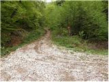 2
2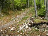 3
3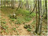 4
4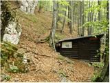 5
5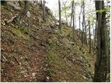 6
6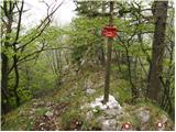 7
7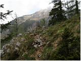 8
8 9
9 10
10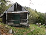 11
11 12
12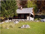 13
13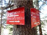 14
14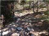 15
15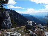 16
16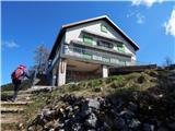 17
17 18
18 19
19 20
20 21
21 22
22 23
23 24
24 25
25 26
26 27
27 28
28 29
29 30
30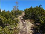 31
31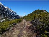 32
32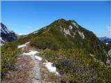 33
33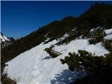 34
34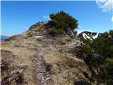 35
35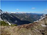 36
36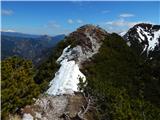 37
37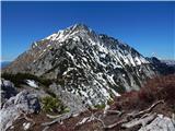 38
38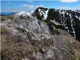 39
39 40
40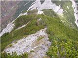 41
41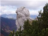 42
42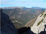 43
43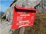 44
44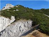 45
45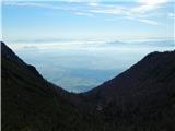 46
46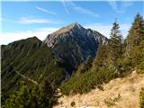 47
47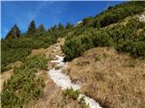 48
48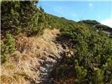 49
49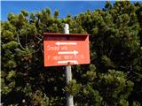 50
50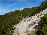 51
51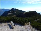 52
52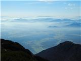 53
53 54
54
Discussion about the trip Laško (obračališče nad vasjo) - Mali Grintovec (via Bašeljski vrh)
To post a comment you must log in:
If you do not yet have a username, you must first
register.