Laško - Storžič (via Javornik)
Starting point: Laško (757 m)
| Latitude/Longitude: | 46,32560°N 14,39690°E |
| |
Route name: via Javornik
Walking time: 4 h 45 min
Difficulty: easy marked way
Elevation gain: 1375 m
Elevation difference along the route: 1450 m
Map: Karavanke - osrednji del 1:50.000
Recommended equipment (summer):
Recommended equipment (winter): ice axe, crampons
Views: 64.116
 | 4 people like this post |
Access to starting point:
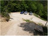
a) From the Ljubljana-Jesenice motorway, take the Kranj-east exit, then continue driving towards Jezersko. When arriving in Preddvor, leave the main road and continue left towards the centre of the mentioned town, from there follow the signs to the Bašelj settlement. Upon arriving in Bašelj, at the beginning of the left bend a narrower road continues straight ahead to the parking lot at the TD Bašelj cabin (starting point Bašelj in descriptions), we, however, from the said intersection continue along the main road for another good 100 m to the next intersection, where we turn right onto the road towards Gamsov raj and Laško hamlet. Just about 50 m further, continue on the left road, which gradually begins to ascend moderately. At the Laško hamlet turn left again, then the asphalt ends and continue driving on a steep gravel road, following it to the parking lot by a small intersection. Red mountaineering direction signs are located at the intersection.
b) From the Jesenice-Ljubljana motorway, take the Kranj-west exit and at the first intersection continue left. Continue through the underpass under the motorway, then arrive at a roundabout, from which continue towards Golnik. The road further leads through the Mlaka pri Kranju settlement, we at the end of the settlement turn right towards the Srakovlje settlement. We drive through Srakovlje, Spodnja Bela, Srednja Bela, Zgornja Bela (in Zgornja Bela we join the road from Preddvor) to Bašelj, where the main road makes a long left bend, where a narrower road continues straight to the parking lot at the TD Bašelj cabin (starting point Bašelj in descriptions), we, however, from the said intersection continue along the main road for another good 100 m to the next intersection, where we turn right onto the road towards Gamsov raj and Laško hamlet. Just about 50 m further, continue on the left road, which gradually begins to ascend moderately. At the Laško hamlet turn left again, then the asphalt ends and continue driving on a steep gravel road, following it to the parking lot by a small intersection. Red mountaineering direction signs are located at the intersection.
Route description:
From the parking lot and intersection, continue on the worse and steeper left road towards sv. Lovrenc and Dom pod Sv. Lovrencem (straight to Kališče and Storžič, to Storžič and Kališče it is also possible by continuing left). From the intersection onwards, we ascend relatively steeply, during the ascent a marked footpath branches off to the right leading directly to the church of sv. Lovrenc and bypassing Dom pod Lovrencem. All the time continue on the road, from which higher up some views open transiently. When the road after some time turns sharply right, it brings us in a few steps to the aforementioned Dom pod Lovrencem.
From the hut continue towards Javornik, Velika and Mala Poljana, Kališče and Storžič, on a path that moderately ascends through the forest. The well-trodden path quickly takes us out of the forest onto a vast meadow, across which we walk with beautiful views to the church of sv. Lovrenc.
Behind the church the path returns to the forest and begins to descend towards a marked junction a few minutes away, where we continue straight towards Storžič and Kališče.
Further continue towards Storžič on the wide path, which however ascends slightly. The path soon becomes narrower and then ascends steeply through the forest for quite some time. Higher up the path takes us out of the forest and beautiful views open to the southern slopes of Storžič. The steepness does not relent all the way to the bench at the junction.
Next, head left towards Planina Javornik and Poljana (right Kališče). The path crosses the southern slopes of Storžič towards the west with some shorter descents and ascents. After 20 minutes of traversing, we reach a junction in the southwestern gully of Storžič. Here we already see Planina Javornik to the left, to which we can ascend in a few minutes up the steep grassy slope, otherwise continue right towards Storžič.
Continue towards Storžič and begin ascending the southwestern gully of Storžič. Higher up, a path joins from the left leading under the slopes of Psica.
From the mentioned junction continue right (left Velika Poljana, Dom pod Storžičem...) and continue ascending the fairly steep southwestern gully of Storžič. Along the said gully, from which increasingly beautiful views open towards Gorenjska, we ascend for another good hour, then the path turns slightly right and brings us to the southwestern ridge of Storžič, where an unmarked path joins from the right leading along the said ridge.
Continue along the ridge, the marked path then turns slightly right and soon other paths from Dom pod Storžičem and Kališče join us. From here to the summit, which we already see ahead, only a short ascent follows with wonderful views.
Starting point - Dom na Lovrencu 0:15, Dom na Lovrencu - sv. Lovrenc 0:05, sv. Lovrenc - saddle at sv. Lovrencu 0:10, saddle at sv. Lovrencu - wide valley 1:45, Wide valley - Junction below Planina Javornik 0:25, junction below Planina Javornik - Planina Javornik 0:05, Planina Javornik - junction in southwestern gully 0:40, junction in southwestern gully - ridge of Storžič 1:05, ridge of Storžič - Storžič 0:15.

Photos:
 1
1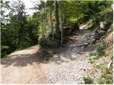 2
2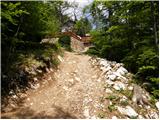 3
3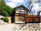 4
4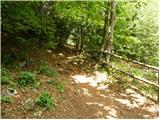 5
5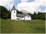 6
6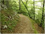 7
7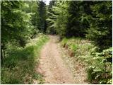 8
8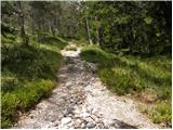 9
9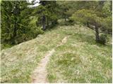 10
10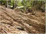 11
11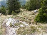 12
12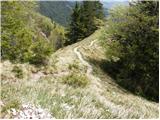 13
13 14
14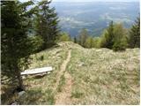 15
15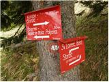 16
16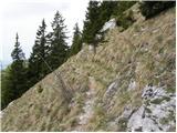 17
17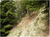 18
18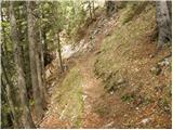 19
19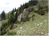 20
20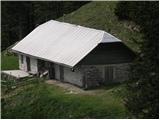 21
21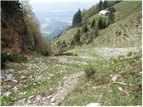 22
22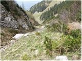 23
23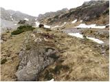 24
24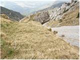 25
25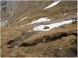 26
26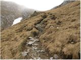 27
27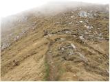 28
28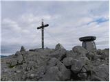 29
29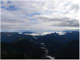 30
30
Discussion about the trip Laško - Storžič (via Javornik)
|
| MartinaZ1. 07. 2008 |
On 29.06.08 we walked this route. It was one of the nicest. Very picturesque and varied, lots of flowers along the path. We were lucky the sun hid a bit, otherwise we'd have been baked-literally I recommend an early start. I recommend an early start.
|
|
|
|
| Fazo2. 08. 2009 |
Around Krničarjeva hut on Javornik pasture everything is torn up, up the gully there's still lots of fallen trees from last winter. Here the path is really "ugly", everything else is super. Today it was damn hot!
Best, matevž
|
|
|
|
| Mate076. 09. 2009 |
I did this trail today on Sunday. The path is very well marked except somewhere in the middle there's a junction RIGHT (Kališče) or LEFT (for easier path turn LEFT...picture 16. But the tour itself is very strenuous, so I advise against it for those without fitness.
I took a full 4 hours to get up. I walked that long on purpose because I rested a lot and looked at our towns, settlements, villages, mountains, pastures....
|
|
|
|
| pikicapikica11. 04. 2010 |
I'm wondering if this is the easiest/least dangerous path to Storžič? If not, which path do you recommend? And which is the most beautiful? Fitness is not an issue, but I have a fear of cliffs. Thank you!
|
|
|
|
| Bojan_A11. 04. 2010 |
This path and the one from Povelj are the only ones completely without safety gear. In dry conditions, they are completely safe. Currently - in winter, of course, it's different.
|
|
|
|
| serajko11. 04. 2010 |
Pikicapikica
This path is safe only when the snow has completely melted. At that time, there is still a great danger of ground avalanche, which almost every year ravages the gully. It's also unpleasant after rain as it becomes muddy: In case of poorer fitness, a hike is also possible from Dom pod Storžičem. Last year, a hiker with similar "dizziness" issues managed this ascent without problems. If you need more info, send me a message and I'll explain in detail.
best regards
|
|
|
|
| pohodnica5313. 04. 2010 |
Hello pikicapikica; yes, pohodnica53 last summer, despite vertigo and fear of precipices, climbed to Storžič without problems ; it was wonderful, nothing precipitous (I avoided Psice widely hehehe), I started from Dom pod Storžičem, then past Velika and Mala Polana and planina Javornik, otherwise serajko will surely help you with detailed information just like he did for me; cheers ; it was wonderful, nothing precipitous (I avoided Psice widely hehehe), I started from Dom pod Storžičem, then past Velika and Mala Polana and planina Javornik, otherwise serajko will surely help you with detailed information just like he did for me; cheers
|
|
|
|
| Iguana25. 05. 2010 |
Bojan A will surely know.....is there still a lot of snow on the path from Laško to the top of Storžič?
|
|
|
|
| Gorazd G25. 05. 2010 |
Laško-Kališče-Storžič (eastern ridge)-SW gully-Lovrenc-Laško.
Were there yesterday. In the SW gully there are still two short (a few meters) snow-covered crossings on the path, which can probably also be bypassed. No difficulties.
The snow tongue is still almost down to the Kališče/Povlje junction, after which you can nicely "ski down", of course descent on foot is also possible.
|
|
|
|
| Iguana25. 05. 2010 |
I'll wait a bit longer, snow crossing terrifies me from last year's experience, even if it's only a meter. Storžič will wait for me.
Thanks Gorazd for the report.
|
|
|
|
| Branee1. 07. 2011 |
Greetings!
I plan to do this path on Sunday and wonder if the forecast in the high mountains is good?
Since I read somewhere that there's a small chance of showers or thunderstorms in the afternoon otherwise mostly clear (but it was for July) so wonder if I can expect similar weather also in the Kamnik-Savinja Alps?
Regards Brane
|
|
|
|
| ANČIKA11. 09. 2011 |
Hi! Pohodnica53 please tell me more precisely the route from Dom pod Storžičem past Velika and Mala Polana and planina Javornik to Storžič because I'd like to do a similar tour as you described on 13.4.2010 Thanks and best
|
|
|
|
| Alni9. 07. 2012 |
How much macadam is there on this path by car and what is the road like? Thanks
|
|
|
|
| mic22. 09. 2013 |
Yesterday I conquered Storžič via this path. The path is, regarding fitness, in my opinion (this year already conquered nine two-thousanders) very demanding. Most of the path makes your knees ache. For the entire ascent I used a full five hours. I have a remark on the sign at Javornik, it says Storžič 1 h 30m. That doesn't hold. I took 2 h 30m (without stops). The path is suitable for us who have a fear of precipices
|
|
|
|
| anč22. 09. 2013 |
The path from Povelj over Javornik is not very demanding, but very steep. The times are also realistic, I myself take 1h 50min from Polvelj to the top.
|
|
|
|
| Darxta22. 09. 2013 |
I agree that 1h 30min from Javornik is not realistic. For a normal pace, 2h would be more appropriate. However, the length of the entire trail (4h) is correctly stated
|
|
|
To post a comment you must log in:
If you do not yet have a username, you must first
register.