Legen (Rotovnik-Plesnik) - Kremžarjev vrh (mimo sv. Barbare, razgledna pot)
Starting point: Legen (Rotovnik-Plesnik) (513 m)
| Latitude/Longitude: | 46,49976°N 15,12317°E |
| |
Route name: mimo sv. Barbare, razgledna pot
Walking time: 2 h 30 min
Difficulty: easy marked way
Elevation gain: 651 m
Elevation difference along the route: 705 m
Map: Pohorje 1:50.000
Recommended equipment (summer):
Recommended equipment (winter): ice axe, crampons
Views: 16
 | 1 person like this post |
Access to starting point:
a) Drive to Slovenj Gradec, then follow the road towards the Kope ski resort. In the village of Legen, first drive past the turn-off to the Vinišnik picnic area, and a little further on you reach the point where the road to the nearby tourist farm Rotovnik-Plesnik branches off to the left. The described route starts at the mentioned intersection, and there are no designated parking spaces for hikers nearby.
b) Drive to Mislinja, then follow the main road towards Slovenj Gradec. Just before Slovenj Gradec, turn right at the roundabout towards the Kope ski resort and the village of Šmartno pri Slovenj Gradcu. Continue through the mentioned village, then the road gradually ascends; as you begin to descend, you pass the famous church of sv. Jurija and reach the intersection in Legen, where you turn right. In the village of Legen, first drive past the turn-off to the Vinišnik picnic area, and a little further on you reach the point where the road to the nearby tourist farm Rotovnik-Plesnik branches off to the left. The described route starts at the mentioned intersection, and there are no designated parking spaces for hikers nearby.
Route description:
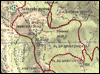
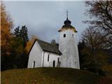
The path ahead leads us along a side road, where we first bypass the tourist farm Rotovnik-Plesnik on the left side, then at intersections, where we still pass individual houses, we follow the yellow hiking signs of the Bernekerjeve poti. The road ahead becomes a gravel road and ascends along the Barbarskem potoku (on some maps also marked simply as Barbara); at intersections we continue to follow the signs of the Bernekerjeve poti. The path ahead leads us past the former Velikanove bajte, Starčevega mlina and a still functioning water trough and cross, after which a path branches off to the right to another homestead. Here we continue straight along the wider road, then turn slightly right onto a wider track, along which the yellow hiking signs continue. We also ascend along the Barbarskem potoku on the track for some time, then turn sharply right and begin a steeper ascent; the turn-off is also marked here with a yellow sign of the Bernekerjeve poti. This is followed by a somewhat steeper ascent through the forest, where we follow the marked path to the chapel of sv. Barbare. Here the path turns sharply left and after another minute or two of walking brings us to the church of sv. Barbare.
Behind the church we reach a transverse gravel road and follow it to the left (straight up the track to Kremžarjev vrh, accessible by bicycle). Further on we no longer follow the Bernekerjevi poti, but there are no orientation difficulties as we constantly follow the gravel road that crosses the slopes to the left until the saddle at the former farm Sedlar.
At Sedlar we reach a marked path that leads from Šmartnega pri Slovenj Gradcu or the starting point at the farm Vinišnik; we follow it to the right uphill, where the path ahead leads us along a track that we follow at junctions in the direction of the Knafelčevih markacij.
Higher up we reach the farm Lampret, which we bypass on the left side; immediately above it we reach another gravel road where the path also forks.
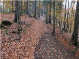
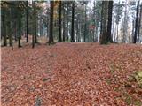
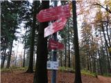
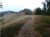
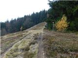
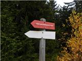
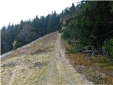
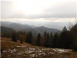
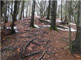
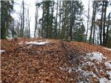
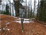
Mountain direction signs point straight onto the track; we continue along the road to the right and then after a few steps turn left onto the track that ascends into the forest, where the markings reappear. Further on we ascend quite steeply along the track, along which there are still some markings at first, then they mostly end until the junction with the ridge path. When we reach the ridge higher up we turn left towards Slovenj Gradec and Koče pod Kremžarjevim vrhom (right Koča Planinc) and quickly leave the forest. The path ahead ascends moderately somewhat to the left of the ridge over scenic grassy slopes, from which we get a beautiful view of the surrounding hills. A few minutes further on, before the path enters the forest, it forks once more. We choose the right path that leads towards Kremžarjevemu vrhu (the straight path bypasses the summit on the left side); this ascends more steeply and brings us in a few minutes to the 1164-metre-high, forest-covered summit.
Starting point - sv. Barbara 1:05, sv. Barbara - Sedlar 0:40, Sedlar - Kremžarjev vrh 0:45.
The description and images refer to the situation in November 2026.
Photos:
 1
 2
 3
 4
 5
 6
 7
 8
 9
 10
 11
 12
 13
 14
 15
 16
 17
 18
 19
 20
 21
 22
 23
 24
 25
 26
 27
 28
 29
 30
 31
 32
 33
 34
 35
 36
 37
 38
 39
 40
 41
 42
 43
 44
 45
 46
 47
 48
 49
 50
 51
 52
Discussion about the trip Legen (Rotovnik-Plesnik) - Kremžarjev vrh (mimo sv. Barbare, razgledna pot)
To post a comment you must log in:
If you do not yet have a username, you must first
register.