Starting point: Leška gmajna (1220 m)
| Latitude/Longitude: | 46,29850°N 14,71970°E |
| |
Walking time: 1 h 15 min
Difficulty: easy marked way
Elevation gain: 205 m
Elevation difference along the route: 325 m
Map: Kamniške in Savinjske Alpe 1:50.000
Recommended equipment (summer):
Recommended equipment (winter): ice axe, crampons
Views: 21.954
 | 1 person like this post |
Access to starting point:
From Gornji Grad or Stahovica we drive to the mountain pass Črnivec, and then we continue driving right (or left, if we came from Stahovica) on a macadam (forest) road which starts ascending on a large clearing (natural disaster 13.7.2008). On the ascending and in parts a little worse road at the first crossroad we follow left, at the second straight ahead. After a few km of ascent the road brings us to a smaller saddle, where there is the next crossroad. Here we continue right on a narrower and partly already overgrown road by which we notice mountain signposts for Rogatec (and a little further also for Lepenatka). This road, which is further slightly descending, we follow to its end, where we park.
To the starting point we can also come from the mountain pass Volovljek (Kranjski and Štajerski Rak).
Route description:
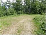
From the end of the road, we continue on a marked footpath which goes into the forest, and it starts moderately descending. After a few minutes of descent, we step on a cart track, on which in a few additional strides we step on the saddle Kunšperk, where there are a few crossings.
We continue straight on a marked cart track which after a few steps of ascent brings us to a marked crossing, where we continue right in the direction of Lepenatka. The path ahead ascends through a short lane of fallen trees, and then it starts turning more and more towards the right. The path then in a gentle ascent crosses steep and in wet for slipping dangerous slopes of Kunšperski vrh. After that, the path steeply ascends and after a few minutes of additional walking brings us to the western ridge of Lepenatka. We further follow a quite overgrown path, which through a thinner forest brings us to the upper grassy slope of the mountain. The path from which increasingly beautiful views open up (the most beautiful view is on the nearby Rogatec), in a few minutes of ascent on the upper slope brings us to a grassy peak.

Along the route: Sedlo Kunšperk (1119m)
Photos:
 1
1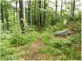 2
2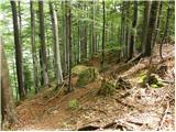 3
3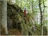 4
4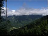 5
5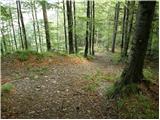 6
6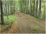 7
7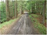 8
8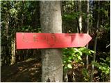 9
9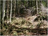 10
10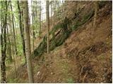 11
11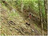 12
12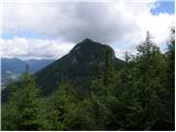 13
13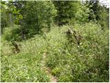 14
14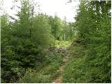 15
15 16
16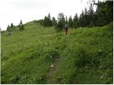 17
17 18
18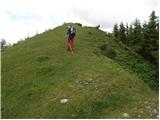 19
19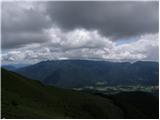 20
20 21
21
Discussion about the trip Leška gmajna - Lepenatka
|
| ločanka25. 10. 2015 |
Today on this path, namely from Črnivc first to Kranjsko Reber, then descent past the hut on Kašina Planina to the path junction (there a sign saying Lepenatka 1.45 hours, then follow the description of this path. It's interesting to combine the trip to both summits, according to the signs, the time distance is two hours. Views from both summits are magnificent!
|
|
|
To post a comment you must log in:
If you do not yet have a username, you must first
register.