Starting point: Leskovica (800 m)
| Latitude/Longitude: | 46,14730°N 14,08660°E |
| |
Walking time: 2 h 5 min
Difficulty: easy marked way
Elevation gain: 762 m
Elevation difference along the route: 762 m
Map: Škofjeloško in Cerkljansko hribovje 1:50.000
Recommended equipment (summer):
Recommended equipment (winter): ice axe, crampons
Views: 77.777
 | 3 people like this post |
Access to starting point:
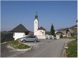
From Škofja Loka we drive towards Gorenja vas and further to Hotavlje, where we turn right in the direction of the village Leskovica. The road soon brings us to the village Kopačnica, after which it starts to ascend more steeply and brings us higher to the village Leskovica, where we notice signposts for Blegoš. Signs for Blegoš direct us to a narrow and steep road, which we then follow to the parking lot by the church.
To the starting point we can also come from Cerkno.
Route description:
From the parking lot we continue along the initially still asphalted road, which with a view of Blegoš and surrounding peaks quickly brings us into the forest. After good 20 minutes of gentle ascent along the road, we will notice signposts on the left side, which direct us onto a cart track in the direction of the shelter of the mountain guard Zavetišče gorske straže na Jelencih.
The cart track then ascends diagonally somewhat to the right and already after a few steps brings us to the place where the path from Volake joins from the right. We continue along the wide marked path, which higher crosses a torrent stream, along which we then ascend for some time. The path, which moderately ascends through the forest, soon brings us to a forest road, which we just cross.
The path ahead ascends over small steps and in 5 minutes of further walking brings us to the shelter of the mountain guard Zavetišče gorske straže na Jelencih.
From the shelter we continue along the marked path, which enters a dense spruce forest. Soon the path from the village Laze joins from the left, and we continue slightly to the right along the path, which quickly brings us out of the forest. Once out of the forest we continue to the right in the direction of the hut Koča na Blegošu (left Črni vrh, straight Črni Kal) along a rougher road, along which we ascend to the hut Koča na Blegošu in a few minutes.
From the hut Koča na Blegošu we continue along the initially gentle path, which ascends over a panoramic grassy slope. The path soon starts to ascend more steeply and brings us to the edge of the forest, where it then ascends along a narrow unvegetated strip. The steepness soon eases and the path brings us to the panoramic ridge of Blegoš, along which we ascend to the summit in a few minutes.
Leskovica - Jelenci 1:05, Jelenci - Koča na Blegošu 30 minutes, Koča na Blegošu - Blegoš 30 minutes.

Photos:
 1
1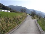 2
2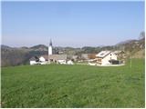 3
3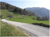 4
4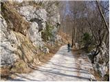 5
5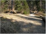 6
6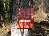 7
7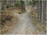 8
8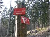 9
9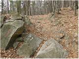 10
10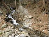 11
11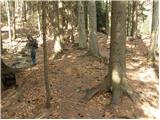 12
12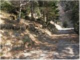 13
13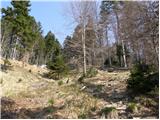 14
14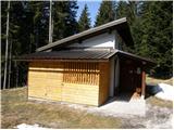 15
15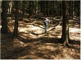 16
16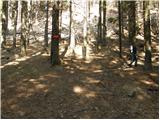 17
17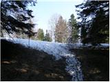 18
18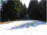 19
19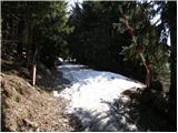 20
20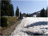 21
21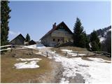 22
22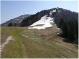 23
23 24
24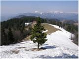 25
25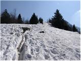 26
26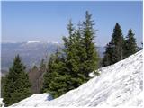 27
27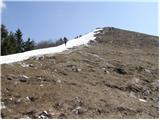 28
28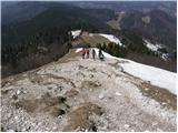 29
29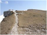 30
30 31
31
Discussion about the trip Leskovica - Blegoš
|
| pohodnik0112. 06. 2010 |
I'd just add that you can drive just under 2 km further past the church and park in the grove in the shade. There's also parking there. I wouldn't have known if a friendly local hadn't told me. 
|
|
|
|
| istrumel8. 02. 2011 |
On Sunday 7.2.2011 I was on Blegoš from Leskovica. The path is wonderful, a little snow in places, weather incredibly beautiful for this time of year, so we sunbathed on the summit in short sleeves because there was no wind either.
|
|
|
|
| croata4. 05. 2011 |
On Saturday 07.05.2011 I'm heading to Blegoš by bike. I'll start in Ljubljana and continue to Hotavelj then via Leskovica to the hut on Blegoš. I hope the path is suitable for a bike.
|
|
|
|
| bike4. 05. 2011 |
Croata, on 1.5. we went to Blegoš on bikes from Šk. Loka via the military road and then through Javorje and Žetino to Kal. The road is passable to the hut normally. I assume the road from Hotavelj is normally passable, as cars were coming to Kal on it.
|
|
|
|
| Jože.4. 05. 2011 |
From Leskovica to the hut on Blegoš by bike, no way, as you'd have to carry it for most of the path. Better option is the one described by "bike" (that's the road behind Lubnik). If you want to ride mostly on asphalt, go from Šk. Loka to Poljan and turn towards Javorje and continue through Gornjo Žetino to Črni Kal. Asphalt ends 500 meters before Kal. From Kal to the hut is another 3 km. The entire path from Šk. Loka to the hut is approximately 28 km. The decision is yours, happy trails.
|
|
|
|
| Kokta20. 05. 2012 |
Today there was a bit of a problem with parking space, because the third KBK was taking place.
The path to the hut leads through the forest in the shade. Further on, views open up on all sides. Definitely one of the nicer hikes. I warmly recommend a visit.
|
|
|
|
| Fulcrum1. 12. 2024 16:38:48 |
There is now a (free) parking lot for hikers right before the village of Leskovica. There is space for about 15 vehicles.
|
|
|
To post a comment you must log in:
If you do not yet have a username, you must first
register.