Leskovica - Zavetišče gorske straže na Jelencih
Starting point: Leskovica (800 m)
| Latitude/Longitude: | 46,14730°N 14,08660°E |
| |
Walking time: 1 h 5 min
Difficulty: easy marked way
Elevation gain: 385 m
Elevation difference along the route: 385 m
Map: Škofjeloško in Cerkljansko hribovje 1:50.000
Recommended equipment (summer):
Recommended equipment (winter):
Views: 5.639
 | 2 people like this post |
Access to starting point:
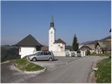
From Škofje Loka we drive towards Gorenja vas and further to Hotavlje, where we turn right in the direction of the village Leskovica. The road soon brings us to the village Kopačnica, after which it starts to ascend more steeply and brings us higher to the village Leskovica, where we notice signposts for Blegoš. Signs for Blegoš direct us onto a narrow and steep road, which we then follow to the parking lot at the church.
We can also reach the starting point from Cerkno.
Route description:
From the parking lot, we continue on the initially still asphalted road, which, with a view of Blegoš and the surrounding peaks, quickly brings us into the forest. After a good 20 minutes of gentle ascent along the road, we will notice signposts on the left side, which direct us onto a cart track towards the mountain hut Zavetišče gorske straže na Jelencih.
The cart track then ascends diagonally somewhat to the right and brings us already after a few steps to the spot where the path from Volaka joins from the right. We continue on the wide marked path, which higher crosses a torrential stream, along which we then ascend for some time. The path, which moderately ascends through the forest, soon brings us to a forest road, which we merely cross.
The path ahead ascends over small steps and brings us to the mountain hut Zavetišče gorske straže na Jelencih in 5 minutes of further walking.
Photos:
 1
1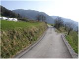 2
2 3
3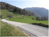 4
4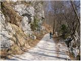 5
5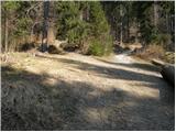 6
6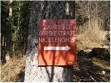 7
7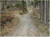 8
8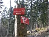 9
9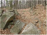 10
10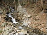 11
11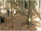 12
12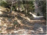 13
13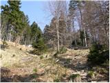 14
14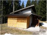 15
15
Discussion about the trip Leskovica - Zavetišče gorske straže na Jelencih
|
| mirank8. 10. 2022 08:12:56 |
It's a more modest hut but full of everything that once defined our huts. In the higher-lying hut I (probably due to the cold outside during the visit) didn't feel welcome at all. outside during the visit) didn't feel welcome at all.
|
|
|
To post a comment you must log in:
If you do not yet have a username, you must first
register.