Liboje - Dom na Šmohorju (via organic farm Kralj)
Starting point: Liboje (324 m)
| Latitude/Longitude: | 46,20976°N 15,20439°E |
| |
Route name: via organic farm Kralj
Walking time: 1 h 30 min
Difficulty: easy marked way
Elevation gain: 460 m
Elevation difference along the route: 460 m
Map: Celjska kotlina, 1:50000
Recommended equipment (summer):
Recommended equipment (winter):
Views: 4.640
 | 1 person like this post |
Access to starting point:
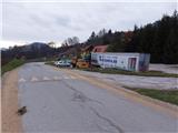
From the highway Ljubljana - Maribor, we take the exit Žalec and continue driving towards Arja vas. At the crossroads at the end of the village, we continue straight in the direction of Liboje. In Liboje, we turn left in the direction of Košnice pri Celju and follow the road for approx. 850 meters to a large private parking lot and a yellow house at the crossroads, where a road branches off to the right leading to the organic farm Kralj. At this crossroads, there is also a self-service stall of the mentioned farm and a cute signpost for the organic farm Kralj. Next to the latter signpost, there is also a hiking signpost for Šmohor and Veliki Slomnik. We can park in a suitable place near the described starting point.
Route description:
From the above-described basic starting point (picture 1), we follow the signpost towards the organic farm Kralj and Šmohor along the asphalt road in a slight uphill. However, 350 meters before the described basic starting point, there is also an alternative starting point (picture 2) at the crossroads by the chapel, where there is also a signpost for Šmohor and Veliki Slomnik mounted on a tree. Both paths from both starting points join on a macadam road approx. 700 meters ahead. The drawback of the alternative starting point is that there is no suitable parking spot nearby.
From the basic starting point, we continue to follow the asphalt road approx. 200 meters to the organic farm Kralj, then continue in the same direction along the macadam road that branches off towards the stream flowing under the Libojska stena wall of Veliki Slomnik. The road at the last homestead before the stream turns into a path running right by the stream. Soon we step onto the macadam road coming from the right from the direction of the alternative starting point. We head left towards Šmohor. Further on, the macadam road enters the embrace of the forest. We continue to a junction where the path to Veliki Slomnik goes left and to Šmohor right.
We continue right towards Šmohor slightly uphill in the embrace of the forest. The marked path runs along the forest road right-left, the steepness increases, passing here and there by some isolated homestead or cottage. Soon we arrive at a junction from where the path from Tremerje joins us from the left. We still follow the forest road uphill. When we arrive directly at the abandoned homestead, we turn through the yard quite sharply right uphill and past another homestead and by the cottage, where we step onto the flat area to the path junction.
According to the markings "Šmohor", we continue sharply left uphill into the forest. We follow the pleasant hiking path; the marking in this section is excellent, the path is varied in a not too strenuous ascent. Further, a short section across meadow/pasture terrain. After a short section through the forest, on the flat section of the path, another hiking path from Liboje - from Podkoritnik - joins from the right. A few more steps and we step out of the forest. Before the macadam road, which otherwise leads left to Malič, we step right slightly downhill onto the meadow in the western direction. Then we go along the under-construction object on the path, where a view of the Savinja side opens up, then a few more meters to the junction of several paths and roads, a bit more uphill through the small forest and the goal of our path is reached – Dom na Šmohorju.

Along the route: Veliki Slomnik (609m), Kamčič (525m), Malič (936m)
The trip can be extended to the following destinations: Gozdnik
Photos:
 1
1 2
2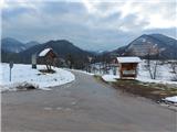 3
3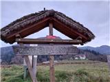 4
4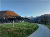 5
5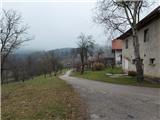 6
6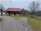 7
7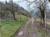 8
8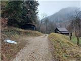 9
9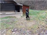 10
10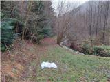 11
11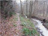 12
12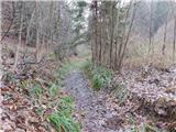 13
13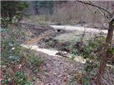 14
14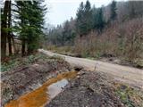 15
15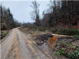 16
16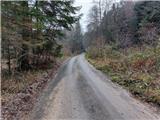 17
17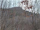 18
18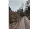 19
19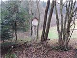 20
20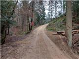 21
21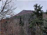 22
22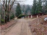 23
23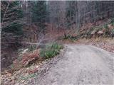 24
24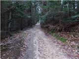 25
25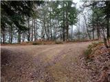 26
26 27
27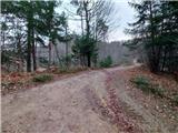 28
28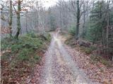 29
29 30
30 31
31 32
32 33
33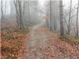 34
34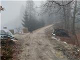 35
35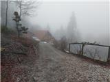 36
36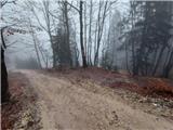 37
37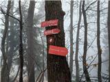 38
38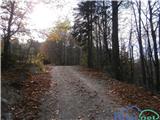 39
39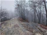 40
40 41
41 42
42 43
43 44
44 45
45 46
46 47
47 48
48 49
49 50
50 51
51 52
52 53
53 54
54 55
55 56
56 57
57
Discussion about the trip Liboje - Dom na Šmohorju (via organic farm Kralj)
To post a comment you must log in:
If you do not yet have a username, you must first
register.