Lienzer Dolomitenhütte - Weißstein Alm (by road)
Starting point: Lienzer Dolomitenhütte (1620 m)
| Latitude/Longitude: | 46,79110°N 12,78420°E |
| |
Route name: by road
Walking time: 30 min
Difficulty: easy marked way
Elevation gain: 131 m
Elevation difference along the route: 131 m
Map:
Recommended equipment (summer):
Recommended equipment (winter): ice axe, crampons
Views: 1.690
 | 1 person like this post |
Access to starting point:
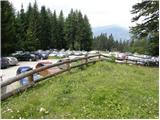
Through the Karawanks Tunnel, we drive into Austria, then continue driving towards Spittal and further towards Lienz (a little after Spittal, the highway ends). Further, we drive on a relatively nice and wide road through the Drau Valley. A few kilometers before Lienz (near the settlement Unterdorf), we will notice signs for the mountain hut Lienzer Dolomitenhütte, which direct us left onto a local road. The road then crosses the Drava/Drau over a bridge and brings us to the village Lavant, where we continue right in the direction of the village Tristach. Between the village Lavant and Tristach, we will come to the next crossroad, where we continue left in the direction of "Lienzer Dolomitenhütte". This road, which starts ascending more steeply, we then follow to the large parking lot near the mentioned mountain hut. The road is toll (July 2009 7€).
To Lienz we can also come if instead of through the Drau Valley we drive through the Gail Valley (Korensko sedlo, Hermagor, pass Ziljsko sedlo/Gailbergsattel), in this case we arrive in the Drau Valley at the settlement Oberdrauburg.
Route description:
From the parking lot, we continue on the road, by which in 2 minutes we arrive at the mountain hut Lienzer Dolomitenhütte.
From the hut, we cross the fence and continue the ascent on a panoramic road (nice view of the serrated ridge - highest is Spitzkofel 2717 m), which in the initial part is exposed to falling stones. The road then crosses a short strip of forest and brings us to the indistinct saddle Premstall (1625 m), where there is a smaller junction.
Here we continue left on the mountain path, which starts to ascend over an increasingly steep grassy slope. The path higher crosses a short and sparse strip of forest, then levels out and in a few minutes of further walking brings us to the shepherd huts on the pasture Weißstein Alm.
Photos:
 1
1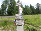 2
2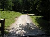 3
3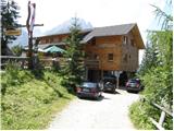 4
4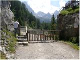 5
5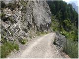 6
6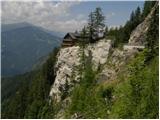 7
7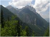 8
8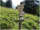 9
9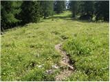 10
10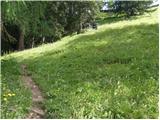 11
11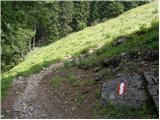 12
12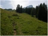 13
13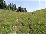 14
14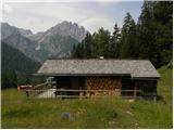 15
15
Discussion about the trip Lienzer Dolomitenhütte - Weißstein Alm (by road)
To post a comment you must log in:
If you do not yet have a username, you must first
register.