Lipa - Grmada (path via Peski)
Starting point: Lipa (335 m)
| Latitude/Longitude: | 46,13580°N 14,44480°E |
| |
Route name: path via Peski
Walking time: 1 h
Difficulty: easy marked way
Elevation gain: 341 m
Elevation difference along the route: 341 m
Map: Ljubljana - okolica 1:50.000
Recommended equipment (summer):
Recommended equipment (winter): crampons
Views: 5.948
 | 1 person like this post |
Access to starting point:
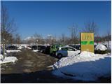
A) From the Ljubljana - Jesenice highway take the Ljubljana - Šmartno exit, then continue driving towards Tacen. In Tacen just before the road over the bridge crosses the Sava river, continue slightly right towards Pirniče. A little after Ljubljana ends, we arrive in Vikrče, a little further on in Spodnje Pirniče, we follow the road to club Lipa, where we park on a large parking lot intended for visitors of Šmarna gora (parking price is 1.5 eur/h - December 2012).
B) From Šentvid we drive to Tacen, there just after the bridge over the Sava river left towards Pirniče. A little after Ljubljana ends, we arrive in Vikrče, a little further on in Spodnje Pirniče, we follow the road to club Lipa, where we park on a large parking lot intended for visitors of Šmarna gora (parking price is 1.5 eur/h - December 2012).
C) From Medvode we drive to Zgornje and then to Spodnje Pirniče, we follow the road to club Lipa, where we park on a large parking lot intended for visitors of Šmarna gora (parking price is 1.5 eur/h - December 2012).
Route description:
From the parking lot, we continue on a marked path which starts on the south side of the parking lot. The path first leads through a passage among spruces, then passes among fields and meadows, over which we gently ascend. After a few minutes, the path enters the forest, through which it gradually begins to ascend more steeply. For some time we ascend steeply, then the path flattens and brings us to the spot where we join the relatively steep road which leads from Zavrh towards Šmarna gora.
We continue the ascent on the road which further leads past the NOB monument and a few meters ahead past the plague or Turkish column. Higher, the road turns somewhat more to the left and brings us out of the forest onto panoramic slopes. With a view of the summit of Šmarna gora and the Kamnik Savinja Alps we quickly reach the Gorjanc homestead, from which a short walk to the marked junction Na Sedlu follows.
From the saddle we continue right downwards towards Tacen (left Šmarna gora), when the path enters the forest we continue right towards Grmada. We continue the ascent on a somewhat steeper path, which first ascends through the forest, then passes onto a partly panoramic ridge, along which in a few dozen steps of further walking we ascend to the summit of Grmada.

Along the route: Na Sedlu (580m)
The trip can be extended to the following destinations: Šmarna gora
Photos:
 1
1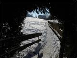 2
2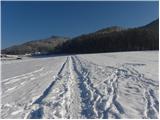 3
3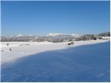 4
4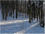 5
5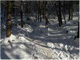 6
6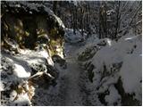 7
7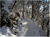 8
8 9
9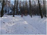 10
10 11
11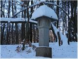 12
12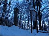 13
13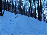 14
14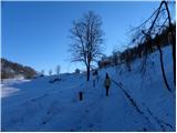 15
15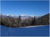 16
16 17
17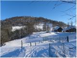 18
18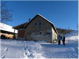 19
19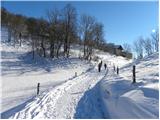 20
20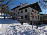 21
21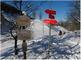 22
22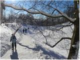 23
23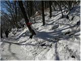 24
24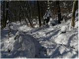 25
25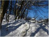 26
26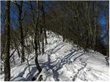 27
27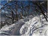 28
28 29
29 30
30 31
31
Discussion about the trip Lipa - Grmada (path via Peski)
To post a comment you must log in:
If you do not yet have a username, you must first
register.