Lipa - Stjenkova koča on Trstelj
Starting point: Lipa (380 m)
| Latitude/Longitude: | 45,84920°N 13,70330°E |
| |
Walking time: 35 min
Difficulty: easy marked way
Elevation gain: 230 m
Elevation difference along the route: 230 m
Map: Goriška 1:50.000
Recommended equipment (summer):
Recommended equipment (winter):
Views: 6.247
 | 1 person like this post |
Access to starting point:
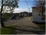
From the Razdrto–Nova Gorica expressway, we take the Selo exit, then follow the road towards the eponymous village. From Selo, we descend to Dornberk, and there at the first major intersection we continue left towards Sežana. We follow the mentioned road for only a few dozen meters, then continue right onto a narrower road in the direction of the villages Lipa, Škrbina and Kostanjevica na Krasu. Higher up, the road leads us over the Železna vrata pass, then brings us to an intersection, where we continue right towards the village Lipa (left downhill to Šibelji and Škrbina). A little further on, we notice signs for the village Lipa, which direct us right into the center of the village, where we also park below the church.
Route description:
At the starting point, we notice signs for Trstelj, which direct us left onto a footpath that ascends along the right side of the wall of the nearby church. Soon above the church or cemetery, the footpath enters a belt of bushes, where it gradually begins to ascend moderately. The well-marked and occasionally somewhat steeper path higher up transitions into partly pine forest, then joins a macadam road, which we follow to the right. We then follow this road, which is also asphalted in the final section, all the way to the Stjenkova koča hut on Trstelj.
Photos:
 1
1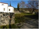 2
2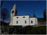 3
3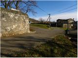 4
4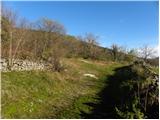 5
5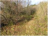 6
6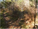 7
7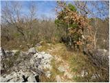 8
8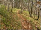 9
9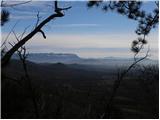 10
10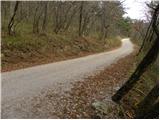 11
11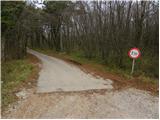 12
12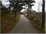 13
13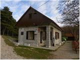 14
14
Discussion about the trip Lipa - Stjenkova koča on Trstelj
|
| Ajda_Zitnik11. 11. 2019 |
On 10.11.2019 I climbed to Trstelj. The path is well maintained and properly marked.
|
|
|
To post a comment you must log in:
If you do not yet have a username, you must first
register.