Lipa - Sveti Jošt above Vransko
Starting point: Lipa (721 m)
| Latitude/Longitude: | 46,26140°N 14,89370°E |
| |
Walking time: 35 min
Difficulty: easy marked way
Elevation gain: 234 m
Elevation difference along the route: 234 m
Map: Zgornja Savinjska dolina 1:50.000
Recommended equipment (summer):
Recommended equipment (winter): ice axe, crampons
Views: 9.455
 | 2 people like this post |
Access to starting point:
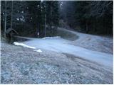
From the highway Ljubljana - Celje, we take the exit Vransko. We continue driving on the old road in the direction of Ljubljana, but only to the spot where the road towards Vransko branches off to the right. On the west side of Vransko, we will notice a road which goes towards the villages of Prapreče and Vologa. We follow the road, which then starts to ascend more steeply, through the village Vologa to the saddle Lipa, where we park on one of the parking areas.
Access from Zadrečka Valley is also possible.
Route description:
From the saddle Lipa we head onto the footpath in the direction of St. Jošt. The path, which runs along a cart track, steeply ascends at the beginning, then the steepness eases somewhat. Next follows a traverse ascent through the forest along the path, which after a little less than 30 minutes of walking approaches a forest road that we notice somewhat above the marked path. Further on, we ascend parallel to the road for some time, then join it and follow it to the right. After a few more steps of walking, the path brings us out of the forest onto panoramic grassy meadows. Here, to the left upwards, a path branches off to the church of St. Gervazij and Protazij, which is a little less than 3 minutes' walk away.
We continue straight along the road, which shortly brings us to the logbook box at the church of St. Jošt.
Photos:
 1
1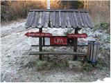 2
2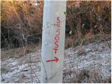 3
3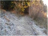 4
4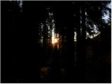 5
5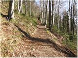 6
6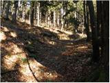 7
7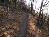 8
8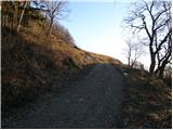 9
9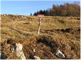 10
10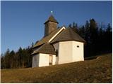 11
11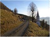 12
12 13
13 14
14
Discussion about the trip Lipa - Sveti Jošt above Vransko
To post a comment you must log in:
If you do not yet have a username, you must first
register.