Ljubelj - Begunjščica (via Y, snow approach)
Starting point: Ljubelj (1058 m)
| Latitude/Longitude: | 46,43240°N 14,26020°E |
| |
Route name: via Y, snow approach
Walking time: 2 h 30 min
Difficulty: very difficult pathless terrain
Elevation gain: 1002 m
Elevation difference along the route: 1002 m
Map: Karavanke - osrednji del 1:50.00
Recommended equipment (summer):
Recommended equipment (winter): helmet, crampons, lamp
Views: 27.813
 | 4 people like this post |
Access to starting point:
From the highway Ljubljana - Jesenice we take the exit Ljubelj and follow the road ahead to the border crossing. Just a few meters before the border crossing signs for Zelenica direct us to the left and after some 10 meters of additional driving the road brings us to the parking lot below the ski center Zelenica.
Route description:
From the parking lot, we head onto the footpath in the direction of Zelenica, Vrtača and Stol. The cart track, which runs along the left side of the ski slope, brings us after approximately 15 minutes of moderate ascent through the forest to the aforementioned slope alongside which we then ascend. The path, which offers nice views of the extensive scree fields of Begunjščica on the left and the ridge of Ljubeljščica on the right, then brings us in a gentle ascent to the hut on Vrtača.
From the hut we continue straight on the marked path, which slowly turns slightly to the left and brings us after a shorter traverse ascent into the belt of dwarf pines. Further, the path ascends more steeply for a short time and then brings us to the cart track (transport-rescue road), which we then follow in a moderate ascent to the mountain hut Dom na Zelenici.
During the operation of the ski slope, walking on the ski slope is forbidden. In that case we use the winter path, which runs along the transport-rescue road.
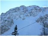
From the hut on Zelenica we head to the south side towards the north face of Begunjščica. The gully, as the name indicates, has the characteristic shape of the letter Y and is located to the left of the central gully. The gully has a slope of 35°-50° and brings us onto the ridge to the left of the main summit of Begunjščica. From the end of the gully to the summit we have a further 5-minute walk along the ridge. We descend via the Šentanski plaz or the nearer central gully.

Photos:
 1
1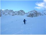 2
2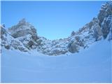 3
3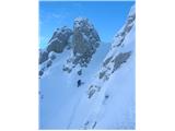 4
4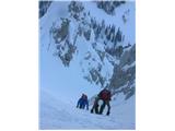 5
5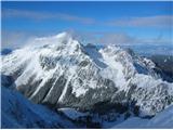 6
6 7
7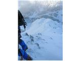 8
8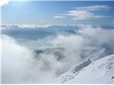 9
9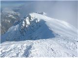 10
10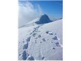 11
11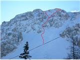 12
12
Discussion about the trip Ljubelj - Begunjščica (via Y, snow approach)
To post a comment you must log in:
If you do not yet have a username, you must first
register.