Ljubelj - Begunjska Vrtača (via Preval)
Starting point: Ljubelj (1058 m)
| Latitude/Longitude: | 46,43240°N 14,26020°E |
| |
Route name: via Preval
Walking time: 3 h 5 min
Difficulty: easy pathless terrain
Elevation gain: 933 m
Elevation difference along the route: 1000 m
Map: Karavanke - osrednji del 1:50.000
Recommended equipment (summer): helmet, lamp
Recommended equipment (winter): helmet, ice axe, crampons, lamp
Views: 16.364
 | 2 people like this post |
Access to starting point:
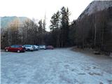
From the highway Ljubljana - Jesenice we take the Ljubelj exit and follow the road ahead to the border crossing. Only a few meters before the border crossing, signs for Zelenica direct us to the left and after some 10 meters of additional driving the road brings us to the parking lot below the ski center Zelenica.
Route description:
At the end of the large macadam parking lot we will notice a wooden mountain sign with the inscription mountain pasture Preval, which directs us into the forest on a footpath that quickly brings us to the foot of the scree. Here we come to a smaller junction, where we will notice on a rock the inscription Prevala and Roblekov dom to the left. A gently sloping path then quickly moves from the scree into a dense forest, which is exposed to falling stones. A wide path then passes from the forest onto steep and well-secured slopes. The scenic path then brings us to Born's tunnel, where a lamp will be helpful. When passing through the tunnel, be careful of the larger number of puddles and the occasionally low ceiling. On the other side of the tunnel we walk for some time on the path which is nicely routed along the eastern ridge of Begunjščica, then we move onto the scree, which we only cross. Next follows a shorter crossing of steep forested slopes, then the path starts to ascend slightly on a less steep slope. The still wide path, which ascends only moderately, joins higher the marked path from Podljubelj.
Here we continue right and follow the wide path to the mountain pasture Preval-a, which we reach after a few minutes of additional walking.
From the cross on Prevala we continue towards the north on a marked footpath in the direction of Begunjščica over Kalvarija (left Roblekov dom over Roža, right Ljubelj and Podljubelj). The path ahead first ascends over a panoramic grassy slope, then passes into the forest through which it starts to ascend more steeply. Higher the forest starts to thin, and the path becomes even a little steeper. Next follows a quite steep ascent, which first runs through some bands of dwarf pines, higher over steep grassy slopes, which are mainly dangerous for slipping when wet. Further we cross a slightly exposed gully, where there is a smaller memorial, and the path then ascends for a few minutes on a steep grassy slope. When the slope a little higher flattens a little, the marked path turns to the left and crosses the slopes to the left. Only a few minutes further we arrive in a smaller valley, where the slope flattens even more.
Here the marked path which leads to Veliki vrh crosses the valley, but we continue up the valley, where at first we still follow a fainter track. A little higher we head slightly to the right, then in 10 minutes of additional walking over easier pathless terrain we ascend to the summit of Begunjska Vrtača.
Ljubelj - Preval 1:30, Preval - Begunjska vrtača 1:35.

Photos:
 1
1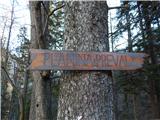 2
2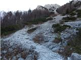 3
3 4
4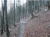 5
5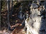 6
6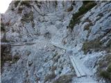 7
7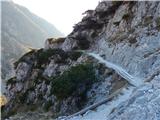 8
8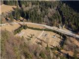 9
9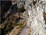 10
10 11
11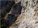 12
12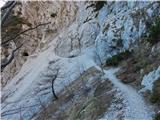 13
13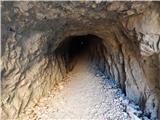 14
14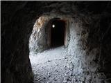 15
15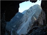 16
16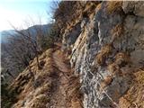 17
17 18
18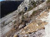 19
19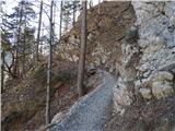 20
20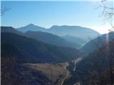 21
21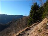 22
22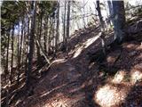 23
23 24
24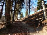 25
25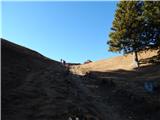 26
26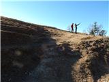 27
27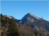 28
28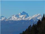 29
29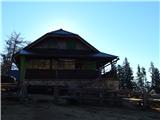 30
30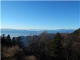 31
31 32
32 33
33 34
34 35
35 36
36 37
37 38
38 39
39 40
40 41
41 42
42 43
43 44
44 45
45 46
46 47
47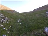 48
48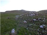 49
49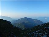 50
50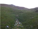 51
51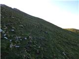 52
52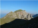 53
53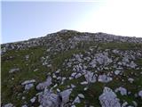 54
54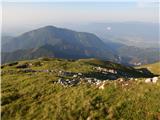 55
55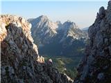 56
56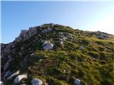 57
57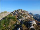 58
58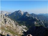 59
59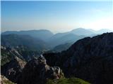 60
60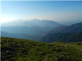 61
61
Discussion about the trip Ljubelj - Begunjska Vrtača (via Preval)
|
| JusAvgustin14. 12. 2010 |
Today we climbed Lenuhova route on BG, the gully is nicely filled with ice, where it's not, you can climb on grass , in the upper part it's a bit wild, but nothing special, the steepest part is beautifully iced. 350m of enjoyment! , in the upper part it's a bit wild, but nothing special, the steepest part is beautifully iced. 350m of enjoyment!
|
|
|
|
| sebanakis15. 12. 2010 |
At night it's even nicer
|
|
|
|
| JusAvgustin15. 12. 2010 |
I can hardly believe it, which way did you go up?
|
|
|
|
| JusAvgustin13. 05. 2011 |
This time a bit different, more climbing in BG wall. After shift Borut and I climbed one scree gully of screes, it was fun and tense. Only possible descent we did ended with 40m jump at end of chamois tracks... Juš and Borut enjoyed immensely. Prešć stayed in car this time...
|
|
|
To post a comment you must log in:
If you do not yet have a username, you must first
register.