Starting point: Ljubelj (1058 m)
| Latitude/Longitude: | 46,43060°N 14,26100°E |
| |
Walking time: 2 h
Difficulty: partly demanding unmarked way
Elevation gain: 361 m
Elevation difference along the route: 420 m
Map: Karavanke - osrednji del 1:50.000
Recommended equipment (summer): helmet
Recommended equipment (winter): helmet, ice axe, crampons
Views: 2.650
 | 2 people like this post |
Access to starting point:
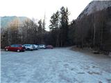
We drive to the border crossing Ljubelj, where before the tunnel we turn left towards Zelenica. Then we drive across a small bridge, after that we descend the parking lot to the lower southern part of the parking lot, where we park.
Route description:
At the end of the parking lot, we notice signs for mountain pasture Preval, which direct us onto Born's path. At first, we diagonally ascend across a smaller scree, then the path enters the forest, where with some shorter ascents and descents it crosses steep slopes towards the left. The forest is soon replaced by steep rocky slopes, through which a wide path leads, secured also on exposed spots. With nice views on the mountains rising above Podljubelj, we arrive at Born's tunnel, where for easier and safer progress the use of a lamp is highly recommended. Somewhere in the middle of the tunnel there is a larger window, from which there is a scenic view of the surroundings, and we carefully continue through the second part of the tunnel. When we leave the tunnel, in which after rain there are also some larger puddles, a few minutes of exposed crossing follow, then behind the bench "Marijino počivališče" we arrive at a larger scree.
In a gentle descent we cross the scree as well, then the path gradually begins to ascend diagonally. At first we still ascend across steep slopes, then the slope first flattens, higher up the trail widens into a cart track. Higher follows the crossing of a grazing fence, then the path brings us out of the forest, and with a few dozen steps of further walking we ascend to Preval, where there is a marked junction.
From the junction we continue left (right Begunjščica) and walk to the shepherd's hut.
We bypass the hut, from which a beautiful view opens up reaching all the way to Triglav, on the left side, and continue the path in the direction of Dobrča. The marked path towards Dobrča, which we follow, further on bypasses an unnamed peak on the left side, and when the path returns to the ridge, we reach it on the saddle between Čisovec and the unnamed peak.
On the mentioned saddle the marked path towards Dobrča turns right downwards, but we continue on a worse trail that continues along the ridge (one trail also leads left from the ridge). Along the ridge we ascend steeply several times, the worse trail due to fallen trees vanishes completely several times, but there are no orientation problems, as we always stick to the ridge. When the forest thins out we quickly reach the panoramic summit of Čisovec.
Ljubelj - Preval-a 1:30, Preval-a - Čisovec 30 minutes.
Description and pictures refer to the condition in the year 2017 (January).

Photos:
 1
1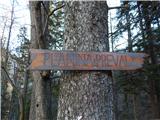 2
2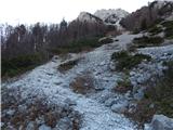 3
3 4
4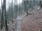 5
5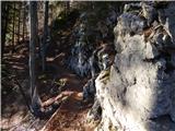 6
6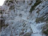 7
7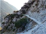 8
8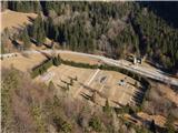 9
9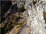 10
10 11
11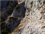 12
12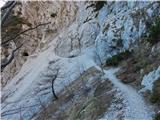 13
13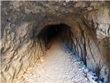 14
14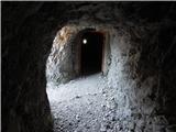 15
15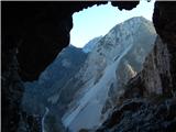 16
16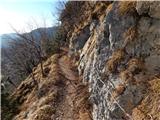 17
17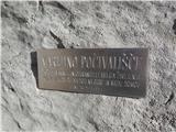 18
18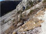 19
19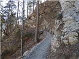 20
20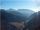 21
21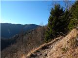 22
22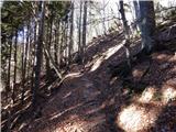 23
23 24
24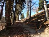 25
25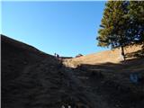 26
26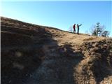 27
27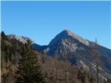 28
28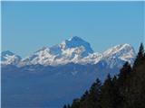 29
29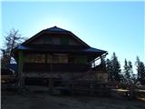 30
30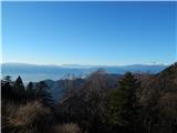 31
31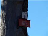 32
32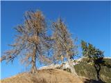 33
33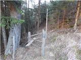 34
34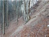 35
35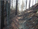 36
36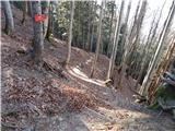 37
37 38
38 39
39 40
40 41
41 42
42 43
43 44
44 45
45 46
46
Discussion about the trip Ljubelj - Čisovec
To post a comment you must log in:
If you do not yet have a username, you must first
register.