Ljubelj - Roblekov dom na Begunjščici (via Zelenica)
Starting point: Ljubelj (1058 m)
| Latitude/Longitude: | 46,43240°N 14,26020°E |
| |
Route name: via Zelenica
Walking time: 3 h 20 min
Difficulty: partly demanding marked way
Elevation gain: 599 m
Elevation difference along the route: 800 m
Map: Karavanke - osrednji del 1:50.000
Recommended equipment (summer): helmet
Recommended equipment (winter): helmet, ice axe, crampons
Views: 70.044
 | 4 people like this post |
Access to starting point:
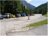
From the Ljubljana - Jesenice highway, we take the Ljubelj exit and follow the road ahead to the border crossing. Just a few meters before the border crossing, signs for Zelenica direct us to the left and after some 10 meters of additional driving the road brings us to the parking lot below the ski center Zelenica.
Route description:
From the parking lot, we head onto the footpath in the direction of Zelenica, Vrtača and Stol. The cart track, which runs along the left side of the ski slope, brings us after approximately 15 minutes of moderate ascent through the forest to the aforementioned slope along which we then ascend. The path, which offers nice views of the extensive scree of Begunjščica on the left and the ridge of Ljubeljščica on the right, then brings us in a gentle ascent to the hut on Vrtača. From the hut, we continue straight on the marked path, which slowly turns slightly to the left and after a shorter diagonal ascent brings us into a belt of dwarf pines. Further, the path ascends more steeply for a short time and then brings us to a cart track (transport rescue road), which we follow in a moderate ascent to the mountain hut on Zelenica.
During the operation of the ski slope, walking on the ski slope is forbidden. At that time, we use the winter path, which runs along the transport rescue road.
From the hut, we continue left in the direction of Begunjščica and Roblekov dom on the path which through a belt of forest and dwarf pines brings us below the scree of Begunjščica. On the other side of the scree, over which a nicely routed path leads, we arrive in a belt of dwarf pines. Here we start to ascend more steeply on the path which offers nice views of the surrounding peaks. At the top of the ascent, which lasts approximately 20 minutes, we step onto a distinct side ridge of Begunjščica. The path ahead crosses relatively steep slopes, behind which after a short descent we step onto the extensive scree of Smokuški plaz. This is followed by crossing the aforementioned scree, and the path then passes again onto steep slopes. This is followed by a diagonal ascent across the slopes, which are partly overgrown with dwarf pines. On this section, we encounter a short, slightly more difficult passage, across which a steel cable assists us and which comes into play when the path is damp and wet. The occasionally somewhat steeper path then brings us with ever better views onto the main ridge of Begunjščica, where we encounter another steel cable that is barely needed when dry. This is followed by a descent a few steps long and the path brings us to a junction, where we continue right downhill in the direction of Roblekov dom. After a short descent, the path quickly enters a belt of dwarf pines, which lower down is replaced by sparse forest. When we step out of the forest, we already see Roblekov dom ahead of us, which we then reach in a few steps.
Ljubelj - Zelenica 1:20, Zelenica - Roblekov dom 2:00.

The trip can be extended to the following destinations: Begunjščica
Photos:
 1
1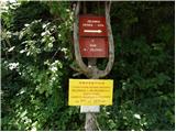 2
2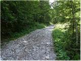 3
3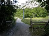 4
4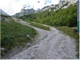 5
5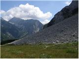 6
6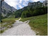 7
7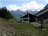 8
8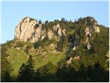 9
9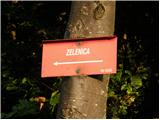 10
10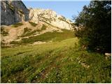 11
11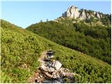 12
12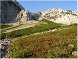 13
13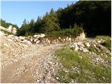 14
14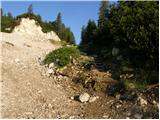 15
15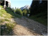 16
16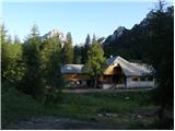 17
17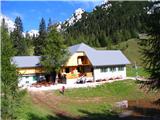 18
18 19
19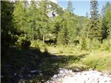 20
20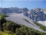 21
21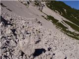 22
22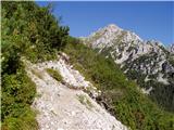 23
23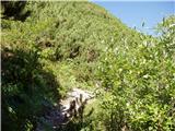 24
24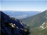 25
25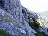 26
26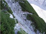 27
27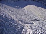 28
28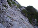 29
29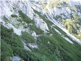 30
30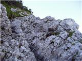 31
31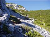 32
32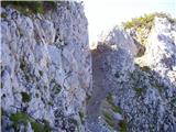 33
33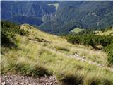 34
34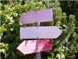 35
35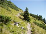 36
36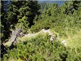 37
37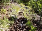 38
38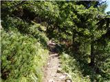 39
39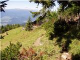 40
40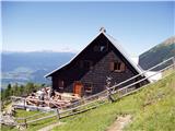 41
41
Discussion about the trip Ljubelj - Roblekov dom na Begunjščici (via Zelenica)
|
| bobek12330. 03. 2007 |
The scree slope mentioned is the longest in Slovenia. The tour over Begunjščica and then back to Roblek hut is very beautiful. A direct path from Begunjščica over Kalvarija (direct path to Prevala pasture) is also possible, but it is a very steep hiking path.
|
|
|
|
| Gost31. 03. 2007 |
The longest scree, disinformation.
|
|
|
|
| jerry24. 06. 2008 |
On Sunday the view from Roblek was simply fairy-tale. Otherwise a very varied trail, which can be shortened by cable car to Zelenica (in summer runs until 10:30) as only this part is quite time-consuming. Time Zelenica-Roblek 1:15 is quite unrealistic, since on both sides at the huts it says the trail takes 2 hours!!
|
|
|
|
| Tadej20. 08. 2008 |
The path is relatively easy despite running along the northern faces of Begunjščica, but it is exposed to falling rocks in some places, so wearing a helmet in certain sections is not superfluous.
|
|
|
|
| zane16. 08. 2010 |
Very nice and varied path, just in wet conditions more caution is needed at some exposed spots. But what I experienced last Sunday at Roblek spoiled the good impression. Huge crowds, folk entertainment music, lottery,... I don't know if that really belongs in the mountains, where we're supposed to go to enjoy nature and seek peace...
|
|
|
|
| Kriška16. 08. 2010 |
If memory serves, such a village party there wasn't organized for the first time . .
Unfortunately, to some mountain huts it's better to go during the week, then they still resemble their name.
|
|
|
|
| majrck17. 08. 2010 |
This party is not a village one and has been organized for several years on the first Sunday in August. The event is also publicly advertised, so all those who are bothered by it can avoid it and visit Roblek the other 364 days of the year. Judging by the visits to the party, there are quite a few of us who happily come exactly that day.
|
|
|
|
| Kriška17. 08. 2010 |
Wouldn't it be simpler if they organized this party in some inn in the valley? And the return from it on potentially wobbly legs would be safer.
|
|
|
|
| turbo17. 08. 2010 |
On Sunday 8.8.2010 we had to listen to the "blaring of folk music" from Roblek on Stol and Celovška špica. Sick! 
|
|
|
|
| Gorazd G17. 08. 2010 |
First I protested against such partying in the mountains here, the second time here and several times in between and later. To one of the main organizers, who since the elections has an even more important position in PZS, I wrote privately last year (given that in his New Year's message in PV he wrote among other things: "... and above all a positive and respectful attitude towards nature.") and politely asked him, if he really means it with the message, to ensure that there will be no party at Roblek anymore. He promised to try to reduce the disturbing impacts in nature.
How it was this year, you see. No help. For hikers - "nature lovers" of course; including the nature protection commission!
P.S. So that I'm not just complaining ... Since last year there has been significant progress: the sound equipment was carried to Roblek on backs and not flown in by helicopter. Perhaps common sense will finally strike them and in the future they will stop disgracing their own organization with such parties.
|
|
|
|
| klm17. 08. 2010 |
Bravo. I completely agree with what's written above. There are many problems in the umbrella organization, namely PZS. Part of the old guard has left, but their offspring has come, who haven't made a single step forward to this day! Learned old patterns are passed on, they behave as if waiting for Godot... PDs are just a reflection of the already disastrous state. Of course, it's easiest to sweep things under the rug, including long-term problems like the decreasing number of members in individual PDs, etc. Then they try to attract members and fill their coffers with various cheap festivals, where the bigwigs of each PD give clever speeches, and the main stars of the afternoon, besides numerous Kacks and Mojcs, are various groups like Atomik Harmonik, Gamsi, Kozorogi, and Zlatorogi: you know the slogan "conquer 10 peaks or ten summits, and get beer for a party for 185 people"?!? - Mountain huts pay only 8.5% tax!!!
|
|
|
|
| Bojan_A17. 08. 2010 |
Well, what can I say. The fact is that this noise pollution is carried out by my home PD (I have never participated in this event). You are right that the matter is not ecologically acceptable and that quasi-hikers come up there to get drunk.
But I actually see an even bigger problem in the pollution of the mountains in summer at the annual event on some church holiday (I don't know which one) at Kredarica. Thousands of people have gathered there at once, and in my opinion, this event should be banned. Chapels, crosses, and similar clutter don't belong in the mountain space anyway!
I hope that PZS will finally come to its senses and no more crosses will be erected or they will start removing them from the mountains. If someone wants to pray, let them do it in the valley. In the hills, it's often too late for that!
Best regards, Bojan
|
|
|
|
| Kriška17. 08. 2010 |
I agree with you that pollution of nature (mountains) can be of various kinds; one of the bigger ones I see is the memorial plaque to Stepinc (I think we all know what kind of person that was?) at Kredarica.
|
|
|
|
| skalar5017. 08. 2010 |
Does anyone from the new PZS guard read all this? It would be very instructive... I strongly agree with the predecessors that a lot needs to be changed and modernized within this organization... and yes, let "Roblek music" echo in the valley if someone likes it, and leave the mountains to silence...
|
|
|
|
| mgrego2231. 03. 2012 |
Does anyone know what the path from Zelenica to Begunjščica is like? Is there a lot of snow, are crampons needed, or is the path dry? 
|
|
|
|
| Salem31. 03. 2012 |
I went up from the south side, Planina Preval, down north via Šentanski plaz. Up top and bottom it's dry, about 300m of snow. At 1 pm in the afternoon it was soft, sometimes sinking knee-deep. Still, ice axe in hand, crampons stayed in the backpack. Can be quite hard in the morning though.
|
|
|
|
| mgrego221. 04. 2012 |
Thanks for the information. We'll still wait a bit for some sunshine.
|
|
|
|
| marezt12. 06. 2013 |
Is there still any snow on the trail?
|
|
|
|
| stanko113. 06. 2013 |
No snow anymore. All paths around Zelenica are dry.
|
|
|
|
| marezt13. 06. 2013 |
Thanks!
I went on a circular tour from Ljubelj yesterday via Bornova pot and over roža to Roblek and then to the hut at Zelenica and back to Ljubelj. Very nice tour.
Next time in the opposite direction!
|
|
|
|
| mgrego2214. 06. 2013 |
My husband and I also went over Zelenica (hut closed, although they assured it would be open every day) to the top of Begunjščica, then to Roblekov dom, which was closed. From there to Prevala, where there's always something for empty stomachs, then through Bornov tunel home.
|
|
|
|
| stanko114. 06. 2013 |
The mountain hut at Zelenica is open from today until 15 September every day.
|
|
|
|
| miran196715. 11. 2013 |
Can someone tell me if this route is suitable for winter time?
Thanks
|
|
|
|
| marezt16. 11. 2013 |
This route is also suitable for winter time... but greater caution is needed in some places!
|
|
|
|
| miran196717. 11. 2013 |
Thanks for the advice. I just walked it today. Sensibly, I didn't risk the danger from Zelenica towards Roblekov dom in winter conditions. But in the morning it was beautiful sunny weather, unfortunately on return it clouded over and the sun didn't shine through the clouds anymore! We'll go up there again!:-)
|
|
|
|
| fackoo29. 12. 2015 |
On Saturday we had a trip from Ljubelj past the hut on Zelenica to Begunjščica and to Roblekov dom.... Unfortunately we were disappointed by the hikers if we can call them that, loud, drunk and no control over the dogs ...Such people should stay in the valley!!!
|
|
|
|
| bipasava10. 09. 2023 09:28:25 |
And does the chairlift at Zelenica operate, or has everything collapsed?
Regards
|
|
|
|
| Janez Seliškar10. 09. 2023 11:57:34 |
It's been many years since they dismantled all the poles and scrapped them as scrap metal.
|
|
|
|
| Macesna10. 09. 2023 11:58:23 |
There's been nothing for about 15 years.
regards
|
|
|
To post a comment you must log in:
If you do not yet have a username, you must first
register.