Starting point: Ljubelj (1058 m)
| Latitude/Longitude: | 46,43240°N 14,26020°E |
| |
Walking time: 1 h 45 min
Difficulty: easy unmarked way
Elevation gain: 624 m
Elevation difference along the route: 624 m
Map: Karavanke - osrednji del 1:50.000
Recommended equipment (summer):
Recommended equipment (winter): ice axe, crampons
Views: 13.643
 | 1 person like this post |
Access to starting point:
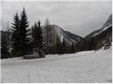
From the highway Ljubljana - Jesenice, at the Podtabor junction we continue in the direction of Ljubelj and Tržič. We continue driving on initially a fast road, then a regional road which we follow all the way to the border crossing Ljubelj. Just before the border crossing we turn left (direction Zelenica) and then after a few tens of meters of additional driving, we park on a large parking lot.
Route description:
At the beginning of the parking lot the signposts for Stol, Vrtača and Dom na Zelenici direct us to a wide cart track which starts ascending by the torrent. When a little higher the cart track turns left, we continue straight on the mountain path which continues through the forest and soon returns to the cart track. The cart track a little higher turns right and brings us out of the forest on the ski piste of the former ski resort Zelenica. There follows a short steeper ascent on the ski slope, then the path flattens and leads us by the foot of the scree below Begunjščica.
From the marked path soon a path branches off to the right which runs along a service road, we continue along the "road" to the nearby Koča Vrtača.
At the hut the road turns right, we continue straight in the direction of the mountain path to Zelenica. For a short time we continue below the former single-seater lift Zelenica II, then the path starts to ascend more steeply on the slope which is partly overgrown by dwarf pines. After a few hairpin turns we return to the service road along which we continue with a view of the Šentanski plaz.
The path ahead leads us along the slopes of Spodnji Plot (peak on which a sport climbing route was equipped some years ago), then from the road we turn right onto a footpath which cuts a longer bend. When we return to the road we are already at the upper station of the former single-seater lift Zelenica II, and only a few steps of descent separate us from the Dom na Zelenici.
Before the mountain hut a marked path to Begunjščica branches off to the left, behind the hut also to the left a path to Stol, Vrtača and Završnica, but behind the hut we continue straight on a poorly visible unmarked path which climbs up an indistinct valley. A little higher we continue right (straight to the saddle Čez Pod and the top of the former draglift Triangel), we cross a small spring and start to ascend steeply on the grassy slope. Higher we reach the ridge which connects Vrh Ljubeljščice and Spodnji Plot, we continue right towards Spodnji Plot. A few steps further the path ascends steeply and brings us to the summit of the precipitous Spodnji Plot.

Photos:
 1
1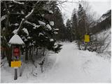 2
2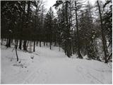 3
3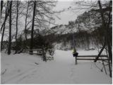 4
4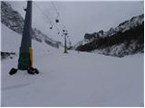 5
5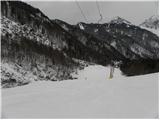 6
6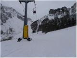 7
7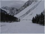 8
8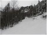 9
9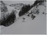 10
10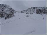 11
11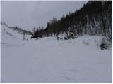 12
12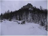 13
13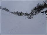 14
14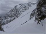 15
15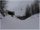 16
16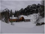 17
17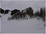 18
18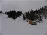 19
19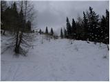 20
20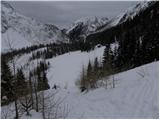 21
21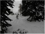 22
22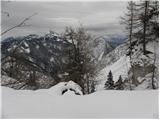 23
23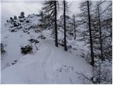 24
24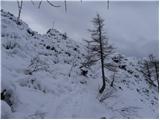 25
25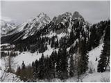 26
26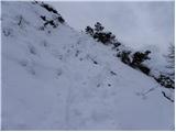 27
27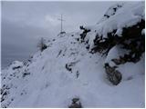 28
28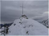 29
29
Discussion about the trip Ljubelj - Spodnji Plot
|
| andrejjerina30. 01. 2010 |
May I ask where you got the information (from which map or something else) that the mentioned peak is called Spodnji Plot? Best regards, Andrej
|
|
|
|
| heinz31. 01. 2010 |
Also in the logbook located in the box there it is written..
Spodnji Plot is quite an interesting point in that area.
The last section of the path could be too (strenuous/demanding) for some old mother.
|
|
|
|
| capraibex31. 01. 2010 |
This peak is marked on the Slovenska pot map, i.e. on the Stol and Begunjščica map at 1:25000 scale. Map year 1990. The saddle that separates the ridge at Može and Spodnji Plot is called Čez Pod. From there to the old Ljubelj runs the Slovenska pot, which was arranged in 2007. The first hut at Zelenica was called Jocifova koča.
|
|
|
|
| andrejjerina31. 01. 2010 |
Thanks for the exhaustive information, I knew the mentioned peak as Triangel, but now I/we know a bit more. Best regards, Andrej
|
|
|
|
| Majdag11. 08. 2013 |
....It's not hard to get to Spodnji Plot. But you have to be careful everywhere
|
|
|
|
| Barentoter22. 09. 2015 |
Late afternoon via ferrata to the top. Nicely routed via ferrata, slightly more demanding jump at the start, then pure enjoyment to the top. Unfortunately no stamp and logbook at the top yet.
|
|
|
|
| urbancek22. 09. 2015 |
The logbook is in the box under the Križ . .
|
|
|
|
| mala paklenica15. 01. 2016 |
Which ferrata is the hardest: Spodnji plot, Češka koča or Gonžarjeva peč?
|
|
|
|
| redbull15. 01. 2016 |
Gonžarjeva
Short, but by far the hardest of the others not to mention these two
good luck
|
|
|
|
| Viper15. 01. 2016 |
The hardest is Spodnji plot.
|
|
|
|
| klemen733. 03. 2016 |
Spodnji Plot - Zelenica is considerably more difficult than Gonžarjeva peč.
|
|
|
|
| ploha4. 01. 2017 |
I'm really wondering which are more demanding "of these two"...I'm not claiming the Czech one...I still think it's Spodnji Plot.
|
|
|
|
| lynx4. 01. 2017 |
Of course it is, its right variant. The left probably not, but everyone can check the section ratings themselves.
|
|
|
|
| don kihott31. 01. 2017 |
The Plot is definitely more demanding as it carries an E rating...Gonžarjeva has a D/E rating which is not pure E!!!..
|
|
|
To post a comment you must log in:
If you do not yet have a username, you must first
register.