Ljubelj - Spodnji Plot (učna zavarovana plezalna pot)
Starting point: Ljubelj (1058 m)
| Latitude/Longitude: | 46,43240°N 14,26020°E |
| |
Route name: učna zavarovana plezalna pot
Walking time: 2 h 10 min
Difficulty: extremely difficult marked way
Via ferrata: D
Elevation gain: 624 m
Elevation difference along the route: 630 m
Map: Karavanke - osrednji del 1:50.000
Recommended equipment (summer): helmet, self belay set
Recommended equipment (winter): helmet, self belay set, ice axe, crampons
Views: 8.450
 | 2 people like this post |
Access to starting point:
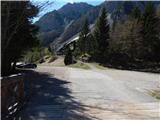
We drive to the border crossing Ljubelj, where before the tunnel we turn left towards Zelenica. Then we drive across a small bridge, and then we park on a large parking lot.
Route description:
At the beginning of the parking lot, signposts for Stol, Vrtača and Dom na Zelenici direct us onto a wide cart track which starts ascending beside the torrent. When a little higher the cart track turns left, we continue straight on the mountain path which continues through the forest and soon returns to the cart track. The cart track a little higher turns right and brings us out of the forest onto the ski slope of the former ski area Zelenica. There follows a short steeper ascent along the ski slope, then the path flattens and leads us at the foot of the scree below Begunjščica.
From the marked path soon a path branches off to the right which runs along a service road, and we continue along the "road" to the nearby Koča Vrtača.
At the hut the road turns right, and we continue straight in the direction of the mountain path to Zelenica. For a short time we continue below the former one-seater lift Zelenica II, then the path starts to ascend more steeply up the slope partly overgrown by dwarf pines. After a few hairpin turns we return to the service road along which we continue with a view of the Šentanski plaz.
The path ahead leads us across the slopes of Spodnji Plot (peak on which a sport climbing path was created years ago), then from the road we turn right onto a footpath which cuts a longer bend. When we return to the road we are already at the upper station of the former one-seater lift Zelenica II, and only a few steps of descent separate us from Dom na Zelenici.
From Dom na Zelenici we continue right towards the northeast and follow the signs which lead us to the start of the climbing paths. First we walk on grassy slopes where the path is not very visible, then we reach steeper slopes on the south side of Spodnji Plot. There follows a crossing of steep slopes which quickly brings us to the start of the climbing paths.
At the start we equip ourselves with a via ferrata set and helmet. Climbing gloves are also recommended.
The climbing path first ascends diagonally along the steel cable (difficulty up to B/C) then turns left and becomes significantly more demanding. There follows an ascent over a vertical pillar (difficulty D) which brings us to a junction.
To the right a very demanding sport via ferrata branches off (difficulty E), and we continue left along the easier path (instructional secured climbing path). From the junction we first cross a steep slope to the left which is quite demanding as there are not many footholds on the path (difficulty C). The path then turns right upwards and ascends along the steel cable (difficulty B). There follows a somewhat more demanding steep ascent (difficulty B/C), after which the difficulty eases slightly. We continue ascending along the steel cable (difficulty B) and soon reach the ridge where the secured path ends. At a few places there is some sand and stones on the path, so we must take care not to dislodge them.
On the ridge we continue right and to the summit it is only a few steps of easy ascent.
We descend along an easy path on the northwest side towards Dom na Zelenici.

Photos:
 1
1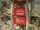 2
2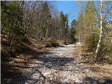 3
3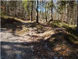 4
4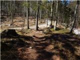 5
5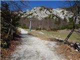 6
6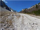 7
7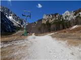 8
8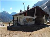 9
9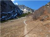 10
10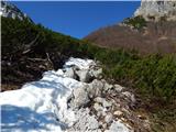 11
11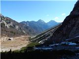 12
12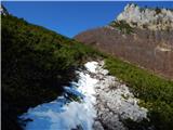 13
13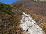 14
14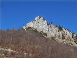 15
15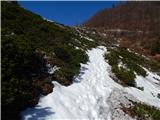 16
16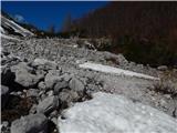 17
17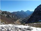 18
18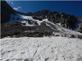 19
19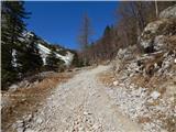 20
20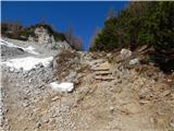 21
21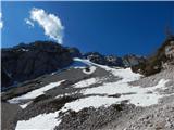 22
22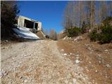 23
23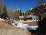 24
24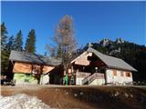 25
25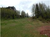 26
26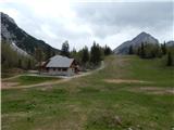 27
27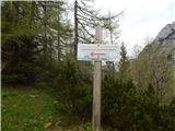 28
28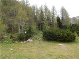 29
29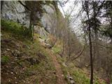 30
30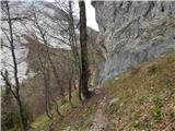 31
31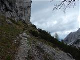 32
32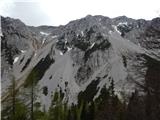 33
33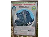 34
34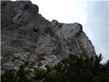 35
35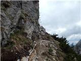 36
36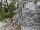 37
37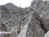 38
38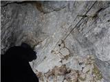 39
39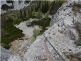 40
40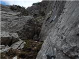 41
41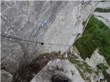 42
42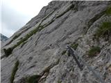 43
43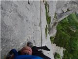 44
44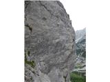 45
45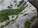 46
46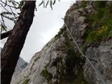 47
47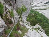 48
48 49
49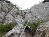 50
50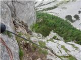 51
51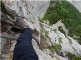 52
52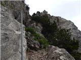 53
53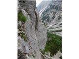 54
54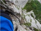 55
55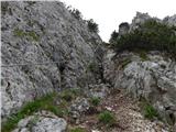 56
56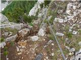 57
57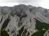 58
58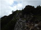 59
59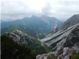 60
60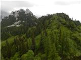 61
61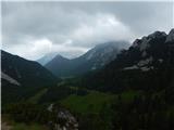 62
62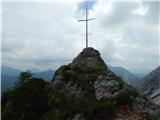 63
63
Discussion about the trip Ljubelj - Spodnji Plot (učna zavarovana plezalna pot)
|
| Tomco18. 05. 2024 21:22:15 |
First time on this via ferrata. It's really nothing too special, but you have to admit that the initial D section is not a walk in the park. Actually, in my case only because at the beginning I couldn't decide whether to take the left or right side of the cable. No logical path was obvious to me. But once I started over the "right" passage, I had no more problems. The cable on the via ferrata is quite thick, so there's always plenty of grip available to pull yourself up - at those spots where it's needed.
The second noteworthy part is the parallel traverse across the smooth wall, which could be problematic for those who might tackle the via ferrata without proper footwear. Here the condition is a suitable sole for safe friction footing.
The right, harder via ferrata, I didn't even have in my plans.
I'll tackle that when the time is right - with additional gear and a lot of extra experience.
|
|
|
To post a comment you must log in:
If you do not yet have a username, you must first
register.