Ljubelj - Srednja peč (upper path)
Starting point: Ljubelj (1058 m)
| Latitude/Longitude: | 46,43240°N 14,26020°E |
| |
Route name: upper path
Walking time: 4 h 5 min
Difficulty: partly demanding marked way, difficult pathless terrain
Elevation gain: 862 m
Elevation difference along the route: 1010 m
Map: Karavanke - osrednji del 1:50.000
Recommended equipment (summer):
Recommended equipment (winter): ice axe, crampons
Views: 1.640
 | 2 people like this post |
Access to starting point:
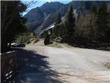
We drive to the border crossing Ljubelj, where before the tunnel we turn left towards Zelenica. Then we drive across a small bridge, and then we park on a large parking lot.
Route description:
At the beginning of the parking lot, the signposts for Stol, Vrtača and Dom na Zelenici point us to a wide cart track which starts ascending by the torrent. When a little higher the cart track turns left, we continue straight on the mountain path which continues through the forest and soon returns to the cart track. The cart track a little higher turns right and brings us out of the forest on the ski track of the former ski slope Zelenica. Next follows a short steeper ascent on the ski slope, and then the path flattens and leads us at the foot of the scree below Begunjščica.
From the marked path soon to the right branches off the path which runs on a transport road, and we continue on the "road" to the nearby Koča Vrtača hut.
At the hut, the road turns right, and we continue straight in the direction of the mountain path to Zelenica. For a short time we continue below the former one-seater chairlift Zelenica II, and then the path starts ascending steeper on a slope which is partly overgrown by dwarf pines. After a few hairpin turns, we return to the transport road, on which we continue with a view towards the gully Šentanski plaz.
The path ahead leads us on the slopes of Spodnji plot (peak, on which they made a sport climbing path years ago), after that from the road we turn right on a footpath which cuts a longer turn. When we return to the road we are already at the upper station of the former one-seater chairlift Zelenica II, and only a few steps of descent separate us from the Dom na Zelenici.
After the mountain hut, we continue left and ascend to half of the children's ski lift, and then on the right we notice signs for Vrtača and Stol, which point us to the right into a strip of forest. A little further, we cross a connecting strip between the children's ski lift and anchor, and then we cross also the other ski track.
The continuation of the path we find at a smaller boulder, and then we cross slopes below the ridge Na Možeh. When the crossing ends, we arrive in an indistinct small valley, where to the right branches off the path to Suho ruševje (at the branch-off there is usually a cairn).
From the junction ahead, we ascend shortly through the forest, and then the path brings us to the slopes of Vrtača, where in a gentle ascent we cross a few screes, occasionally also some really short strip of forest. Further on, from the left joins the path from Dom pri izviru Završnice, a little further ahead the path splits.
We continue on the somewhat narrower lower path in the direction of Stol (right Vrtača), from which the nearby dwarf pine-covered Srednji vrh is nicely visible. At the next junction we continue straight in the direction of Stol (left saddle Šija, Srednji vrh, Stol-lower path...), and the path then crosses occasionally steeper grassy slopes, which are interrupted by some less steep gullies. The traversing of the grassy slopes soon ends, and the path brings us to a steep groove, through which we start steeply descending on a path that is in places roughened and in some spots dangerous for slipping. When the groove ends the path passes onto the scree, over which below the cliffs it descends diagonally to the cirque V Kožnah. Here the path starts ascending again, and from the left joins the lower path and the path from Završnica.
We continue straight, and the path further leads us past several larger boulders. Next follows a somewhat steeper ascent with nice views of the surroundings and on the wall of Srednja peč on the left. When higher the marked path flattens, still before the marked junction where to the right branches off the path to Celovška koča / Klagenfurter Hütte, at the smaller cairn which is located at the edge of the dwarf pines, we continue left onto pathless terrain.
We continue along the edge of the dwarf pines, on easy passable pathless terrain, along which individual cairns show the right direction. After approximately 5 minutes we arrive at a smaller saddle west of Srednja peč, where on the left across the scree we notice a worse track. We ascend to the mentioned track, and then cross the scree to the right. When the scree ends, the track leads through a narrow strip of dwarf pines, then the worse track turns left along the dwarf pines steeply upwards and after a few steps ends in relatively steep grass. We continue the ascent steeply upwards along the dwarf pines, and we continue in approximately the same direction all the way to the ridge, where a worse track appears again. We continue right, a little further also through a short strip of cut dwarf pines, and then along and on the ridge, which on the left side is occasionally also precipitous, we ascend to a little visited and panoramic summit.
Ljubelj - Koča Vrtača 40 minutes, Koča Vrtača - Dom na Zelenici 40 minutes, Dom na Zelenici - turn-off from the marked path 2:20, turn-off from the marked path - Srednja peč 25 minutes.

Photos:
 1
1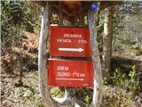 2
2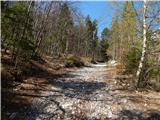 3
3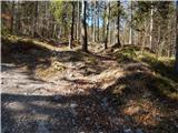 4
4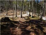 5
5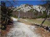 6
6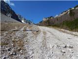 7
7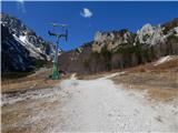 8
8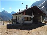 9
9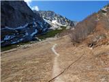 10
10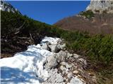 11
11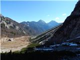 12
12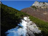 13
13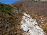 14
14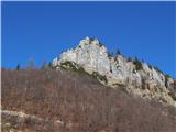 15
15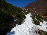 16
16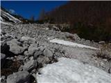 17
17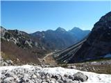 18
18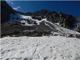 19
19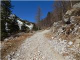 20
20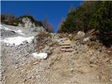 21
21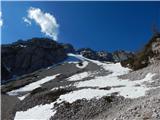 22
22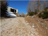 23
23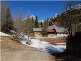 24
24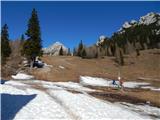 25
25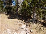 26
26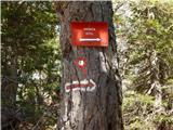 27
27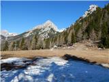 28
28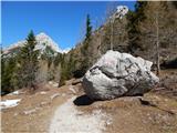 29
29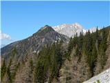 30
30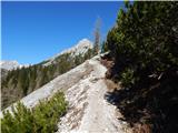 31
31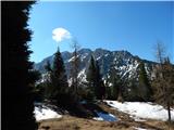 32
32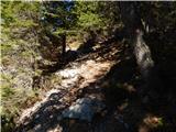 33
33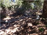 34
34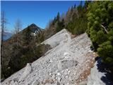 35
35 36
36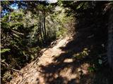 37
37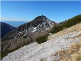 38
38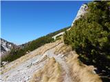 39
39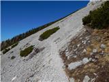 40
40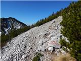 41
41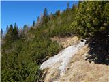 42
42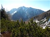 43
43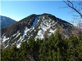 44
44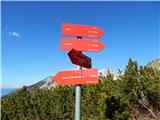 45
45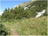 46
46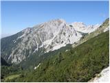 47
47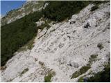 48
48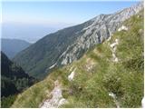 49
49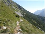 50
50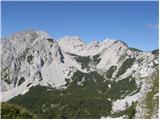 51
51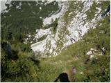 52
52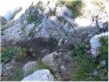 53
53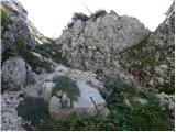 54
54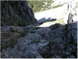 55
55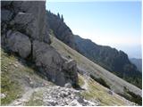 56
56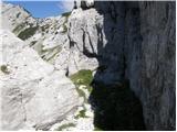 57
57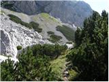 58
58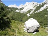 59
59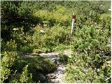 60
60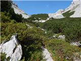 61
61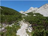 62
62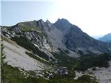 63
63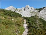 64
64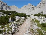 65
65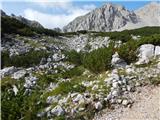 66
66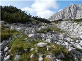 67
67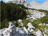 68
68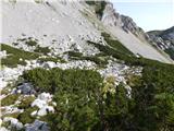 69
69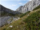 70
70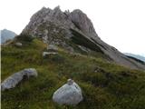 71
71 72
72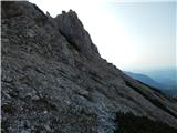 73
73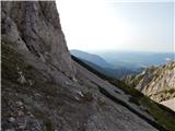 74
74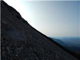 75
75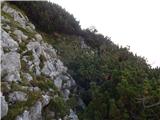 76
76 77
77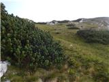 78
78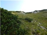 79
79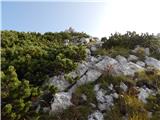 80
80 81
81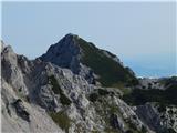 82
82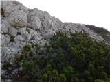 83
83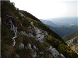 84
84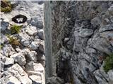 85
85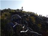 86
86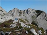 87
87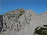 88
88
Discussion about the trip Ljubelj - Srednja peč (upper path)
To post a comment you must log in:
If you do not yet have a username, you must first
register.