Ljubelj - Žleb (Suho ruševje)
Starting point: Ljubelj (1058 m)
| Latitude/Longitude: | 46,43240°N 14,26020°E |
| |
Walking time: 2 h 40 min
Difficulty: easy unmarked way
Elevation gain: 858 m
Elevation difference along the route: 920 m
Map: Karavanke - osrednji del 1:50.000
Recommended equipment (summer):
Recommended equipment (winter): ice axe, crampons
Views: 14.699
 | 2 people like this post |
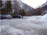
Access to starting point:
From the Ljubljana - Jesenice highway, take the Ljubelj exit and follow the road to the border crossing. Just a few meters before the border crossing, signs for Zelenica direct us left, and after a few tens of meters of further driving, the road brings us to the parking lot below the Zelenica ski center.
Route description:
From the parking lot, we head onto the footpath in the direction of Zelenica, Vrtača, and Stol. The cart track, which runs along the left side of the ski slope, after approximately 15 minutes of moderate ascent through the forest, brings us to the aforementioned slope, along which we then ascend. The path, which offers nice views of the extensive screes of Begunjščica on the left and the ridge of Ljubeljščica on the right, then leads us in a gentle ascent to the Vrtača hut. From the hut, we continue straight ahead on the marked path, which slowly turns slightly to the left and, after a short diagonal ascent, brings us into a belt of dwarf pines. Further on, the path ascends steeply for a short time and then leads us onto a cart track (transport and rescue road), which we follow in a moderate ascent to the mountain hut Dom na Zelenici.
From the Dom na Zelenici hut, we continue to the right in the direction of Stol and Vrtača (left Begunjščicaica) on the path that immediately behind the hut turns left and ascends beside the children's tow lift. Somewhere halfway up the lift, we come to a less noticeable junction, where we continue to the right and diagonally ascend across the ski slope (straight ahead the hut Koča pri izviru Završnice). Further on, we cross a short strip of forest, and the path brings us to the next tow lift, which we cross in a gentle descent. On the other side of the ski slope, we notice a larger rock with a mark on it that directs us into the forest. The path then descends slightly and, after a few minutes of further walking, brings us to the upper end of the Suho ruševje valley, where an unmarked path branches off to the right upwards to Palec.
We continue in the direction of Palec (straight ahead Stol and Vrtača) on the path that ascends through a strip of forest and higher up brings us below the screes of Vrtača and Palec. Here the steepness eases, and the path then leads us along the Suho ruševje valley. Higher up, the path turns slightly to the right and ascends steeply again. After a few minutes of further walking, we reach the border ridge (Žleb 1916 m), from where the view opens to the Austrian side.
Ljubelj - Zelenica 1:20, Zelenica - Žleb 1:20.

Photos:
 1
1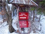 2
2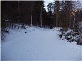 3
3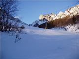 4
4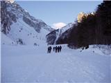 5
5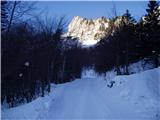 6
6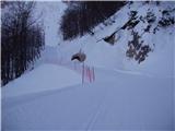 7
7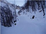 8
8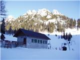 9
9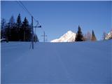 10
10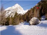 11
11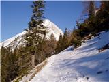 12
12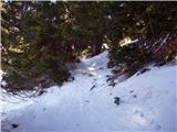 13
13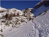 14
14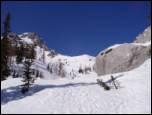 15
15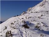 16
16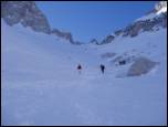 17
17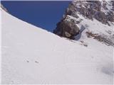 18
18
Discussion about the trip Ljubelj - Žleb (Suho ruševje)
|
| Gost8. 07. 2006 |
Beautiful wild world. Fortunately, also not a massively visited paradise. The cairns show the way.
|
|
|
|
| heinz26. 06. 2009 |
In the opposite direction it is more suitable or faster over the scree than through the thicket, which is just high enough to constantly snag your backpack. Regarding beauty I agree with the above comment.
The junction for Palec (Žleb) on the Zelenica-Stol path is poorly marked (I saw only a cairn).
|
|
|
To post a comment you must log in:
If you do not yet have a username, you must first
register.