Ljubljana (Bokalce) - Klobuk at Ljubljana
Starting point: Ljubljana (Bokalce) (310 m)
| Latitude/Longitude: | 46,05180°N 14,44670°E |
| |
Walking time: 30 min
Difficulty: easy unmarked way
Elevation gain: 131 m
Elevation difference along the route: 140 m
Map: Ljubljana - okolica 1:50.000
Recommended equipment (summer):
Recommended equipment (winter):
Views: 159.890
 | 2 people like this post |
Access to starting point:
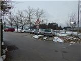
From the western Ljubljana bypass, we take the Brdo exit, then continue driving in the direction of Vrhovci. Further, we drive past the Lesnina Brdo shopping center, then arrive at a roundabout, from which we take the second exit. A little further on, when we reach the next intersection, we turn right and park on the macadam parking lot.
Route description:
From the starting point, we head along Grič Street, beside which there is also a sign for a dead-end street. Along the road, we slightly ascend to the last house, from there we continue on a cart track that goes into the forest. Along the cart track, we ascend diagonally for a few minutes, then we arrive at the forested ridge Utika, which is a sort of southeastern ridge of Klobuk. A little further, signs for the hunting cottage direct us slightly to the right from the cart track onto a footpath that continues ascending along and beside the mentioned ridge. The path soon returns to the cart track, then continues alternately on cart track and footpath; at junctions, we keep to the direction that adheres most closely to the ridge. Higher up, the path ascends somewhat more steeply for a while, then brings us to the Lovska koča na Klobuku hunting cottage.
Before the cottage, we continue left, where the path brings us out of the forest in a few dozen steps. Once we step out of the forest, just a few more steps separate us from the panoramic summit.
The description and pictures refer to the conditions in 2015 (November).

Photos:
 1
1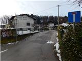 2
2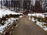 3
3 4
4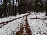 5
5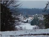 6
6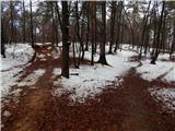 7
7 8
8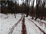 9
9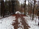 10
10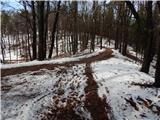 11
11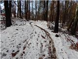 12
12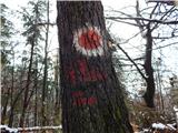 13
13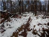 14
14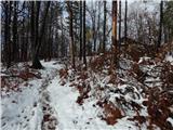 15
15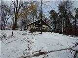 16
16 17
17 18
18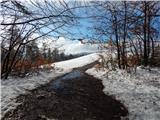 19
19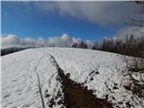 20
20 21
21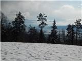 22
22
Discussion about the trip Ljubljana (Bokalce) - Klobuk at Ljubljana
|
| J Kiselić28. 11. 2025 01:52:11 |
There is no view from the top of Klobuk but a bit lower from the viewpoint tower from which you can see the Krim side with Krim. The tower is wooden. Also from the hunting hut below the summit there is no view, because the hut stands in the forest.
|
|
|
To post a comment you must log in:
If you do not yet have a username, you must first
register.