Ljubljana (Botanični vrt) - Mazovnik (Golovec)
Starting point: Ljubljana (Botanični vrt) (290 m)
| Latitude/Longitude: | 46,03970°N 14,51370°E |
| |
Walking time: 1 h 5 min
Difficulty: easy unmarked way
Elevation gain: 160 m
Elevation difference along the route: 200 m
Map: Ljubljana - okolica 1:50.000
Recommended equipment (summer):
Recommended equipment (winter):
Views: 18.426
 | 1 person like this post |
Access to starting point:
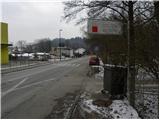
From the Ljubljana ring road, head to the Ig exit, then follow the road in the direction of the Rudnik shopping center. From the roundabout (between Merkur and Supernova center), continue driving on Jurčkova cesta to the second traffic light. At the second traffic light, continue right (left Ig, straight center and Trnovo), then drive approximately another 500 m to the spot where on the left side we will notice the school, and on the right the Ljubljana botanical garden. At the starting point, there are no appropriate parking spots.
Access from the center of Ljubljana is also possible.
Route description:
From the botanical garden, we continue on a slightly ascending road or sidewalk, which through the underpass and bridge over the railway brings us to the intersection of Ižanska cesta and Hradeckega cesta. We continue left on Hradeckega cesta and follow it for approximately 50 m, then at the smaller intersection continue right in the direction of "Pot na Golovec" and continue the ascent on a paved and quite steep road. Higher, the road becomes macadam and flattens a little. We then follow the mentioned road to the observatory on Golovec, or the sharp left turn.
At the turn, which is located right next to the observatory, we notice an information board for the Golovec forest learning path, which directs us onto a wide and initially gently sloping cart track. After a few minutes of walking, the cart track moderately ascends for a short time, then gradually starts to descend. After a few minutes of descent, we come to a forest road, which we only cross, then join the Trail of Remembrance and Comradeship. We follow the mentioned trail to the left, which after a few shorter ascents brings us to Črni hrib (highest point of the mentioned trail).
From Črni hrib, we first slightly descend, then, when the path levels out, we come to an unmarked junction. Here we leave the Trail of Remembrance and Comradeship and continue on the right path, along which we notice one of the otherwise rare blazes on the path. Just a few tens of meters ahead, we come to the next unmarked junction. This time we continue left and after a short ascent step onto the highest peak of Golovec.

Along the route: Observatorij Golovec (380m)
The trip can be extended to the following destinations: Orle
Photos:
 1
1 2
2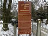 3
3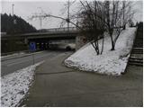 4
4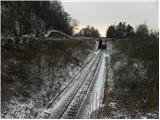 5
5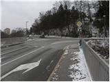 6
6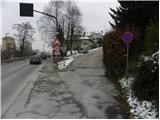 7
7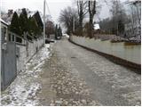 8
8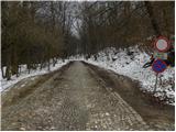 9
9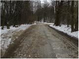 10
10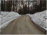 11
11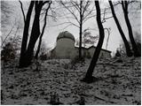 12
12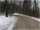 13
13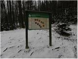 14
14 15
15 16
16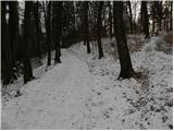 17
17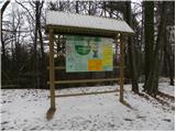 18
18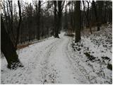 19
19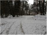 20
20 21
21 22
22 23
23 24
24 25
25 26
26 27
27 28
28 29
29
Discussion about the trip Ljubljana (Botanični vrt) - Mazovnik (Golovec)
To post a comment you must log in:
If you do not yet have a username, you must first
register.