Ljubljana (Koseze) - Cankarjev vrh (Rožnik) (by road)
Starting point: Ljubljana (Koseze) (312 m)
| Latitude/Longitude: | 46,06580°N 14,47460°E |
| |
Route name: by road
Walking time: 1 h
Difficulty: easy unmarked way
Elevation gain: 82 m
Elevation difference along the route: 125 m
Map: Ljubljana - okolica 1:50.000
Recommended equipment (summer):
Recommended equipment (winter):
Views: 3.750
 | 2 people like this post |
Access to starting point:
A) From the western Ljubljana bypass take the Ljubljana Brdo exit, then continue driving in the direction of the ZOO. Further on, drive along Pot za Brdom road, then at the traffic-light crossroads continue left in the direction of the zoo. When after approximately 1 km of further driving we arrive at the crossroads with Večna pot, continue left in the direction of Šiške and Center (right zoo). Further on, drive along Večna pot, where opposite the football pitch a macadam road branches off to the right, which leads to Mostec. Here continue straight, then after good 100 m right onto the other macadam road, alongside which we park.
B) From the crossroads of Celovška and Šišenska streets, continue along Šišenska cesta, then at the crossroads continue straight or in the direction of the ZOO. When we arrive at Večna pot, after approximately 200 m we will come to the pedestrian crossing and smaller crossroads. Behind the crossing on the left side is our starting point, but since we cannot turn left from the road here, drive a little further to the place where to the left branches off the access road towards Mostec. Here turn left, turn around and along Večna pot return to the pedestrian crossing, where now turn right onto the macadam road, alongside which we park.
Route description:
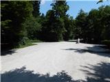
From the starting point, by which there is drinking water from a tap, we continue straight, where first we cross the asphalt path intended for pedestrians and cyclists and continue the path on the macadam road. By the road there are also further on some parking options, we soon continue right on the wide sandy path, which first gently descends to a smaller stream. After the stream the path starts to ascend somewhat and then quickly brings us to the recreational park Mostec, where there are guesthouse, playgrounds, boules court...
From the guesthouse we continue on the road, along which we quickly arrive at the crossroads, from which we continue straight in the direction of Cankarjev vrh. After a shorter ascent we arrive at the ski jumps, which we bypass on the left side. Follows an ascent through the forest, the road brings us to the end of the ski jumps, from which there is also a nice view of all three ski jumps. Higher the road leads past the brick tower, behind it we arrive at the crossroads, from which we continue in the direction of Cankarjev vrh. Somewhat further we join the road which leads from Tivoli towards Šišenski hrib and Cankarjev vrh, which we follow to the right. Somewhat further the road descends to the crossroads, by the monument of the war for Slovenia. We continue straight, then the road descends for some time more. Lower a footpath from Mostec also joins us from the right, we however also in all following crossroads follow the direction of Cankarjev vrh. In the last part the road ascends somewhat more steeply and quickly brings us to the inn on Rožnik, from it to the church on Cankarjev vrh only a short ascent separates us.
Description and pictures refer to the condition in 2015 (July).

Photos:
 1
1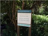 2
2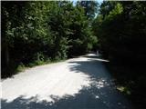 3
3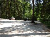 4
4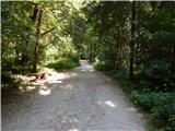 5
5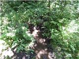 6
6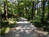 7
7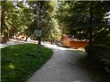 8
8 9
9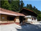 10
10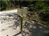 11
11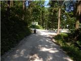 12
12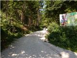 13
13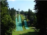 14
14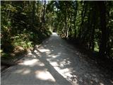 15
15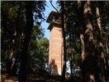 16
16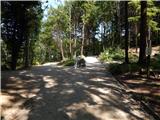 17
17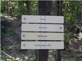 18
18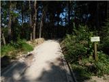 19
19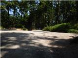 20
20 21
21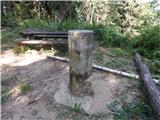 22
22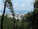 23
23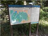 24
24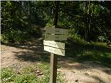 25
25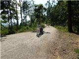 26
26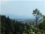 27
27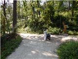 28
28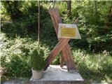 29
29 30
30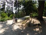 31
31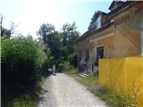 32
32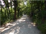 33
33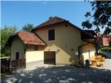 34
34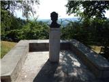 35
35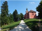 36
36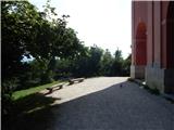 37
37 38
38
Discussion about the trip Ljubljana (Koseze) - Cankarjev vrh (Rožnik) (by road)
To post a comment you must log in:
If you do not yet have a username, you must first
register.