Ljubljana (Zalog) - Castle Stari grad (Stari Osterberg)
Starting point: Ljubljana (Zalog) (276 m)
| Latitude/Longitude: | 46,06320°N 14,62450°E |
| |
Walking time: 30 min
Difficulty: easy marked way
Elevation gain: 167 m
Elevation difference along the route: 175 m
Map: Ljubljana - okolica 1:50.000
Recommended equipment (summer):
Recommended equipment (winter):
Views: 9.001
 | 2 people like this post |
Access to starting point:
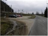
From the eastern Ljubljana bypass, we take the exit Ljubljana - east and continue driving along Zaloška cesta in the direction of Zalog. Further, we drive on the main road, and then only about 300 meters after we crossed the Ljubljanica river, we park on a well-maintained macadam parking lot by the railway track.
Route description:
From the parking lot, we go through the underpass under the railway track above which there are signs »Debni vrh, Stari grad and Pečar«. Immediately after the underpass we continue left and after a short diagonal ascent, the path brings us to a junction by a smaller stream. Both paths lead towards Debni vrh and a little higher again cross each other.
If we continue on the right path, which is slightly less steep, we at first ascend steeper beside the mentioned stream, after that the path turns to the right. The path becomes less steep and quickly brings us to the left turn where to the right upwards the »Trda varianta« to Debni vrh branches off.
We continue left on the less steep path, parallel with the stream, which is situated left below us. The path then turns to the left and after a diagonal ascent we cross the already mentioned slightly steeper path. After that, the path becomes a little steeper and slowly turns to the right. A pretty steep path then continues ascending through the forest and higher joins with the previously mentioned path. Next follows a shorter ascent and the path brings us to a side forested ridge where there is a junction. At the junction there is also a bench.
To the right at first along the ridge leads the path towards Debni vrh, and we continue a little to the left of the ridge along Ostrovrharjeva pot towards the old castle Osterberg. At the junction there is also a sign that marks Ostrovrharjeva pot. From the junction, we first descend a few meters and join the path from Podgrad. The relatively level path then crosses the slopes towards the south, then turns to the left and crosses a distinct gully. Further on, mostly in a gentle ascent, we cross the slopes towards the east. Here the path slightly widens and leads us past Ostrovrharjev studenec.
Next follows a short ascent and the path brings us to a junction where a more direct cart-track path from Podgrad joins from the left. We continue right and quickly reach the saddle below the old castle Osterberg, where there are also some benches and an information panel.
From here towards the summit two paths lead, both of which after a short ascent bring us to the summit where the ruins of the old castle Osterberg are located.

Along the route: Ostrovrharjev studenec (430m)
Photos:
 1
1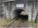 2
2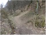 3
3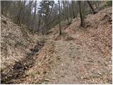 4
4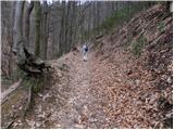 5
5 6
6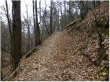 7
7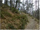 8
8 9
9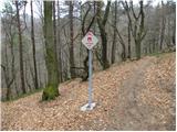 10
10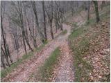 11
11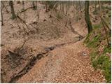 12
12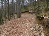 13
13 14
14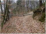 15
15 16
16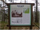 17
17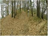 18
18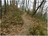 19
19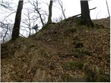 20
20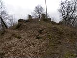 21
21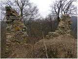 22
22 23
23
Discussion about the trip Ljubljana (Zalog) - Castle Stari grad (Stari Osterberg)
|
| bruny1. 05. 2014 |
Today along the described path start of activity above the right bank of the Sava. Pleasant path with some historical note to Stari Osterberg...On the path some fallen trees after the junction to Debenji vrh, I assume ice storm but no passage problems.
|
|
|
To post a comment you must log in:
If you do not yet have a username, you must first
register.